Satellite images reveal monstrous Category 3 Hurricane Ian from space
Satellites are capturing the enormous Hurricane Ian from space as the Category 3 storm barrels towards the Florida coast.
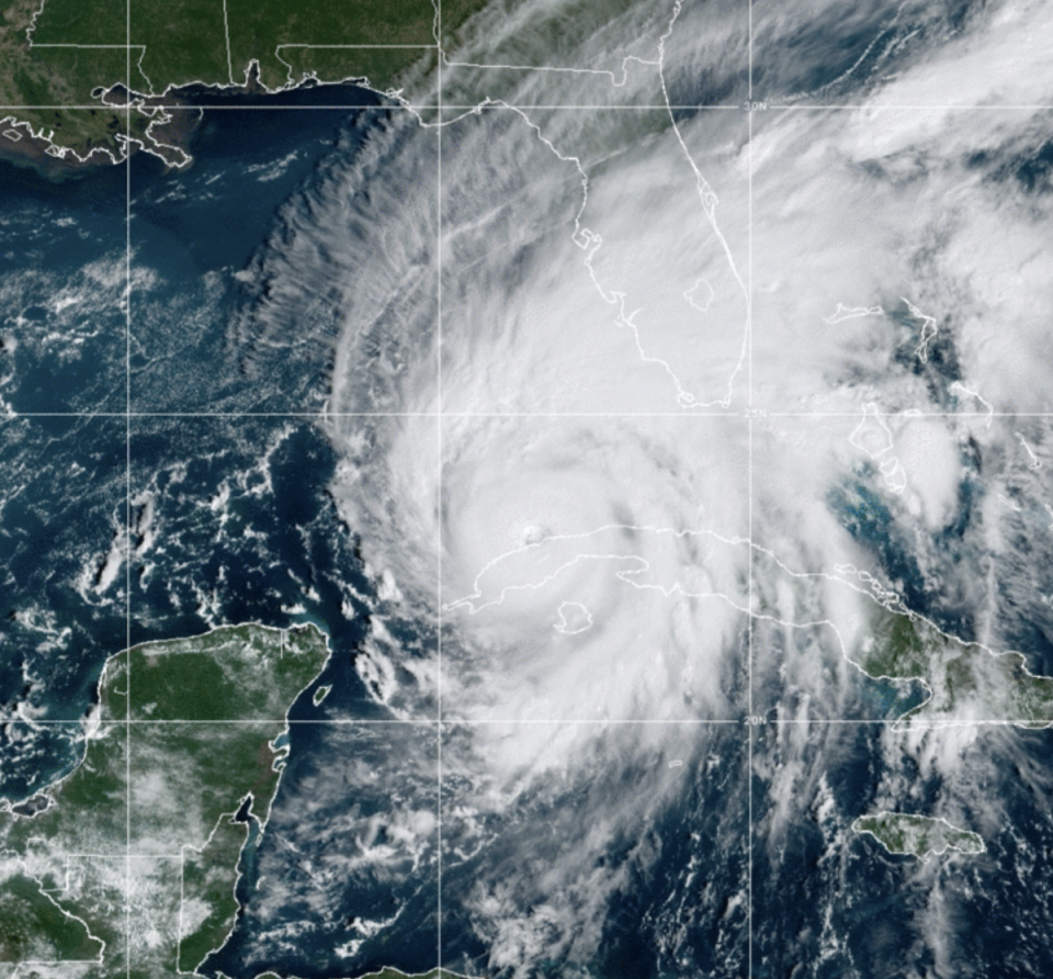
The images, released by the US National Oceanic and Atmospheric Administration (NOAA), showed tightly packed storm bands rotating north as the eye passed over western Cuba on Tuesday morning.
As of midday Tuesday (EST), the storm was moving at 10mph over Havana in the direction of Key West with maximum sustained winds of about 115mph.
Cuba was lashed with heavy rain and winds overnight, bringing the threat of coastal surges, flash flooding and landslides.
Water is already over the sea wall in Key West. Storm surge here will peak at 2-4 feet. Highest wind gusts could range 60-70mph tonight. #HurricaneIan pic.twitter.com/eGHTHpBXgS
— Brandon Orr (@BrandonOrrWPLG) September 27, 2022
Meteorologist Brandon Orr, from WPLG in Miami, tweeted video shortly before midday on Tuesday showing water already pouring over the sea wall in Key West. The region is expected to have storm surge between two and four feet, and winds up to 70mph.
The most recent weather models have the hurricane projected to make landfall south of Tampa Bay but the size of the storm, which is being supercharged by warm waters in the Gulf, means that large stretches of Florida’s west coast are also at-risk.
On Tuesday, Governor Ron DeSantis urged Floridians to heed warnings to evacuate and seek higher ground due to potential for “‘catastrophic flooding and life-threatening storm surge”.
New hurricane watches and warnings were also being issued for neighboring states of Georgia and South Carolina on Tuesday.
As the climate crisis drives up the world’s average ocean and air temperatures, hurricanes are expected to become stronger — and the damage more catastrophic, scientists say.

