Satellite images show the re-emergence of Tulare Lake
Satellite images taken over the past six weeks have captured the re-emergence of Tulare Lake in California’s San Joaquin Valley and show how suddenly water flooded and settled across miles of land once used to grow crops that fill grocery shelves nationwide.
At its widest point, the reformed lake stretches about 10 miles from bank to bank, according to the images, which were provided to NBC News by Planet Labs.
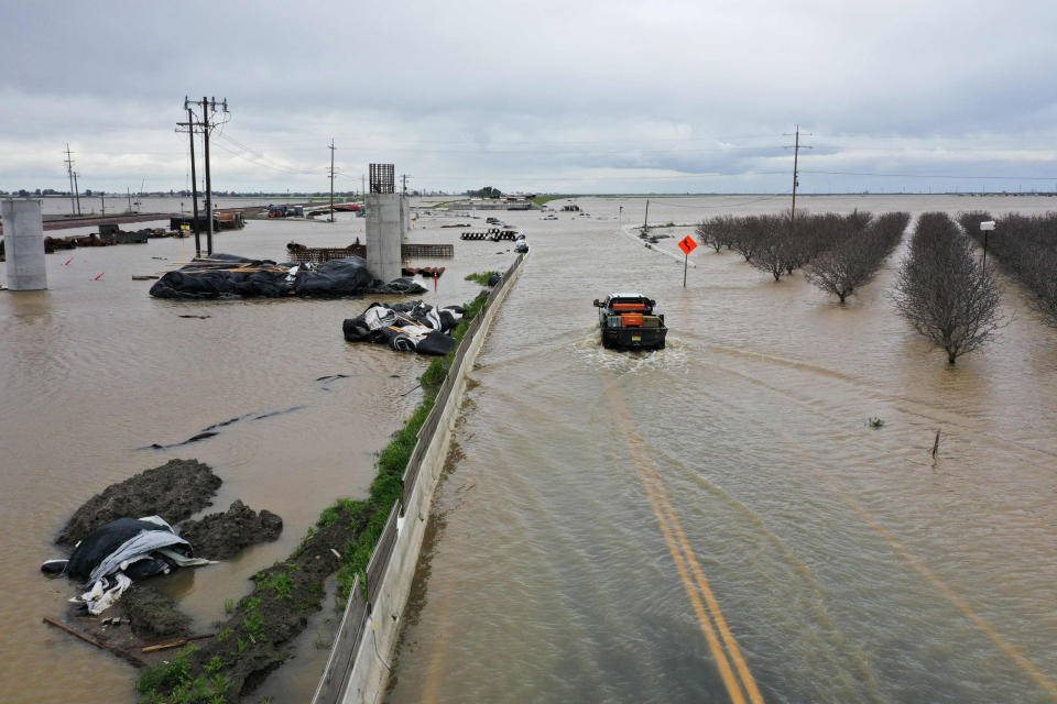
The images highlight the scale of flooding in one of the world’s most productive regions for crops like almonds, tomatoes and pistachios after more than a dozen atmospheric river storms hammered California this winter. More than 1,200 structures in Tulare County, which sits about halfway between Los Angeles and San Francisco and about 78 miles inland, have been damaged by flooding so far.
More flooding is likely, and the lake could grow more. Winter storms have blanketed mountains in the nearby Sierra Nevada with a layer of snow roughly three times what’s typical, which will soon melt out and send water streaming into the basin.
The worst may be yet to come. California Department of Water Resources officials are predicting that the snowpack will drive more runoff into the Tulare Basin than the atmospheric storms that already deluged the area.
Peak flows on the largest rivers that feed the Tulare Basin — including the Kings, Kaweah and Kern — are projected to arrive in May or June, said David Rizzardo, a hydrology manager at the department, during a Tuesday media briefing.
Each of these rivers historically flowed into the Tulare Lake, which disappeared after farmers rerouted and diverted so much water beginning in the late 1800s that it dried up. The lake reappears periodically during extremely wet seasons.
This week, during a lull between the damaging winter storms and the spring melt, communities were racing to assess flood risk this summer and bolster their defenses.
“We’re taking advantage of the dry weather,” said Savanna Birchfield, a public information officer for the California Department of Forestry and Fire Protection incident command team responding to the crisis.
Birchfield said emergency responders have been working to raise a critical roadway between Allensworth and Alpaugh, two towns that have already been hit by damaging floods. Raising the roadway should give residents a safe exit route if they need to flee. Workers are also reinforcing levees and constructing portable muscle wall barriers in an attempt to control future flows.
In nearby Kings County, residents expressed fear and angst over what is to come in the next months during a Wednesday community meeting.
“We don’t know how much we’re going to get and when we’re going to get it, but it’s going to come and we want to be prepared when it gets here,” said Doug Verboon, a Kings County supervisor.
This article was originally published on NBCNews.com

