Satellite launched from Vandenberg spots signs of El Niño off California coast
Less than a year after arriving in space thanks to a rocket launched from Vandenberg Space Force Base, a satellite to monitor water on Earth has noted warmer than normal temperatures for the ocean off the California coast.
The Surface Water and Ocean Topography, or SWOT, mission traveled to space in December aboard a SpaceX Falcon 9 rocket in December from Space Launch Complex-4 on the South Base.
Program scientists recently noted that the satellite spotted warm ocean waters attributed to the developing El Niño weather phenomenon moving northward.
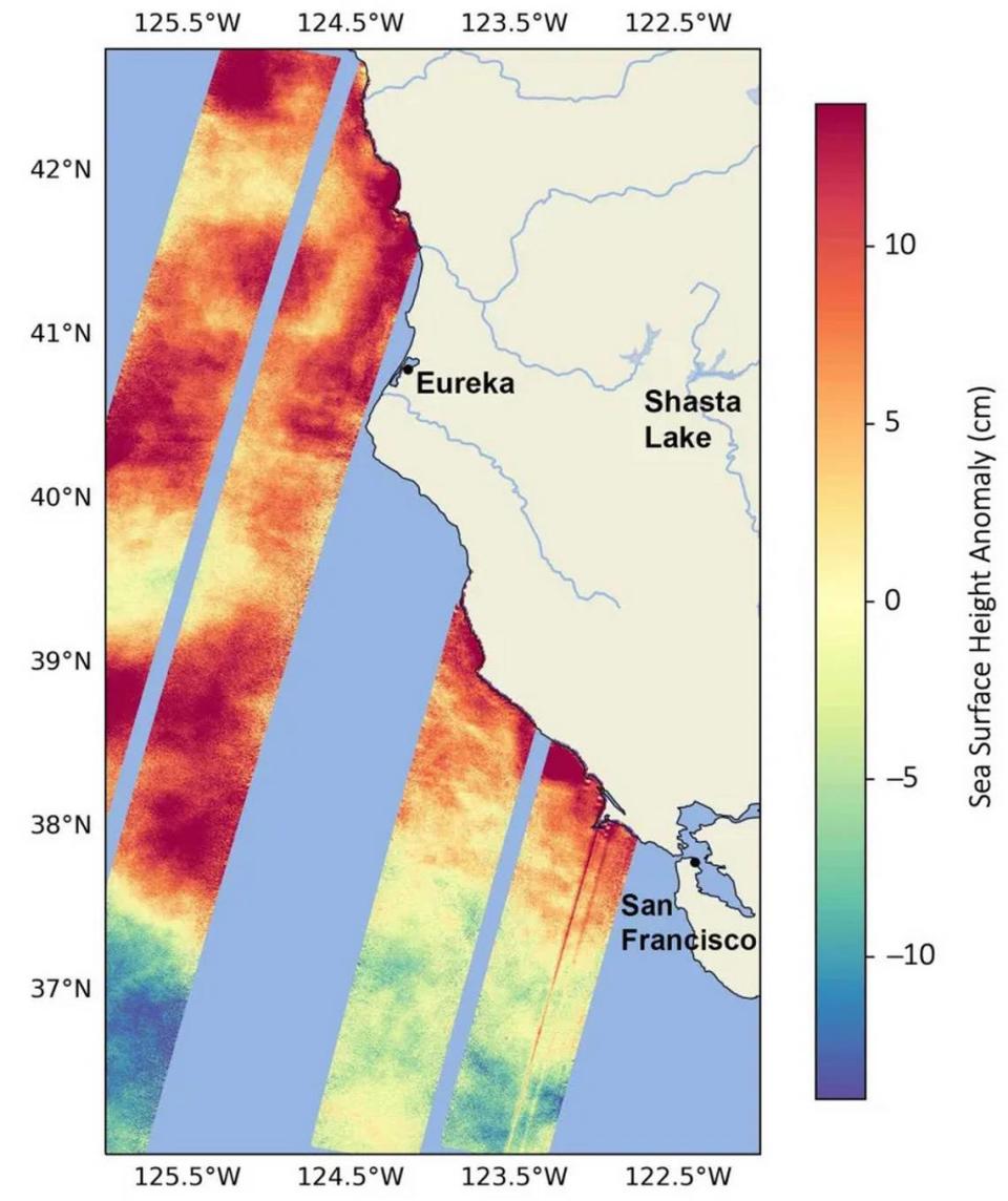
SWOT captured data showing rising sea surface heights off the West Coast, near the California-Oregon border, in August.
El Niño can bring cooler, wetter conditions to the U.S. Southwest, including California and drought to countries in the western Pacific Ocean, such as Indonesia and Australia.
“SWOT’s ability to measure sea surface so close to the coast will be invaluable for researchers but also forecasters looking at things like the development and progress of worldwide phenomena like El Niño,” said Ben Hamlington, a sea level researcher at NASA’s Jet Propulsion Laboratory in Pasadena.
SWOT involves a collaboration between NASA and French space agency Centre National d’ÉtudesSpatiales.
The spacecraft can measure the height of nearly all water on the Earth’s surface, giving scientists one of the most detailed, comprehensive views yet of the planet’s oceans and freshwater lakes and rivers.
Since water expands as it warms, sea levels tend to be higher in locations with warmer water.
Along California’s coast, warm waters are interacting with a persistent marine heat wave that recently influenced the development of Hurricane Hilary.
In the spring, scientists noted that average sea surface temperatures had surpassed the highest levels seen in long-term data records. Months later, sea surface temperature remained at record levels approximately 2 degrees higher than average in July. That was the fourth consecutive month they were at record levels, officials said.
In its September outlook, the U.S. National Oceanic and Atmospheric Administration forecast a greater than 70% chance for a strong El Niño this coming winter.
In addition to warmer water, El Niño is also associated with a weakening of the equatorial trade winds.
This is the second satellite launched from Vandenberg to note the looming El Niño phenomenon.
The U.S.-European satellite Sentinel-6 Michael Freilich lifted off from the base aboard a Falcon 9 rocket Nov. 21, 2020, and has orbited Earth since then.
Earlier this year, scientists said data from that craft had indicated early signs of a developing El Niño across the equatorial Pacific Ocean. Satellite data also noted warmer water and higher sea levels off the coasts of Peru, Ecuador and Colombia.
Noozhawk North County editor Janene Scully can be reached at jscully@noozhawk.com.

