How Satellites Protect Historical Sites From Looters and War
In August 2012, a group of Italian archaeologists discovered six rock reliefs chiseled into the walls of an ancient Assyrian canal near the town of Faida in northern Iraq. Three other reliefs had been discovered by a British archaeologist 40 years earlier, but fighting between Kurds and the Iraqi government had made excavation impossible. Armed conflict prevented work at the site for a second time as ISIS advanced into nearby Mosul in 2014 and the front line lay only 16 miles away.
Monitoring Faida at the time of the site’s initial discovery in 1972 would have proven expensive, dangerous, and near impossible. The 2,700-year-old reliefs were of magnificent archaeological value, but as is often the case in unstable regions of the world, archaeology had to wait. By 2012, though, the team from the University of Udine in Italy had an addition to their toolbox: satellites.
Aerial imagery has been used to inform archaeology ever since tethered hot air balloons hoisted cameras into the air in the first years of the 20th century. Up high, it becomes much easier to locate, survey, and monitor archaeological sites. The images also hold particular value when those sites are located on difficult or hostile terrain. Public satellite imagery has now lifted those advantages to new heights.
In the early 2000s, the U.S. government began to declassify its collection of military satellite imagery collected as part of the CORONA spy program between 1960 and 1972. Such imagery predated the use of modern intensive agricultural techniques, which meant that archaeologists could—for the first time—view sites before they had been damaged by farming. It also meant they could cover vast geographical areas.
The arrival of tools like Google Earth in 2001 then democratized access to satellite imagery with a free, accessible service. Archaeological teams often survive on small budgets. The open-source imagery meant archaeologists could exploit satellites without needing to worry about high costs. Now NASA’s Landsat and the European Union’s Copernicus programs also provide free imagery.
“There are now vast amounts of open data satellite imagery which can be used for archaeology,” Stéphane Ourevitch, senior executive adviser at Copernicus, told The Daily Beast. “In an image, you can detect the presence of buried structures, especially during dry periods, thanks to the difference in ‘color’ of the vegetation.”
Now, the proliferation of commercial satellite imagery is giving archaeologists access to imagery with up to 50-centimeter resolution. This allows them to spot much smaller details like the spoil heaps left by looters. “Frequent pass” services also mean specific locations can be updated as often as every five days, on demand. Multi-spectral imaging has improved the analysis of obscure photos too by revealing otherwise hidden features on the ground.
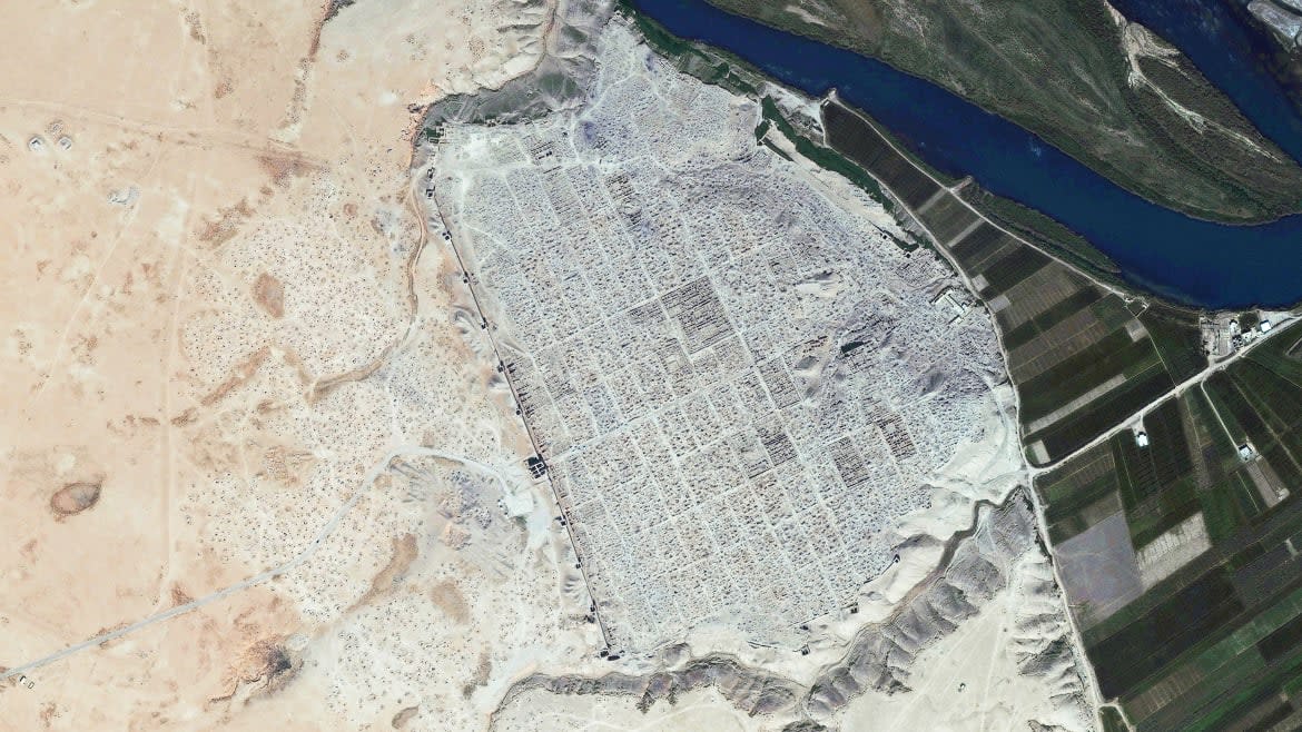
At Faida, the Italian team had already used satellites to identify more than 1,000 new historic sites in the region since 2012—of which, only 40 were previously known. Now the team could use satellites to monitor the specific Faida site for any signs of damage.
How Satellites Are Zeroing in on the Most Dangerously Hot City Neighborhoods
Using Google Earth, Simi and her colleagues noticed several threats encroaching on the land around the reliefs: the construction of an aqueduct, an illegal dig, and an expanding farm. “This site was in particular danger because the people noticed that it was something, but they didn't know exactly what was there,” Francesca Simi, the project’s deputy director, told The Daily Beast.
So, in 2019, they decided to intervene.
The University of Udine team discovered the new aqueduct had already destroyed one of the precious reliefs. Another had been partly bulldozed to make room for a cattle shed. But it wasn’t too late for the others. The archaeologists alerted the local Kurdish government, which created a special buffer zone around the site to protect it from further destruction.
“This was a great achievement for us,” Simi said. “From the scientific point of view, we are now able to better understand the transformation of the landscape.”

Rock reliefs in the walls of an ancient Assyrian canal near the town of Faida in northern Iraq.
Urban expansion around sites like Faida presents one of the greatest dangers to archaeological heritage. But looting, damming, vandalism, agriculture, and war all present persistent threats too. “People think that behind the rock reliefs there is a treasure, so they use hammers to try to open a secret gate to collect it,” Simi said. Luckily, satellite imagery helps archaeologists monitor these threats as well.
During several recent violent conflicts, including the Syrian Civil War and Iraq War, archaeologists have used satellites to monitor sites since warfare restricted them from visiting in person. Military encampments are sometimes built atop millennia-old ruins. Trenches are dug through burial mounds. And bombs blow craters into ancient sites, as seen at Tell Na’am in Syria.
3D Tech Is Helping Archaeologists Unearth Ancient Indigenous Art
Bill Finlayson, a researcher at the University of Oxford, directs the collaborative Oxford-led Endangered Archaeology in the Middle East and North Africa (EAMENA) project. His team has just paid thousands of dollars for a commercial satellite to fly frequent passes over a classified Buddhist site in Afghanistan, which is at risk from a mining project in the area.
“It’s another case of where, partly because of the nature of the site, it’s not being as protected as it might otherwise be,” Finlayson told The Daily Beast. “What we’re trying to see is how much it’s being eaten away by the ongoing mining problem.”
However, there’s only so much that the project can do. Archaeologists are often restricted in their capacity to protect sites due to resources, government restrictions, and more. “We’re not a kind of emergency archaeology service that parachutes in to rescue,” Finlayson said. “We pass the information on to people we think can do something, or would want to at least try to do something about it.”
EAMENA archaeologists feed all their satellite-acquired data into a public database. Anyone can access its 333,000 records covering 20 countries, which means local partners can use it to enhance their own understanding of the sites too. EAMENA has even launched a free training course in English, Arabic, Farsi, and French to help others learn the basics.
Fossil Hunting Husband and Wife Used Google Earth to Make Rare Find in U.K.
Imagery acquired from satellites can, however, be tedious to survey. The method also takes a lot of time to learn. One study attempted to teach a class of cultural heritage students at Dartmouth College through a lecture and reading materials. The subsequent test resulted in a 90 to 100 percent fail rate.
But artificial intelligence has raised some hopes for a way around this. “That’s nothing hugely complicated in theory,” Finlayson said. “You’re just looking at the change in different pixels in an image to see if they've altered or if they stayed the same.” But, as is often the case with AI, archaeologists are struggling to expand its use beyond specific parameters and environments.
“You can’t just create [an AI program] and then apply it anywhere,” Finlayson said. “Probably what you’ve developed works very well for the test area, but may or may not work very well outside of that.” So while future innovation still needs work, existing satellite technology has transformed archaeology forever. For many, it has become a priority in securing cultural heritage for future generations.
After using satellites to identify and stop the damage at Faida, Simi and her colleagues launched an educational project for the site’s community last year. They held a public meeting in the local heritage center and invited school children to look around.
“People came and started to understand,” Simi said. “They were extremely curious. And it’s so important because it’s their heritage, just 100 meters from their houses.”
Got a tip? Send it to The Daily Beast here
Get the Daily Beast's biggest scoops and scandals delivered right to your inbox. Sign up now.
Stay informed and gain unlimited access to the Daily Beast's unmatched reporting. Subscribe now.

