Saturday updates: What's happening on a cold Christmas Eve in Louisville
- Oops!Something went wrong.Please try again later.
Well, without a dramatic turn of events Saturday, it looks like we'll have a white Christmas in Louisville.
If you've been outside or have looked out a window in the past 36 hours you know the story – temperatures dropped dramatically Thursday night as snow moved into the region, and Friday's forecast include some of the coldest weather the city's seen in more than 30 years. The temperature hit -6 degrees for a time during the morning, with wind chill values hovering at times between -25 and -30 degrees.
The National Weather Service's local office had given warning about the weather ahead of time, and its projections were accurate. The weather agency is calling for warmer temperatures Saturday, but don't put that coat away just yet – we probably won't climb out of the teens before Sunday, and temperatures aren't expected to rise past freezing until Tuesday.
National updates:Most of US faces dangerous winter weather, with power outages, travel delays
This story will be updated with news and notes from throughout the day Saturday, and will air Gov. Andy Beshear's planned 10 a.m. press conference. In the meantime, here's a quick look at what's happening.
2:30 p.m.: Conditions improve on I-71 North
Traffic issues that have persisted on I-71 North in Gallatin County have improved, according to the Kentucky Transportation Cabinet, but plan ahead if you're traveling through the area on Christmas Eve.
One lane of northbound traffic along the interstate is open between mile marker 62 and 66 as of 2 p.m., the department said in a release, and a detour is in place at mile marker 55 to direct drivers to I-71 South as well.
Earlier in the day, passenger vehicles had been directed to turn around on the freeway to take a separate detour, which allowed salt trucks to open a lane and allow other cars to continue north. Commercial trucks are still being held until the highway can completely reopen.
It's expected to take several hours to clear the backup of vehicles, the release said.
Both lanes of I-71 South are still open, though traffic is moving slowly.
Speed has been a factor in several crashes on the roadway, Beshear had previously said. In response, the governor announced a temporary speed limit reduction to 45 mph on that stretch of road, along with a reduction to 45 mph from I-264 in Jefferson County to the merger of I-71 and I-75 in Boone County at mile marker 77.
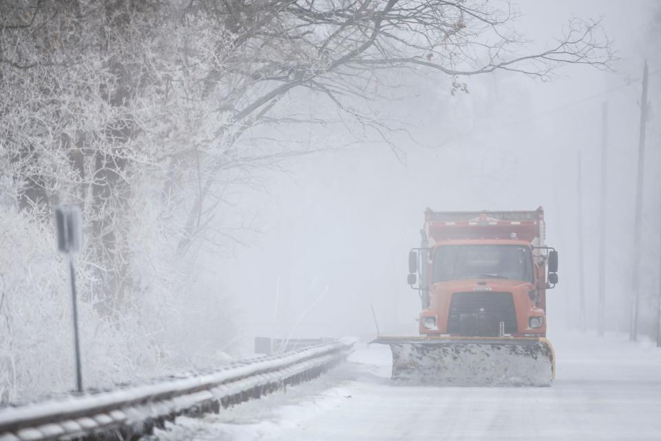
12:30 p.m.: Louisville's major roads in 'fair condition'
While Public Works officials continue to promote caution while driving through Louisville, the department said the city's major roadways have been treated.
All 111 snow routes covering 2,700 miles have been cleared, Public Works said in an email Saturday morning, with three complete passes. Those roads are in "fair condition," the department said, and while many secondary streets remain covered in snow due to low temperatures, those roads are "passable using caution."
"We continue to urge commuters to be careful as they drive, to at least double their travel time to reach their destination and allow our snow fighters room to work," the Public Works email added. "Working around the clock, we anticipate the Snow Team will continue to work into Monday evening to ensure our roadways are as safe as possible."
Louisville remains under a wind chill advisory until 1 p.m. Saturday. As of about noon, according to the National Weather Service's local office, the local temperature was 10 degrees, with a wind chill of -6. The temperature is expected to drop to about 6 degrees overnight before rising to 21 degrees Sunday.
10 a.m.: Beshear provides an update
In a 10 a.m. press conference, Beshear urged Kentucky residents to do what they can to stay off the roads Saturday, with conditions expected to improve Sunday.
"The main message is to stay home – stay safe and stay alive," Beshear said. "… It’s simply not safe to travel right now. I know that’s hard because it’s Christmas Eve.”
Dozens of crashes have been reported around the state, he said, and while temperatures are set to rise back into the teens Saturday after hovering in negative and single digits Friday, hurdles still remain. Salt on the roadways will be more effective when temperatures jump back into the 20s Sunday, Beshear said.
Several significant traffic jams have been reported on Interstate 71 – he urged drivers to stay away from the highway in Gallatin County, between Louisville and Cincinnati. Gusty winds with snow on the ground can create "blizzard-like" conditions, he said.
More than 43,000 power outages have been reported Saturday morning in Kentucky, with Secretary of Transportation Jim Gray describing the situation as "still an active weather event." Cold temperatures are straining the power grid, Beshear said, and while some energy providers have put rolling blackouts in place, the governor said any outages should not last long enough to cause home temperatures to drop. He urged Kentucky residents to keep thermostats as low as comfortably possible and to turn off unneeded lights and other electric devices.
"Daylight and sunlight is good news," Gray said, and should help road conditions improve, but remaining home is still your best bet in the meantime. If you do hit the road, he said, be prepared to drive slow and bring a safety kit with you in case you end up stranded.
9:30 a.m.: Traffic issues persist on Interstate 71
Kentucky drivers should continue to avoid Interstate 71 North in Gallatin County, between Louisville and Cincinnati.
Several crashes that occurred on the roadway Friday caused major backups on the highway and a complete closure of northbound lanes, according to Beshear and the Kentucky Transportation Cabinet. Sevev miles of the 14-mile backup had been cleared as of about 6:30 a.m., the transportation cabinet said in a release, but crews were still working the scene Saturday morning.
More coverage:Severe winter storm in Kentucky causes major ongoing backup along Interstate 71
Saturday's forecast in Louisville
A wind chill will remain in effect in Louisville and Southern Indiana through Saturday afternoon, according to the weather service, but temperatures are expected to be higher than Friday's frigid lows.
Overnight snow flurries are possible, but they aren't expected to have much of a visible impact. Expect partly sunny conditions throughout the day with a high of 16 degrees – cold, but an improvement from Friday. Still, a wind chill of -15 degrees is possible early Saturday morning, and gusty winds of up to 28 mph are still in the forecast.
Christmas Day should be another step in the right direction with a high of 21 degrees after an overnight low of around 7 degrees. Monday has a projected high of 27 degrees and Tuesday's high is 33 degrees. By Thursday, local meteorologist John Gordon previously said, local temperatures could hit 50.
City and state officials have urged drivers to stay off the roads unless travel is absolutely necessary, though Gordon said driving conditions are expected to improve significantly Sunday. Transit Authority of River City buses stopped some services early Friday, at 8 p.m., due to a significant number of breakdowns, but TARC buses are back on their regular schedule Saturday.
What happened Friday in Louisville

Friday was the coldest day recorded in Louisville since 1989, with a 54-degree swing in temperature from a day earlier. It was cold – have we made that clear yet?
A total of 2.8 inches of snow fell in Louisville, according to weather service records. Some areas east of Jefferson County were hit harder, with closer to 5 inches in Covington and 4 inches in Frankfort.
Power outages were reported around the state. Louisville Mayor Greg Fischer said Louisville Gas & Electric responded to about 12,000 customers over the course of Friday morning, and as of 7 p.m. Friday night, power outage aggregator poweroutage.us estimated more than 40,000 homes were without power, with high concentrations in Hopkins, Mason and Franklin counties. In Louisville, according to LG&E's power outage map, just over 200 homes were without power at that time.
At least deaths were reported across the state, according to Kentucky Gov. Andy Beshear. Two people were killed in separate car crashes, he said, while an unhoused individual in Louisville is believed to have died Thursday night as well.
National Guard personnel responded to several crashes around the state, with significant backups reported at times on Interstate 71 in Gallatin County and on Interstate 64 in Scott County. I-71 North was still closed as of 7 p.m., according to Kentucky State Police.
Three shelters in Louisville – Wayside Christian Mission, St. Vincent de Paul and The Salvation Army – are currently operating under Operation White Flag, which allows them to go over capacity. The city has also opened Broadbent Arena as a temporary shelter.
Related:Services for Louisville's unsheltered population amid severe winter weather
Reach Lucas Aulbach at laulbach@courier-journal.com.
This article originally appeared on Louisville Courier Journal: Winter storm Kentucky: Louisville updates Saturday as temperatures rise

