SC has 5 of the most vulnerable counties to hurricanes in the US, new ranking shows. Here’s where
Hurricane season is in full swing after getting its official start in June.
The season extends from June 1 to Nov. 30 for the Atlantic basin, according to NOAA’s National Hurricane Center.
If you think the remainder of the year will emulate how the season has been so far, that’s not necessarily accurate. With August beginning in the coming days, it’s important to know that NOAA details that the Atlantic hurricane season’s peak is on Sept. 10, with “most activity occurring between mid-August and mid-October.”
Are you prepared if one were to hit the area? Are you positioned in a location more vulnerable to a potential hurricane?
In a recent ranking by Gutter Gnome of 2023’s most hurricane-vulnerable counties, several South Carolina areas made the list.
To determine the most at-risk counties, the company combined hurricane risk assessments by the National Center for Disaster Preparedness with 10 years of historical storm data and financial impact projections from government agencies.
Although Florida destinations took up the number one and two spaces as being the most hurricane-vulnerable counties in the U.S., South Carolina wasn’t far behind. Out of the top 10 most at-risk counties, five were found in the Palmetto State.
The top 10 most hurricane-vulnerable counties in the nation, according to Gutter Gnome’s study, include:
Broward County, Florida
Palm Beach County, Florida
Charleston County, South Carolina
Horry County, South Carolina
Miami-Dade County, Florida
Beaufort County, South Carolina
Berkeley County, South Carolina
Chatham County, Georgia
Dorchester County, South Carolina
Onslow County, North Carolina
Moreover, once the categories of risk, most hurricanes within the past decade and expected annual financial loss, Clarendon and Charleston Counties in the state also earned themselves a top spot within the individual category of most hurricanes.

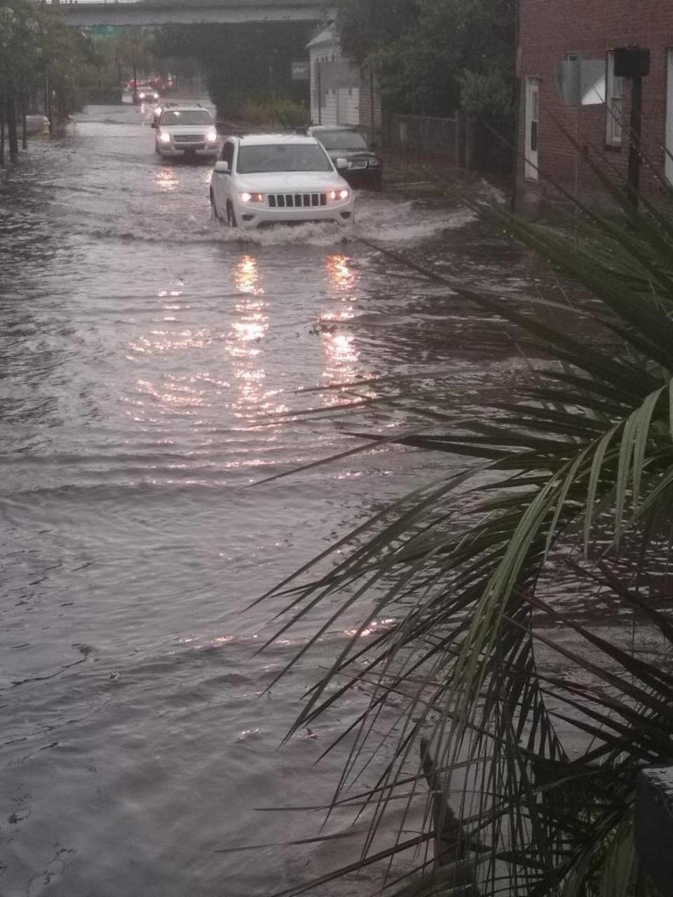
Charleston County also ranked 8th overall for the amount of expected annual financial loss from hurricanes. This statistic could partially be attributed to the problems the city of Charleston faces with widespread flooding.
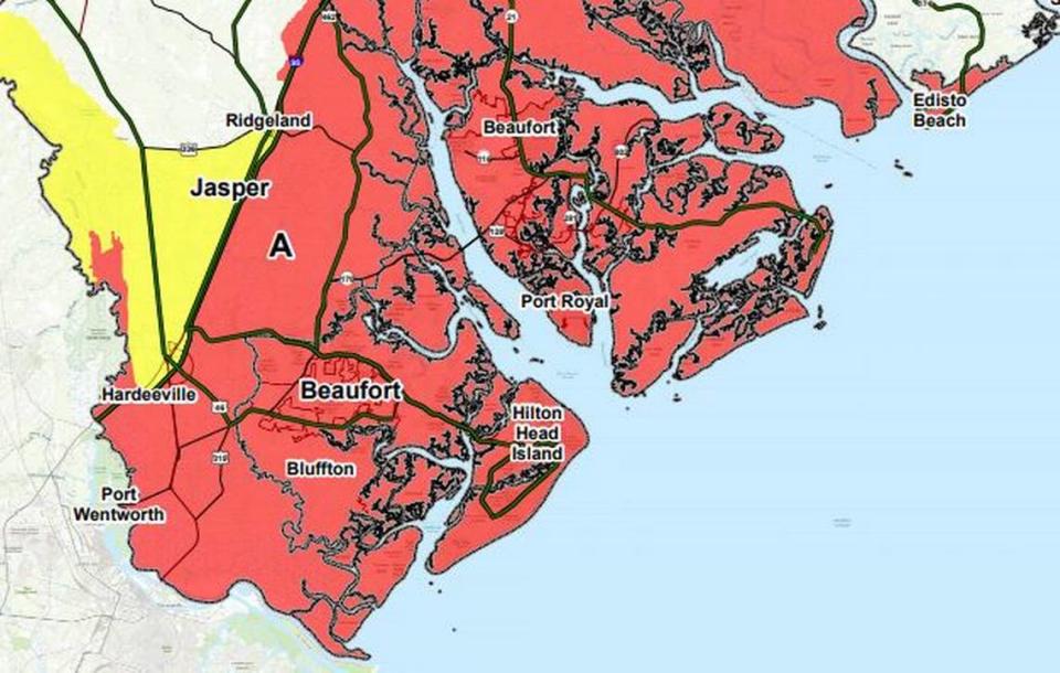
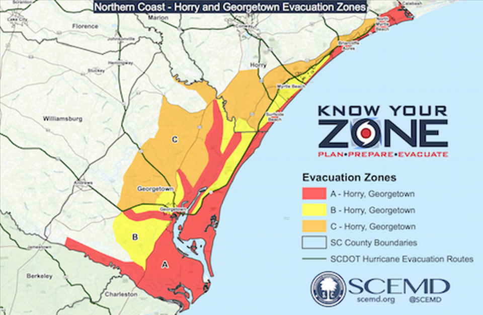
When preparing for the impact of a potentially incoming hurricane, it’s important for South Carolina residents to know and understand their zone. Knowing your family’s zone is important as state and local authorities will announce evacuations by these predetermined zones allotted by SCEMD.
For example, parts of Horry, Georgetown, Charleston, Colleton, Beaufort and Jasper counties are in Zone A.