Schools close again, as heavy snow and winds continue over Newfoundland

Dangerous blizzard conditions forced delays, cancellations and closures across across parts of Atlantic Canada on Wednesday, with several schools and services remaining closed in Newfoundland once again for Thursday.
Winter storm warnings spanned the region early Thursday, with the threat for additional snow and winds to make for difficult travel and whiteout conditions.
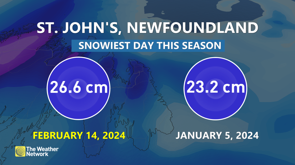
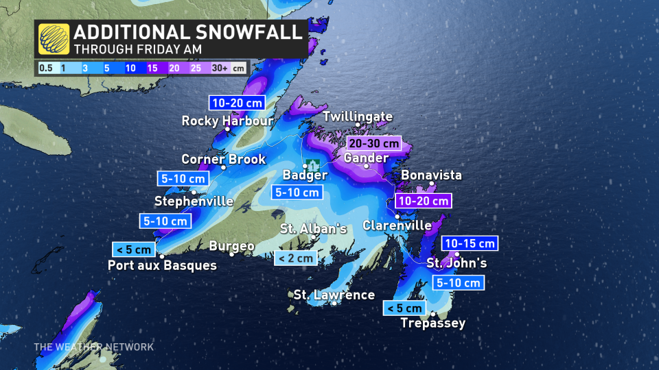
As of Thursday morning, 26.6 cm of snow had already been reported at the St. John's airport, making for the snowiest day so far this winter season in the region. Total snowfall accumulations from this storm could reach 40-60+ cm in some of the hardest hit areas by Friday.
RELATED: PHOTOS: Snow piling up quickly as intense nor'easter batters Atlantic Canada
"Evaluate the possibility of delaying any non-essential travel until conditions improve," says Environment and Climate Change Canada (ECCC) in the winter storm warning.
Snow and blowing snow threatens difficult travel through Thursday
Snow developed for the Avalon Peninsula through Wednesday, and picked up in intensity pretty quickly. Nearly 20 cm fell in St. John’s by Wednesday evening alone, surpassing the 30 cm mark by the morning hours on Thursday. In Gander, over 50 cm of snow had fallen by early Thursday afternoon.
Regions along the south coast were already seeing improving conditions early Thursday, however periods of blowing snow and gusty winds will persist over northern and eastern sections throughout the day.
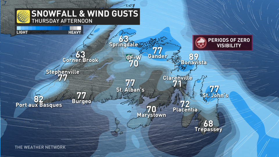
Light to moderate snowfall is forecast to continue for the north coast of the island, paired with wind gusts between 60-90 km/h, which will continue to cause hazardous driving conditions. Periods of near zero visibility are expected southeast of Gander, including the St. John's area.
For Thursday, an additional 10-15 cm is expected for St. John's, with 20-30 cm for Gander and the Bonavista, where snowfall rates of 2 cm per hour could pick up at times through the day.
BEWARE: Towering snow piles could lead to very expensive problems you didn't see coming
Active pattern stays locked through the second half of February
Colder than normal temperatures will spread across the region during the weekend and early next week.
An active pattern is expected to resume later next week, with the potential for a significant storm or two, though still too early to have confidence in the storm track and details.
Make sure to keep checking back to The Weather Network for forecast updates and impact information across Atlantic Canada

