Schools close, power outages rack up as potent winter storm wallops Quebec
A Texas low will continue to make its presence felt in Quebec Wednesday, moving through with a bout of heavy snow, ice and howling wind gusts that will make for hazardous travel.
Before 9 a.m., 16 cm of snow had piled up in Montreal, with over 20 cm reported in Quebec City. The deteriorating conditions forced dozens of schools to close their doors first thing Wednesday morning. More than 30,000 customers were without power across the Eastern Townships, as well.
Going somewhere? Check out the current highway conditions before heading out!
Widespread winter storm warnings remain in effect, with drivers being urged to consider postponing non-essential travel until conditions improve. There is the chance for some areas to see between 30-40 cm of snow by the time the system departs.
The sprawling, low-pressure system is drawing on cold air from Canada, warm and humid air from the Gulf of Mexico, and a tremendous amount of energy swinging over the Rockies to produce an array of hazardous weather across the continent.
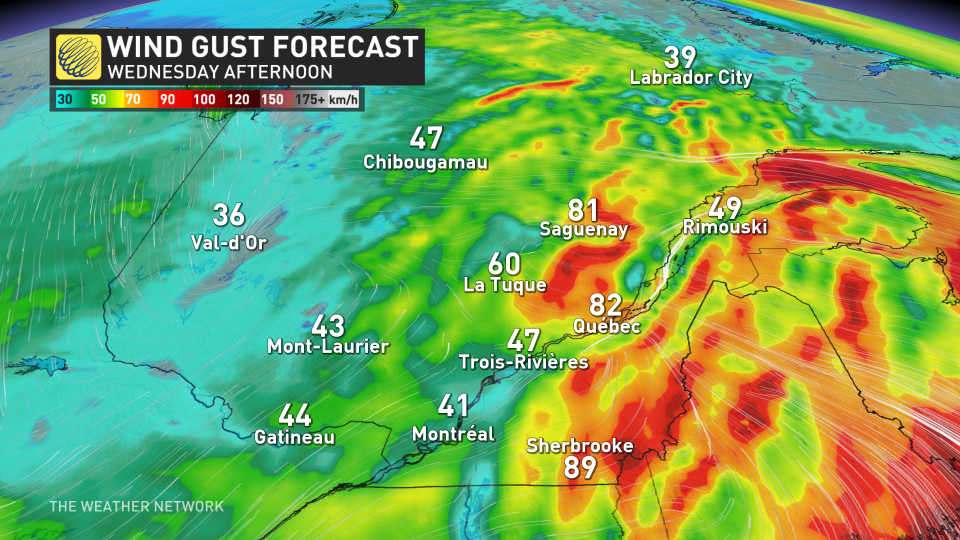
Winds remain strong through Wednesday, risk for climbing outages
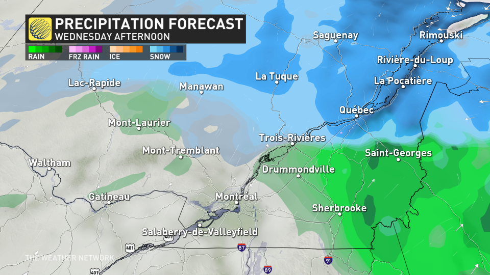
Snowfall began Tuesday afternoon in southern Quebec, intensifying through the overnight hours. A transition over to rain occurred across the south before dawn.
The rain will end in Montreal through the morning hours, and eventually the snow, and ice pellet mix for Trois-Rivières into the afternoon. The snow will last longest across Quebec City before gradually winding down through the evening hours. A total of 20 to 40 centimetres of snow is possible for the region by the time all is said and done.
One of the biggest threats through Wednesday will be the strong wind gusts that have been occurring across the Eastern Townships. Sherbrooke had already recorded a gust of 90 km/h by Wednesday morning.
The combination of freshly fallen snow and strong winds could make for dangerous whiteout conditions with near zero visibility at times.
Those with air travel plans are also urged to call ahead with multiple flight cancellations and delays reported at Montreal-Trudeau International Airport Wednesday.
This won't be the end of the stormy weather for Quebec, either, as forecasters are already eyeing the next storm, which will bring widespread, strong winds and heavy snow into southern and central Quebec this weekend.
Areas near and south of the St. Lawrence River could see the snow change to rain for a while, but much of the precipitation should fall as snow with lots of cold air to work with.

Stay with The Weather Network for the latest on this major storm in Quebec.

