Scientists Just Mapped a Quarter of the World's Coral and Boy Is It in Bad Shape
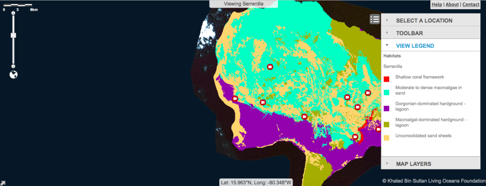
An international team of scientists has created the world's first global coral reef atlas. The atlas, created with the help of Earth-orbiting satellites and field observations, contains 25,097 square miles (65,000 square kilometers) of coral reefs and their surrounding habitats. Considering there are an estimated 110,000 square miles (284,300 square kilometers) of coral reef across the planet, the new atlas covers around 23 percent of that total.
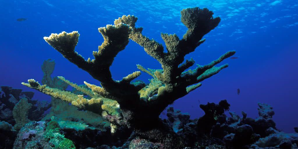
Coral reefs are among the world's most threatened habitats. According to the Environmental Protection Agency, they're in decline around the world, and a number of scientists "believe the very existence of coral reefs may be in jeopardy unless we intensify our efforts to protect them." The new mapping project could better help identify areas under immediate threat.
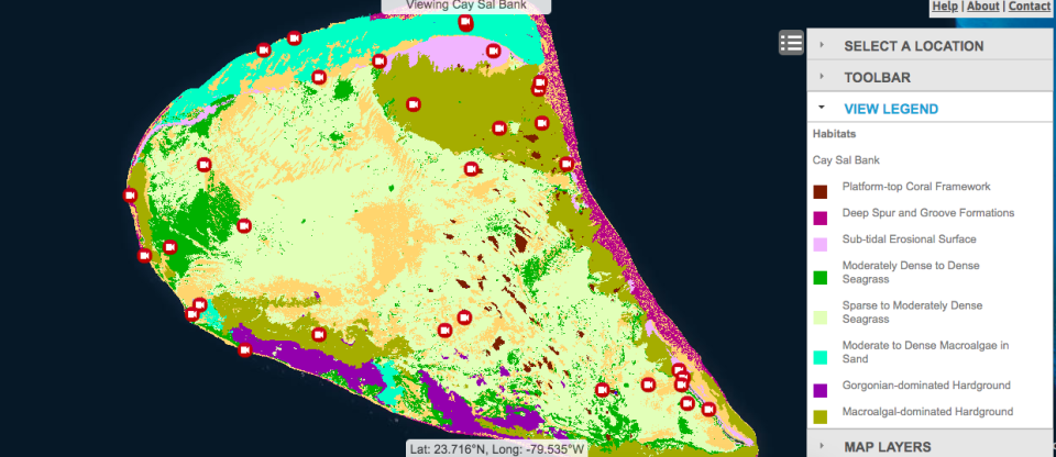
"In order to conserve something, it's imperative to know where it is located and how much of it you have," says Sam Purkis, professor and chair of the UM Rosenstiel School Department of Marine Geosciences, in a press statement. "Developing such an understanding for coral reefs is especially challenging because they are submerged underwater and therefore obscured from casual view. With this study, we demonstrate the potential to use satellite images to make coral reef maps at global scale."
Scientists took data from surveys conducted on what was known as the Global Reef Expedition, a study of coral reefs that, like this mapping project, was partially funded by the Khaled bin Sultan Living Oceans Foundation (KSLOF), a scientific foundation based in America and founded by Saudi Royal Prince Khalid bin Sultan Al Saud. Scientists at KSLOF and the University of Miami (UM) worked together to combine the survey data with ultra-high-resolution satellite imagery.
Researchers hope that the atlas will provide an easier way for up-to-date to be accessible for the coral reefs included within. Purkis tells Earther:
“We can better monitor how they’re doing, and then we can better apply our solutions to the coral reef crisis, which might be marine protected areas or it might be reef rehabilitation or no-fishing areas. We can make those decisions now at the global scale.”
Reefs have no shortage of woes in the modern era. Around the planet, forces ranging from overfishing, pathogens from untreated sewage, fertilizer runoff, and the increasing challenge of global warming conspire to make things very difficult for coral reefs.
Living creatures, coral across the world is still recovering from the massive bleaching epidemic which lasted from 2014 through 2017. A 36-month heatwave, the epidemic ended up affecting over 75 percent of Earth’s tropical reefs. Of those, 30 percent reached a mortality level. Scientists describing the event have noted that "severe bleaching is now occurring more quickly than reefs can recover, with severe downstream consequences to ecosystems and people."
While the atlas isn't complete, its a good baseline for scientists to determine where and how severe further damage looks. That will give them an advantage in a fight where they hold precious few cards.
"Benthic habitat maps are an essential tool in coral reef conservation as they provide a snapshot of where reefs are located and the status of their health," says Alexandra Dempsey, the director of science management for the KSLOF and a co-author of the paper. "Scientists will use these habitat maps as baseline data to help track changes in reef composition and structure over time."
Source: Earther
('You Might Also Like',)

