Should we add a Category 6 to the hurricane scale? Why scientists say we need it
Fed by climate change, hurricanes have outpaced the tool meteorologists use to convey their strength, and the National Hurricane Center should add a Category 6 to the Saffir-Simpson scale to reflect the change, researchers said this week.
Michael F. Wehner and James P. Kossin made the argument in a paper released Monday, which puts two years of scientific study behind an observation meteorologists and others had made more casually for some time. That is, that a scale that tops out with Category 5, capturing any storm with sustained winds at 157mph or more, underestimates in the public’s mind the actual threat of much more powerful storms occurring.
What does the research say?
Wehner and Kossin suggest adding a Category 6 that would include any storm with sustained wind speeds of more than 86 meters per second, or about 192mph.
Several storms already have reached that threshold, the pair say, and more are likely to come as the planet warms.
The National Oceanic and Atmospheric Administration has said it’s premature to conclude that the increase in hurricane activity and severity since 1980 is due to global warming.
Reached by phone in California where he works in Lawrence Berkeley National Laboratory’s Applied Mathematics and Computational Research Division, Wehner said he and Kossin, an atmospheric scientist, don’t expect the National Hurricane Center to amend the Saffir-Simpson scale. But demonstrating that there could be scientific justification for doing so could bring attention to the need to deal with global warming, he said.
“Our point is simply that climate change is making the big ones worse,” said Wehner, who also has studied other weather extremes such as heat.
In the short run, Wehner said, when a hurricane is barreling up the coast, residents in its path need to pay attention to evacuation orders and take necessary steps to protect themselves and their loved ones.
“Bu when there is not a storm coming, this could be a way to remind people that climate change is making these storms and all kinds of extreme weather more hazardous.”
What is the Saffir-Simpson Hurricane Wind Speed scale?
Developed by wind engineer Herb Saffir and meteorologist Bob Simpson, the scale was first published in the 1970s as a way to quantify the threat of a given hurricane and alert the public to possible impacts. It’s been compared to the Richter scale used for earthquakes.
Its metrics have been changed over time, and the current version uses only peak wind speeds to classify storms as:
▪ Category 1, maximum sustained winds of 74-95 mph
▪ Category 2, 96-110 mph
▪ Category 3, 111-129 mph
▪ Category 4, 130-156 mph
▪ Category 5, 157 mph or higher
Critics say Saffir-Simpson understates dangers
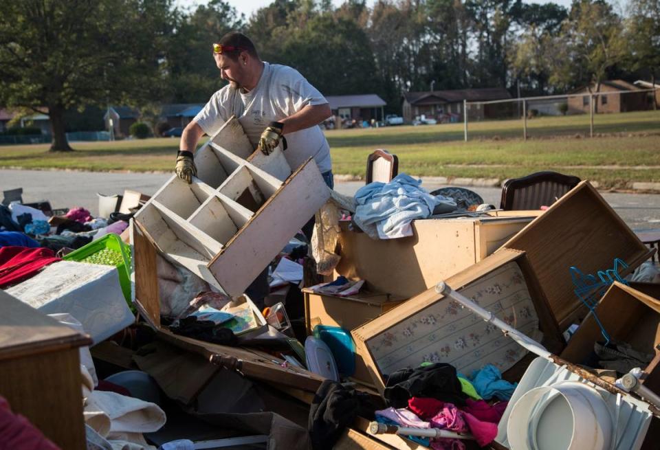
If you live in North Carolina, which is behind only Texas, Florida and sometimes Louisiana in the number of hurricane strikes sustained, you know that excessive wind — which can collapse structures, bring down trees and turn ordinary objects into missiles — is only one potential danger in a hurricane.
Using data from the U.S. Centers for Disease Control, the National Weather Service reported in August 2023 that most deaths in recent tropical cyclones have been from inland freshwater flooding caused by excessive rainfall. Other major risks from hurricanes include ocean storm surge and tornadoes, such as one spawned by Isaias in August 2020 that killed two people in Bertie County. Hurricanes that hit the Gulf of Mexico and travel north through the North Carolina mountains, dropping huge amounts of rain, also can cause landslides.
That’s why the National Hurricane Center offers a detailed description of the increasing dangers of different category storms ascending through the Saffir-Simpson scale along with more digestible summaries of the risks.
The National Hurricane Center also has produced an animated video that demonstrates the effects of increasing wind strengths from Category 1 to Category 5.
North Carolina focuses on impacts, not storm categories
In modern record-keeping, North Carolina has never sustained a direct hit from a Category 5 hurricane, but has seen death and destruction from many storms that, based only on their category, might not have sounded like big threats.
Hurricane Matthew that came into North Carolina as a Category 1 storm after making landfall in South Carolina in October 2016 killed 25 people here, the weather service said, and caused billions of dollars in damages.
In an interview, Diana Thomas, a meteorologist with N.C. Emergency Management, said that leading up to a hurricane, state officials use information about wind speeds but also the size of a storm, potential storm surge and rip current risk, projected rainfall, possible tracks and other data to help residents prepare and stay safe.
As a meteorologist and disaster preparedness official, she said, she’s not bothered by the fact that the current Category 5 is open-ended.
“We really message out the impacts. We may not even mention what category a storm is, because the impact and the local effects are what matter and what drives our response and the need to move resources to those areas,” she said. “The addition of a Category 6 would not alter our addressing of those impacts.”
The National Hurricane Center’s response
NHC Director Michael Brennan said in a statement that the agency doesn’t comment on reports or papers from outside its organization.
But Brennan said that, like N.C. officials, “We’ve tried to steer the focus toward the individual hazards, which include storm surge, wind, rainfall, tornadoes and rip currents, instead of the particular category of the storm, which only provides information about the hazard from wind. Category 5 on the Saffir-Simpson scale already captures ‘Catastrophic Damage’ from wind, so it’s not clear that there would be a need for another category even if storms were to get stronger.
“In addition, most deaths in tropical cyclones occur not from the wind but from water — storm surge, rainfall/inland flooding, and hazardous surf — causing about 90% of tropical cyclone deaths in the United States. So, we don’t want to over-emphasize the wind hazard by placing too much emphasis on the category.”
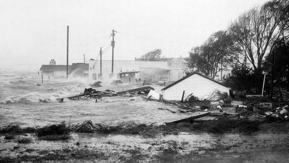
The National Hurricane Center announced this week that in mid-August, it will roll out an experimental version of its hurricane cone forecast graphic to include effects of storms that could be felt far inland. That’s because in the past, people who live in areas away from the coast often have ignored the risks posed by winds and heavy rain that can occur far from the coast. After it came ashore in Calabash in 1954, for instance — bringing an 18-foot storm surge — Hurricane Hazel traveled far inland.
The Ralegh-Durham airport recorded 90 mph winds from Hazel.
The Atlantic hurricane season runs from June 1 to Nov. 30.
What’s up with ‘Super El Niño’ in NC? From an Arctic Blast to blasting the A/C
2024 will bring a total solar eclipse. Here’s how it will look across North Carolina

