Lingering snow means poor travel continues in parts of Atlantic Canada

After a blockbuster winter storm that rampaged across North America finally loosened its grip on Atlantic Canada, cold air blowing in behind it will give rise to sea-effect snow across the Maritimes and Newfoundland just in time for Christmas, possibly giving some areas a white Christmas after all.
Under the snow squall bands, visibilities will be significantly reduced due to the heavy snow, and snow will quickly accumulate.
Resources:
DON’T MISS: The ‘magic number’ that makes for a white Christmas across Canada
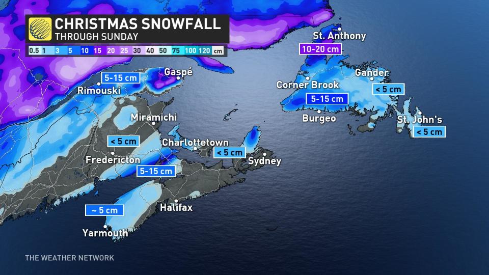
Colder air swinging in behind the departing storm will will lead to bands of sea-effect snow developing across the Maritimes and Newfoundland Saturday overnight, expected to last through Sunday evening for some areas.
Snow squall watches are in effect for parts of Nova Scotia.
The greatest opportunity for sea-effect snow in the Maritimes will spread across the Fundy Shores and portions of Nova Scotia and Prince Edward Island. These bands will stretch into western Newfoundland through the evening hours on Christmas.
WATCH: Hundreds of thousands without power as blizzard hammers Ontario and Quebec
Thumbnail courtesy of Frank Bailey, taken in Bridgewater, N.S.
Stay with The Weather Network for the latest on conditions across Atlantic Canada.

