How search parties located the plane crash near Saint Marys Wilderness area Sunday
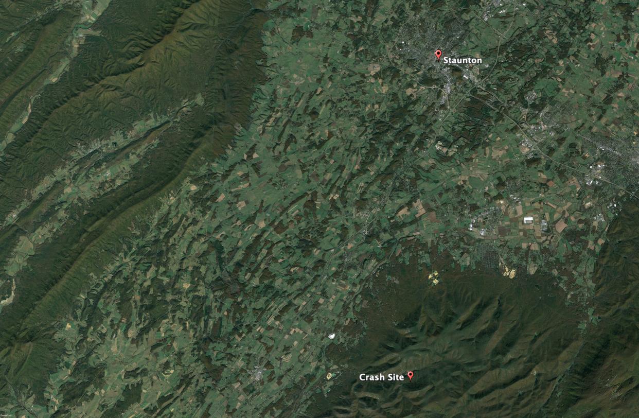
STAUNTON—Sunday afternoon a Cessna Citation plane crashed into a ridge near Saint Marys Wilderness area south of Staunton, Virginia.
The crash was connected with the sonic boom heard in the DC area, as fighter planes scrambled to identify and make contact with a plane flying into D.C. airspace. Getting no response, they followed the plane into the Blue Ridge Mountains then left once the plane hit a lower altitude.
The FAA issued the following release: "A Cessna Citation crashed into mountainous terrain near Montebello, Va., around 3:30 p.m. local time on June 4. The aircraft took off from Elizabethton Municipal Airport in Elizabethton, Tenn., and was bound for Long Island MacArthur Airport in New York.
"The FAA and NTSB will investigate. The NTSB will be in charge of the investigation and provide all further updates."
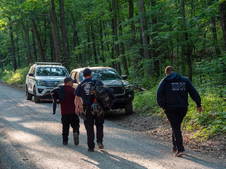
The News Leader followed radio traffic throughout the late afternoon and evening as local fire and rescue teams searched for the crash site through steep and difficult terrain, aided by Virginia State Police in the air.
What follows are dispatches from the scene on the ground and in the air, as crews sought to locate and reach the crash site before darkness.
4:38 p.m.
According to first responder units heard over an open channel due to lack of cell service, the plane ran into problems at 30K feet. Had to land and was being escorted to D.C. by two military aircraft. They stayed with the plane and broke off when it went below 6k feet. Due to angle of travel, they believe it’s a couple of miles west of the originally plotted location.
4:50 p.m.
Information relayed from an aircraft out scouring the area, and relayed to fire department said they observed several small fires and something on the ground, but couldn’t confirm if it was indeed an aircraft. No roads nearby.
4:55 p.m.
The crash is located 300 feet below the peak of a mountain, according to the spotting aircraft. Traffic among rescue crews mentioned the intersection of Beech Grove Road and the Blue Ridge Parkway.
"Northeast of Mount Carmel Church at the tallest peak," a firefighter in the church parking lot reported seeing smoke from that location.
5:05 p.m.
Radio traffic continues to mention the firefighter who reported the sighting from the parking lot of the church.
Virginia State Police sent the following release: "At 3:50 p.m., Virginia State Police was notified of a possible aircraft crash in the Staunton/Blue Ridge Parkway region. Search efforts are still underway by state and local law enforcement. Nothing has been located at this time. State police is unable to fly the area due to fog and low clouds within the mountains."
5:20 p.m.
From traffic among rescue crews: "We’re not going to be able to fly here. No visibility."
Crews apparently are meeting at Saint Mary's Wilderness area.
5:54 p.m.
Overheard on rescue traffic:
"We've got a burned area with still burning flames. We don't see any plane parts or anything. If we can relay that message, I can get them close to the area." That caller was going to communicate to the Battalion Chief. "I can kind of guide them in."
Then: "I have ambulance, white unmarked and a firetruck sitting all together (on the Blue Ridge Parkway). If they can track my location, I can show them the ridge where we got this pretty good possibilty where we got the plane.
"They're trying to get a visual on you."
"It would be easier for them to track my location."
That information might be relayed from a helicopter, possibly state police.
6:07 p.m.
The helicopter reports it will have to head in for fuel, but they think they have a crash location.
"We are 95% sure" they found the crash site, he said. ''There are bright burn spots, smaller fires, but an active fire going on. We're not able to see pieces of aircraft through the trees, but we're thinking this is gonna be your spot. It's in the middle of nowhere, and it's gonna be tough getting in there."
The copter handed over coordinates to crews on the ground.
6:35 p.m.
Rescue crews are making their way through the woods. “We’re at a steep incline at the moment," one responder said. "We’ll let you know when we get to our location.”
County residents report they saw or heard military aircraft in the air around the time of the crash.
"I heard the jet fighters around 3 p.m.," Randall Wolf told The News Leader.
This connects reports on social media of a sonic boom heard in the D.C area. The Washington Post reported that fighter planes scrambled to intercept a small plane flying over D.C. that did not respond to attempts at communication.
6:50 p.m.
Overheard on rescue traffic: "Can you copy the helicopter just passed over you?’
A few minutes later: "We're pretty close."
6:55 p.m.
Rescue traffic sounds like the search crew is asking for the helicopter to circle the spot again.
They're being told the helicopter is still refueling in Lynchburg.
"A lot of vegetation .. we’re going through slowly," one of the searchers on the ground commented.
7:09 p.m.
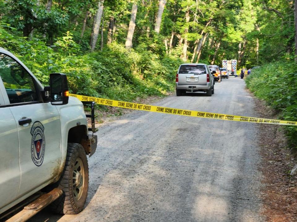
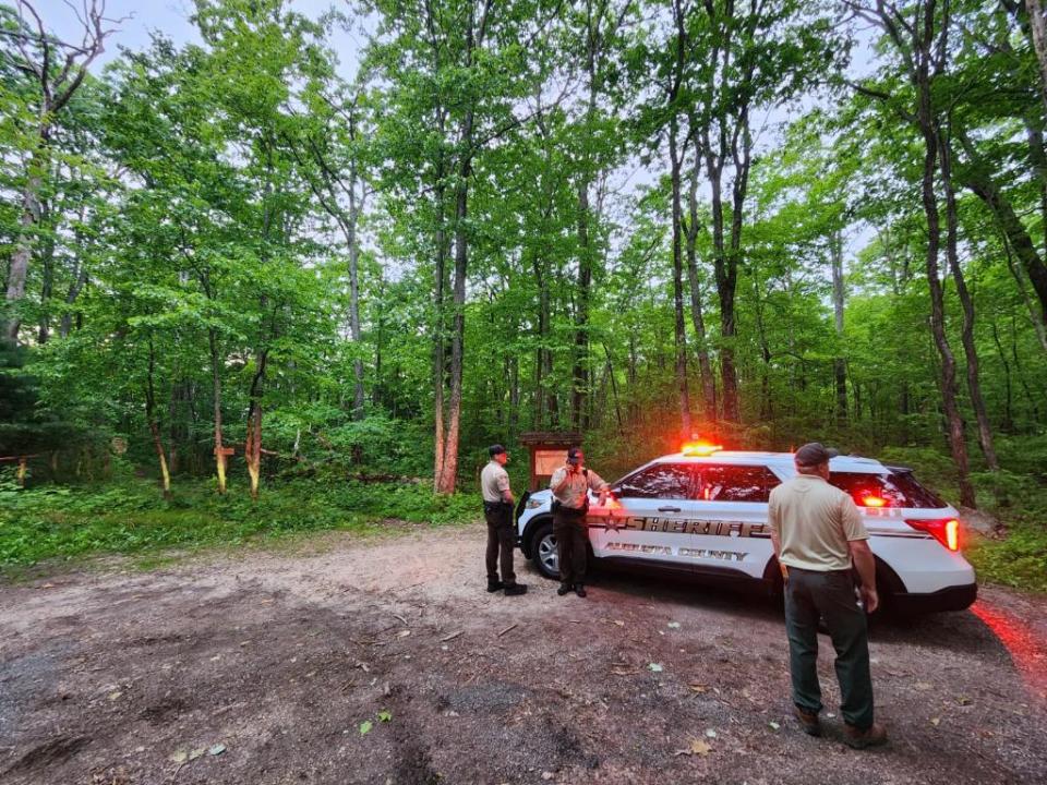
The News Leader has a person on the scene where rescue personnel are gathering. He's reporting about 15 people from Virginia State Police, Augusta County Sheriff's Office, and county fire and rescue personnel.
Radio traffic indicates the search is at a standstill. "The four guys aren't finding anything at those coordinates." They are asking the helicopter to go back up and provide coordinates again.
New coordinates have been called in.
7:16 p.m.
People on the ground are still asking for a copter to hover above the site.
CNN reported earlier that there were four people aboard the Cessna Citation that crashed.
7:30 p.m.
State police helicopter is back in the air and heading toward the site again, per rescue traffic.
NORAD confirms that aircraft tried to engage the plane but it was unresponsive. They then followed it into Virginia.
NORAD Responds to an Unresponsive Aircraft over the National Capital Region pic.twitter.com/EX7r1B1Uum
— 1st AF/America's AOC (@1stAF) June 4, 2023
7:41 p.m.
State police copter is about 3 minutes from the site.
"We’re gonna try to hover right over that area. We have to make this quicker, we got clouds dropping in with the temperature drop."
"There should be some firefighters somewhere nearby, on the ground."
7:50 p.m.
"If you can see the helicopter, he is hovering over the site."
"They grounded the drones, correct?" from the helicopter.
"Sheriff's office checking?"
"I got a news helicopter up here that's cramping my style," says the state police chopper.
There's confusion on the ground which copter they should be looking at, because of the news chopper.
"Blue and gray, I'm the one right above the trees," from the state police chopper.
"Okay, we're gonna start traveling that way," from the ground.
"I keep on making passes, and I hover above it." From the copter. He says the media helicopters may cause them to abort.
7:56 p.m.
The state chopper is hovering now over the site. "Hovering over in 3 seconds... hovering over the site."
From the ground, "They got you." The chopper says the site is "just up the ridge" from that last set of coordinates.
"I'm gonna get out of this valley, and get a little higher."
8:02 p.m.
Fire/rescue has located the crash site.
8:18 p.m.
"Forestry has fire-fighters en route."
There's been no characterization of the state of the crash scene on rescue traffic.
8:39 p.m.
Forestry is still several minutes away from the site, and first responders have now moved 100 yards uphill of the crash site to get away from the smoke.
9:20 p.m.
Based on the most recent coordinates provided and from radio traffic, the crash site is two ridges north of the Parkway.
This article originally appeared on Staunton News Leader: How search parties located the downed Cessna in wilderness near Staunton

