Seismologists Discover Mountain Ranges 410 Miles Below Earth’s Surface
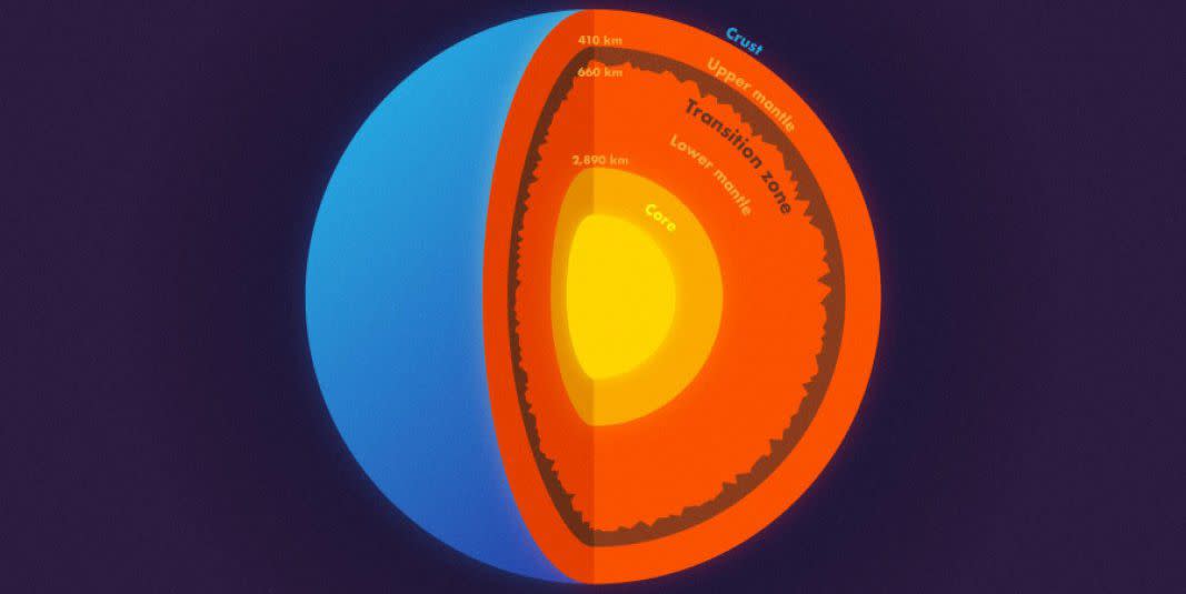
Deep beneath the surface of the Earth lies an entire landscape of mountains possibly rougher and taller than any on the surface. So say Princeton geophysicists Jessica Irving and Wenbo Wu, who published a study last week in Science in collaboration with Sidao Ni from the Institute of Geodesy and Geophysics in China. The researchers used scattered seismic waves registered during an epic magnitude 8.2 earthquake that struck Bolivia in 1994 to map the topography of a boundary layer 410 miles (660 km) “straight down.”
This layer, called the Transition Zone, is about 155 miles thick. It divides Earth’s mantle into an upper and lower section, revealing the interior of our planet to be far more complex than the tri-tone crust-mantle-core models we’re used to. Irving and Wu found that the top of the Transition Zone, at about 255 miles deep, is smooth for the most part and drastically different from the roughness at its “the 660-km boundary,” which is what they’ve started calling it for lack of a better term.
When your data lies far inside the Earth, the bigger and deeper the earthquake the better, says Irving: “the shockwaves they send out in all directions can travel through the core to the other side of the planet-and back again.” Waves of that magnitude carry information about the path they traveled. They go straight through rocks that are homogenous or uniform in composition and bounce off or bend around the edges and boundaries of heterogenous or conglomerate materials.
“That’s why we can see these objects,” said Wu. “The scattering waves carry the information about the surface’s roughness.” And what they’ve been able to “see” appears just as complex, varied, and dramatic as what can be found on Earth’s surface, with two-mile elevation changes between level, ocean-floor-like areas and colossal mountain ranges.
The researchers used a bank of extremely powerful supercomputers, including Princeton’s Tiger cluster, to simulate the behavior of the Bolivian earthquake waves. As the sophistication of seismic instruments and computing develops in the future, scientists will be able to add more detail to the 660-km boundary map. But there are plenty of questions to explore in the meantime that have been debated by geoscientists for years.
For example: Does heat travel evenly through the mantle, or does the Transition Zone interrupt that process? Are the upper and lower mantle chemically distinct, and if so, how do the separate thermodynamic cycles work? Wu, Irving, and Ni believe that some answers might lie in the newly revealed subterranean landscape. The more gentle topography on the floor of the Transition Zone may indicate areas where the mantle is well mixed, while the rugged, mountainous zones may be the result of an interruption or blockage of the heat-transfer cycle-what the abstract calls “imperfect circulation between the upper and lower mantle.”
The study also offers insights into what happens to sea floor slabs that get pulled into subduction zones and pushed down into the mantle. Some of these slabs might have traveled down through the upper mantle, perhaps as far as the rugged 660-km boundary or just past it.
Understanding more about the remnants of such ancient tectonic plates and how they have impacted the chemical composition of the mantle will help seismologists understand how Earth formed, how it changes over time, and how these changes impact our planet’s integrity and longevity. It’s like the real-world geophysicists’ redux on Jules Verne’s Journey to the Center of the Earth, 155 years later. Just enough time for science-fiction to become science.
('You Might Also Like',)

