Severe heat is worsening. OKC planners need volunteers to help measure the impact.
Oklahoma City planners and engineers are seeking hundreds of local volunteers to be a part of a nationwide campaign to map urban heat islands in large cities.
The volunteers, called “street scientists” by city officials, would be asked to help record temperature and air quality data along pre-planned routes throughout the city during the early morning, late afternoon and evening on the hottest day in August.
The mapping event is tentatively set for Aug. 12, but the date could change, depending on weather conditions. Upwards of 300 people would be needed to most effectively staff the Oklahoma City campaign, planners said.
“It’ll be about 35 routes, driven 3 times during the day, and we did not want to assume that our volunteers would want to take multiple shifts,” said Sarah Terry-Cobo, an associate planner with Oklahoma City’s Office of Sustainability. “We would love it if people would, and we already have some folks who are interested in multiple shifts, but we didn’t want to say we need 100 people and only get 100 people signed up, and then they’d have to work an 11-hour, 12-hour day on the hottest day of the year.”
Each group will consist of three volunteers, including a driver, a navigator and a support. The group will be tasked with attaching equipment to their vehicle and driving one of the routes, measuring how hot the area is and how clean the air is. After the route is finished, the volunteers will return the equipment to a “heat hub,” where they also can hydrate and cool themselves.
Related: Heat mapping campaign could identify, solve extreme heat targeting OKC's most vulnerable
The first training for volunteers was held virtually Tuesday night, with additional sessions planned for July 13, from noon to 1 p.m., and July 27, from 5:30 to 6:30 p.m.
“There will also be a knowledge check and a liability waiver,” Terry-Cobo said. “So they will need to sign the liability waiver and then perform the knowledge check, which is basically just a short quiz to make sure you were paying attention during the volunteer training so that we can ensure that you know how to turn on the equipment, how to take care of it, how to troubleshoot and that sort of thing.”
Volunteers are encouraged to sign up for the heat mapping initiative using the online form on the planning department page of the city's website.
What is an urban heat island?
An “urban heat island” is another name for an area with few trees and more pavement, which allows for increased absorption of heat. These locations can be up to 20 degrees hotter than neighborhoods with more trees, more shade, more grass and less black asphalt.
Nationwide studies show communities in the most heavily affected areas during heat waves have seen higher heat stroke rates, poorer air quality, increased financial burdens, unsuitable work and school conditions, limited access to water, and reduced crop production.
More: Urban heat islands are why it can feel 20 degrees hotter in different parts of the same city
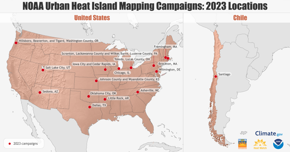
Oklahoma City is one of 18 communities chosen by the National Oceanic and Atmospheric Administration for the 2023 NOAA Urban Heat Island mapping campaign. The Oklahoma City Council approved a grant award for the effort in early June.
Numerous organizations in the Oklahoma City metro are partnering with the city’s Office of Sustainability to assist in the campaign, including the Oklahoma City-County Health Department, Oklahoma City Parks and Recreation, the Metropolitan Library System, and the Oklahoma City Zoo and Botanical Garden.
Why is the heat island mapping campaign important to the city?
Researchers with The University of Oklahoma’s colleges of architecture, public health, and atmospheric and geographic sciences are also coordinating public education workshops with sustainability planners to raise awareness about heat vulnerability.
Terry-Cobo said meteorologists with the National Weather Service Forecast Office in Norman have provided climate model data so that the planners can understand how the heat mapping initiative will inform their own research.
“We know that extreme heat is only going to get worse from here,” Terry-Cobo said. “What the data shows is the number of extreme heat days, which is the days above 100 degrees. Currently we average 9 days. In 2030, we’re expected to have double that. And by 2050, we’re expected to have more than 30 days. It will cost people more to respond to that extreme heat later as opposed to responding to it now.”
Related: We created scorching 'heat islands' in big cities. Now they're becoming unlivable
Once the heat mapping data collection is complete, CAPA Strategies, a NOAA contractor, will synthesize the information into a report that local policymakers and organizations can use to help prioritize responses and solutions to extreme heat.
When issuing heat advisories, forecasters also consider social factors, such as heart and lung conditions, diabetes and obesity among the most vulnerable of the city’s population, including children, older adults, low-income residents and minority demographics.
The heat mapping campaign data could be used to pinpoint areas needing more trees, more public transportation shelters, more cooling relief centers, more weatherized installations and more heat action plans.
Heat wave hitting Oklahoma: Find cooling centers, utility assistance
“That’s exciting for us in the sense that this campaign can help inform people,” Terry-Cobo said. “It can also help inform not just the science of how do we prepare for this and how do we mitigate this and how do we prioritize our resources for the most vulnerable. But if we’re helping National Weather Service improve the way that they issue their heat advisories, that’s incredible. That’s very important and profound work, I think.”
The first public workshop is scheduled for July 8, 10:30 a.m. to 11:30 a.m., at The Auditorium at The Douglass on 600 N High Ave.
Find top spots to beat the heat: Water parks near Oklahoma City
This article originally appeared on Oklahoman: OKC planners call for volunteers in urban heat island mapping campaign

