A severe snowstorm threat will spike your Ontario snowfall forecast
We have looked at the current weather data, and there is a significant risk of a colossal snowfall event unfolding later this week.
You might want to be sitting down before you read the highest possible snowfall outlined below.
SEE ALSO: PHOTOS: Poorly timed snow, ice in southern Ontario creates travel chaos
Ingredients
This section is for those wondering why. Over the past several weeks, a handful of Colorado and Texas lows have swept across Ontario and Quebec, giving maximum snowfall totals of 10-25 cm. This low has a higher ceiling.
The Texas low born on Thursday will have ample moisture, compounded by an overheated Gulf of Mexico, with ocean temperatures up to 3°C above average.
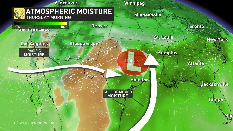
The setup is even capable of drawing moisture up from Mexico. Yes, Mexico, along with Pacific moisture from an active California.
A severe weather outbreak across the U.S. will set the stage for northward moisture transport through the day on Friday. This significant moisture anomaly collides with a cool trough that drops in on Thursday, priming the surface for winter weather.
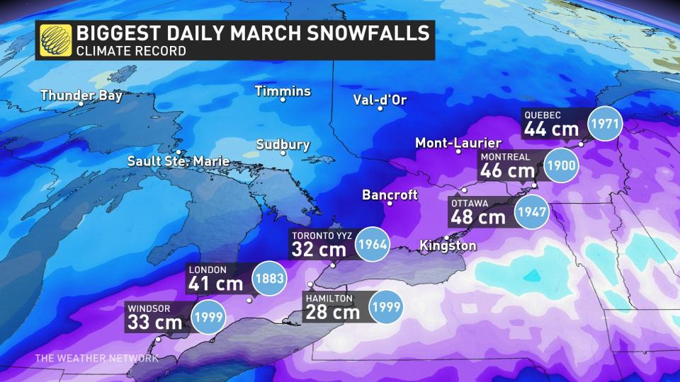
Historical context and impacts
The biggest snow event of the season? For some, potentially, yes. The highest storm totals this season: 32 cm for Montreal, 36 cm for Ottawa, and 18 cm for Toronto.
For those wondering, here are our biggest single-day March snowfall records:
With a swath of over 30 cm possible, substantial travel issues and flight disruptions are likely. We’ll continue to analyze the latest weather data, but do not be surprised to see increases in your snowfall forecast over the coming days.
On paper, this looks like a particularly drawn-out storm, with precipitation extending up to 24 hours.
Uncertainty
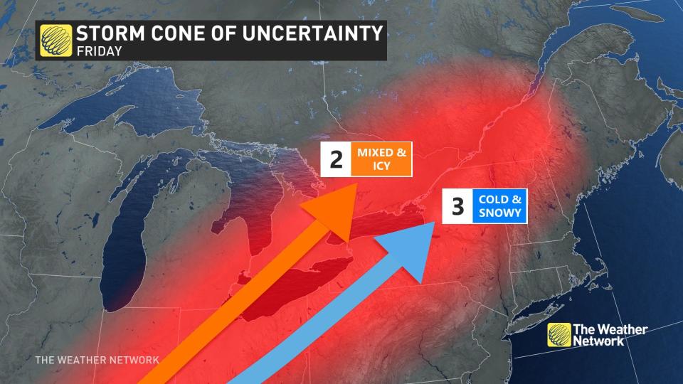
Severe weather outbreaks in the U.S. can drastically alter the ultimate track of low-pressure systems. Thunderstorms contain tremendous amounts of energy and occur on such a micro-scale that they become a source of model error in the long range.
By the time the Texas low reaches Ontario, it will already be in transition. It attains peak intensity in the U.S. by Friday, before some energy transfers into a coastal low. During this delicate baton pass, moisture will slide east of the Appalachian Mountains.
Moreover, computer models are in conflict, especially concerning a wedge of warm air aloft. All locations start off as snow, but we will carefully monitor the risk of a wintry mix.
There is a lot in flux here. Be patient as we keep updating this southern Ontario forecast as the storm draws near.

