Severe storms in the forecast again. Is Lexington having an extra rainy spring this year?
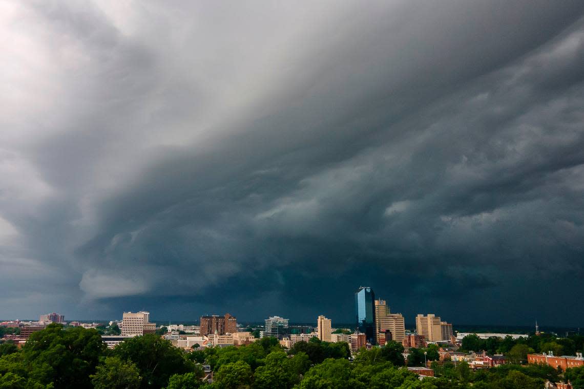
Storms are expected through Central Kentucky Thursday afternoon and into the evening, bringing gusty conditions and more rain, the National Weather Service in Louisville warned in a hazardous weather outlook issued Thursday.
Wind gusts of 30 to 40 mph are expected, and a cold front will move into the region Thursday evening. In Lexington, precipitation is expected this morning and afternoon, followed by possible thunderstorms beginning around 2 p.m., the NWS said in its latest forecast. While the high is 69 degrees Fahrenheit, showers and storms will dampen most of the day with rainfall totals expected between a quarter and a half an inch.
In a Thursday forecast, WKYT meteorologist Chris Bailey also noted severe storms remain possible and “the best chance for severe weather here in Kentucky will be across central and eastern Kentucky with northeastern part of the state having an increased risk.”
However, the storms will not be “on par” with the severe weather last week that resulted in 11 tornadoes touching down across the state.
The greatest risk for Thursday tornadoes is across northeastern Kentucky. The Storm Prediction Center is highlighting this area through parts of Ohio and West Virginia. #kywx pic.twitter.com/6vMlxGQn2H
— Chris Bailey️️ (@Kentuckyweather) April 10, 2024
Mike Kochasic, a meteorologist with the NWS in Louisville, said in an interview Wednesday afternoon it’s generally a good time of year to revisit your emergency plans.
“Make sure you have a battery-operated radio, three day’s worth of supplies, things like that,” Kochasic told the Herald-Leader. “If folks are looking for templates on how to make an emergency plan, or a kit, they can go to Ready.gov. That’s a good website to go check out to make sure you’re prepared.”
Is Lexington on track for above-average rainfall this spring?
According to Kochasic and NWS data, rainfall totals taken at Lexington’s Blue Grass Airport show the area has received 15.48 inches of rain since Jan. 1. That amount is current as of Tuesday, Kochasic said.
Normally, the rainfall total for this time of year is 12.76 inches, Kochasic said, meaning Lexington has seen nearly 3 inches above its normal amount so far this year.
Citing the latest outlook from the nation’s Climate Prediction Center, Kochasic said, “for the next month and the next three-month outlook, we’ll be more likely to have above-normal precipitation.”
What role is El Niño playing in Kentucky weather this spring?
El Niño is a weather phenomenon that begins with a warming of the waters in the middle of the Pacific Ocean and influences weather across the U.S. via a shift in the jet stream.
That warming weakens the wind currents that normally blow east to west along the equator, sometimes even reversing them. The result is a shift in normal weather patterns across the U.S. and worldwide. In the winter, El Niño generally brings flooding to the southern U.S. and warmer, drier conditions over the Pacific Northwest, northern U.S. and Canada.
Currently, Kentucky is still experiencing an El Niño pattern, though the weather service is expecting a reversion to more neutral conditions. By later summer, there’s a good chance we’ll move into a La Niña, the exact opposite of El Niño.
“There’s an 83% chance that we’re going to go back to neutral conditions. And there’s even a 62% chance by later this summer that we’ll go to La Niña phase, which means that the water is colder than average in the Pacific,” Kochasic said.
All this could result in a colder pattern later this year and into the winter, Kochasic said.
However, it’s worth remembering that El Niño and La Niña are complicated phenomena and a multitude of factors can influence weather outcomes, meaning we’ll have to wait and see.
Do you have a question about the weather in Kentucky for our service journalism team? Send us an email at ask@herald-leader.com or contact us with the Know Your Kentucky form below.

