Tornado watch issued for much of Wisconsin; Milwaukee area not included in watch; weather 'could get a bit feisty' by late afternoon
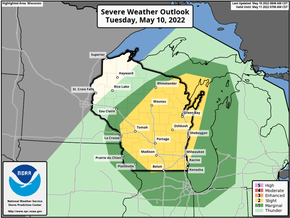
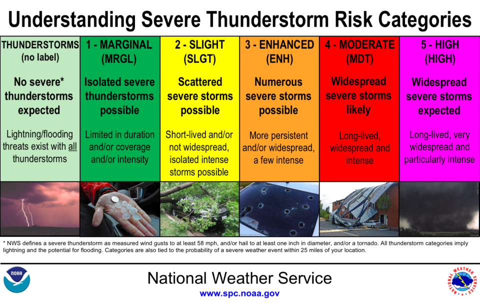
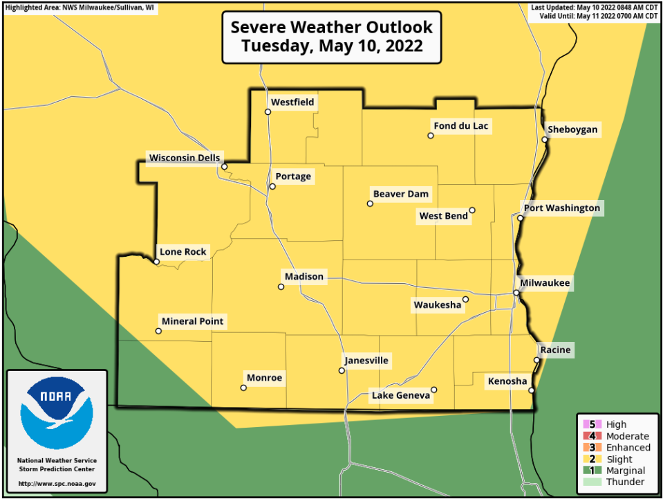
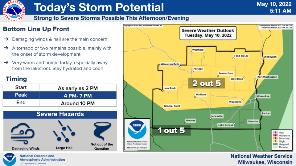
Severe thunderstorms are possible across Wisconsin on Tuesday, with the greatest threat being northwest of Milwaukee, forecasters say.
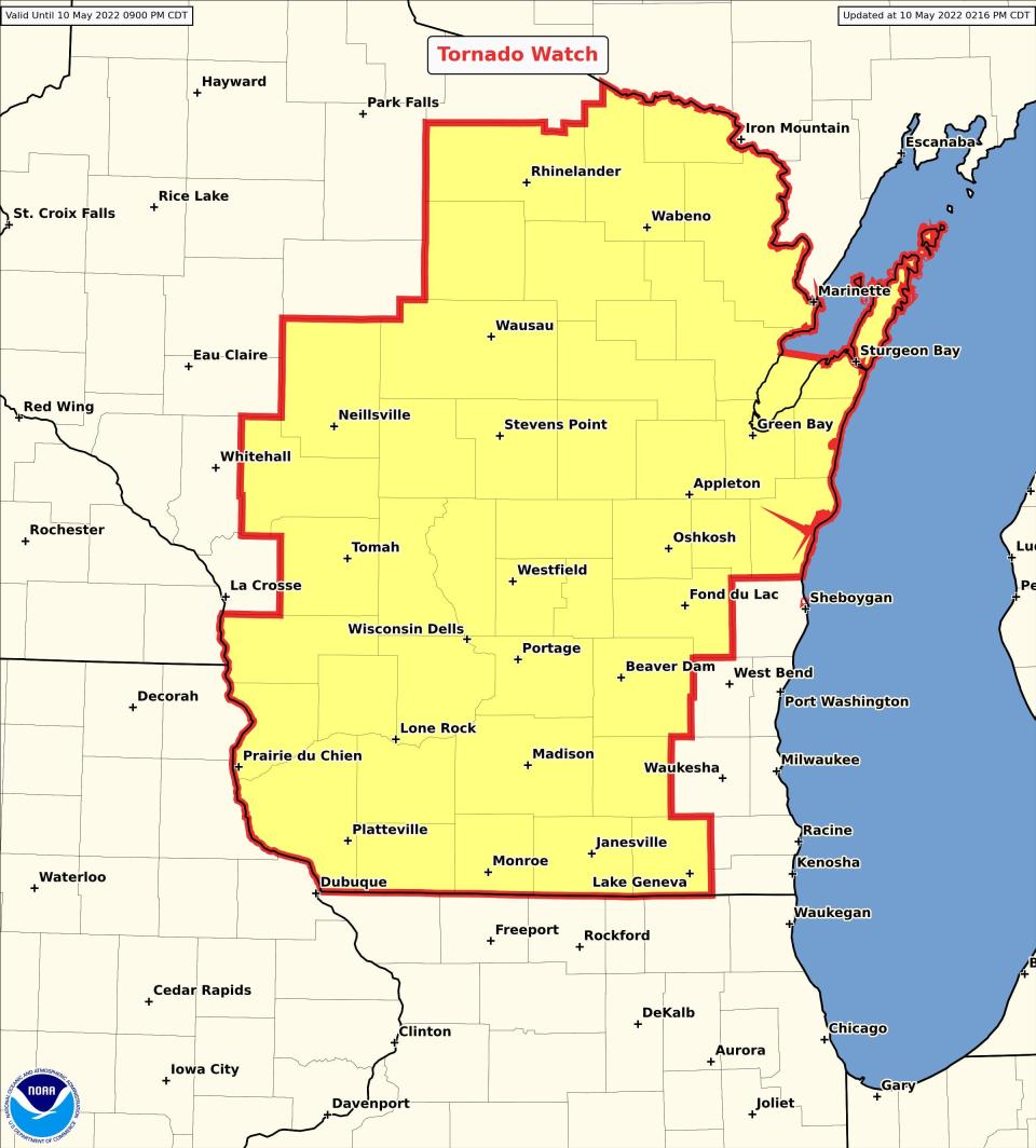
A tornado watch is in effect for almost all of Wisconsin, excluding the Milwaukee metro area, until 9 p.m.
Milwaukee and counties surrounding it are not included in the tornado watch because a breeze has developed off Lake Michigan which means cool, more stable air is over far southeast Wisconsin, said Paul Collar, a meteorologist with the National Weather Service in Sullivan.
Thunderstorms, especially severe storms, feed on warm unstable air.
While not in the tornado watch, the weather could still get loud over far southeast Wisconsin during the evening hours, Collar said.
Among the cities included in the tornado watch are Green Bay, Appleton, Oshkosh, Madison, Fond du Lac, Wausau, Stevens Point, La Crosse, Marshfield, Wisconsin Rapids, Manitowoc, Sturgeon Bay and Janesville
"The storms could get a bit feisty in the late afternoon or early evening," said Rebecca Hansen, a meteorologist with the National Weather Service in Sullivan.
All of this is being caused by a cold front that is poised to collide with unseasonably warm, humid air that is flowing up into Wisconsin from the Gulf of Mexico.
"We sort of skipped spring and went straight into summer," Hansen said. "With the warmer and more humid air, there are more chances for thunderstorms."
The cold front that is set to move through won't be enough to overpower all that warm air, but it will be enough to potentially stir up some storms.
"It looks like the peak (time for thunderstorms) is going to be between 4 p.m. and 7 p.m., but storms could linger a little longer than that," on Tuesday, Hansen said.
Look for storms possibly popping up by early afternoon.
“We’re expecting storms to fire out west of Madison and north and northwest of Fond du Lac starting as early as 1 p.m. or 2 p.m. this afternoon and they’ll start to make their way to the east and southeast during the mid- to late-afternoon hours,” said John Gagan, a weather service meteorologist in Sullivan.
Eventually, the thunderstorms are expected to become more numerous and could form into a line of storms along the front, Hansen said.
Storms are expected to move out of state by 9 p.m. or 10 p.m.
Heat index may approach 90 Tuesday
While storms are expected to fire up along a cold front on Tuesday, the front won't be strong enough to overcome the summer-like weather that is forecast for the week throughout much of Wisconsin.
Highs away from Lake Michigan are forecast to reach into the 80s on Tuesday.
“We’re going to be well into the 80s today, especially as you get away from the lakefront,” Gagan said. “A lot of the inland areas are going to be in the mid-80s with increasing humidity.”
The heat index – the combination of heat and humidity that reflects what it actually feels like outside -- could approach 90 in some spots on Tuesday, Gagan said.
“Given how cool we were in April, this will be an abrupt change,” Gagan said. “Remember to wear your sunscreen, keep yourself cool and stay hydrated,” especially if you are working outside on Tuesday.
The high on Tuesday in Waukesha is forecast to be 83. The high in Milwaukee on Tuesday is forecast to be 76.
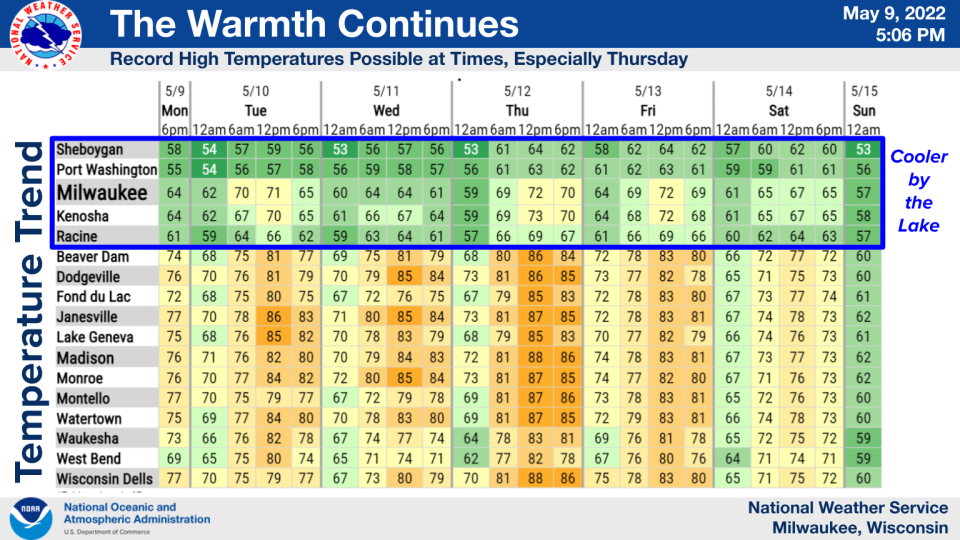
The humidity will be rising along with the temperatures.
Madison is forecast to hit a high of 89 degrees on Thursday and some folks will no doubt be switching on their air conditioners for the first time this year.
The summer-like temperatures are expected to remain in place at least through the end of the workweek, according to the weather service.
"It's going to get warm," Hansen said. "It's everybody's favorite time of year: Cooler by the lake."
Weather Radar

Our subscribers make this reporting possible. Please consider supporting local journalism by subscribing to the Journal Sentinel at jsonline.com/deal.
DOWNLOAD THE APP: Get the latest news, sports and more
Contact Joe Taschler at (414) 224-2554 or jtaschler@gannett.com. Follow him on Twitter at @JoeTaschler or Facebook at facebook.com/joe.taschler.1.
This article originally appeared on Milwaukee Journal Sentinel: Tornado watch in effect for most of Wisconsin except Milwaukee

