Severe storms pound metro Detroit after Wayne County flooding; 300K in state without power
Forecasters are expecting a mostly dry Friday after a frustrating day of flooding for many in Wayne County that blocked access to a major airport terminal, inundated Canton businesses and homes, and led to the highest number of power outages in the country.
Residents, utilities, transportation and airport officials were bracing for potentially more flooding early Friday after expected rainfall was forecast for late Thursday night. Gov. Gretchen Whitmer declared a state of emergency Thursday evening in response to the flooding earlier in the day.
In Kent County, on the west side of the state, a tree and house were struck by a possible tornado, but it hasn't been confirmed, a meteorologist with National Weather Service in White Lake said, citing a report from the Kent County emergency manager. In Ingham County, a large and dangerous tornado was reported about 10 p.m. near Williamston and Webberville and was headed east, according to the National Weather Service. Tornado and thunderstorm warnings were issued throughout the night, but had ended by about 11 pm.
“Activating the State Emergency Operations Center ensures we can support communities in Southeast Michigan as they respond to the impacts of flooding,” Whitmer said in a news release. “We will get first responders and emergency crews on the ground the resources they need to keep people safe. Safety is our top priority, and we will get through this together.”
Thursday had begun with flooding, widespread power outages, dozens of flight delays and cancellations, and an extreme heat alert. There was all that and the threat of even more dangerous weather throughout the day, including hail and tornadoes.
Overnight rain had turned parts of Detroit Metro Airport into an island, flooding the tunnels that lead to and from the McNamara Terminal, which Delta uses as a hub. Flyers were stranded for hours, with long lines of cars waiting to get to the airport.
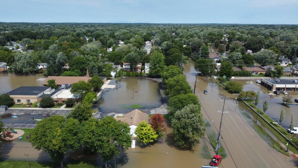
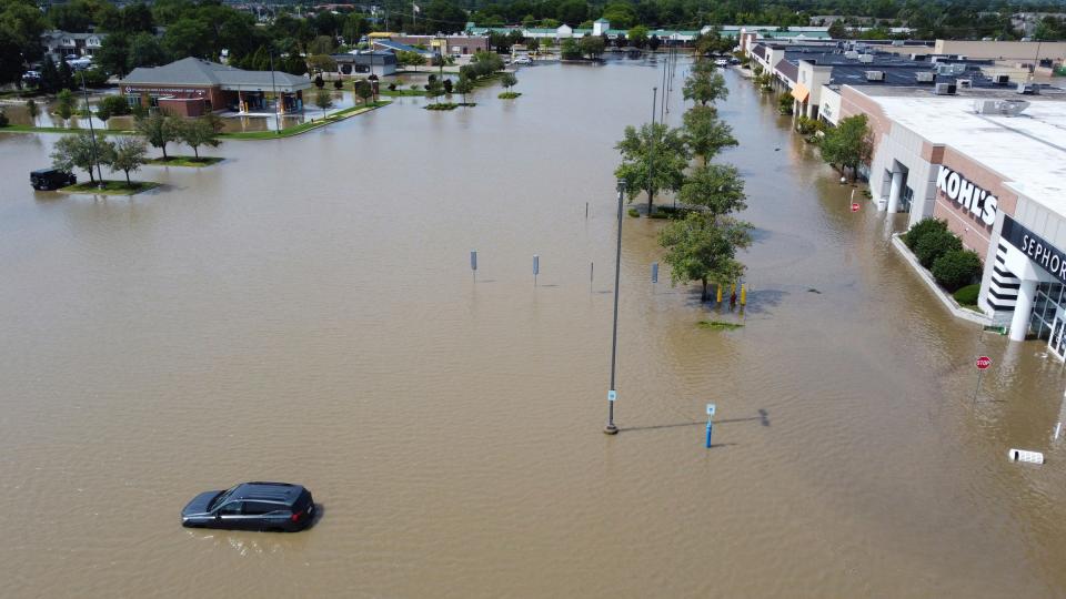
And much of Canton was under water, with hundreds of flooded homes, along with parts of Van Buren Township, Plymouth and Novi. The water was so deep in some places in Canton that residents paddled through it in kayaks as if it were a lake.
By about 4 p.m., access to the airport terminal was restored. The rainwater had receded significantly, but it was unclear whether another overnight deluge would cause the tunnels to flood again. The Wayne County Airport Authority said it was trying to find a way to solve the problem.
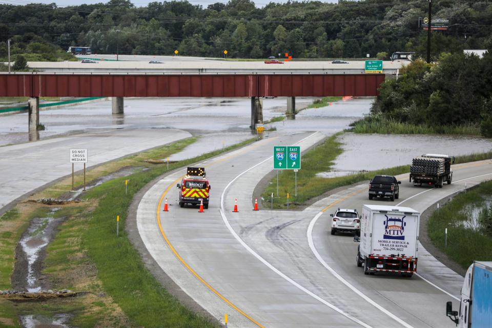
It also was likely that north and southbound Interstate 275 near the airport off Interstate 94 would be closed until Friday, the Michigan Department of Transportation said Thursday.
Until the tunnels were cleared, the airport asked passengers for patience, but some flyers said theirs had run out.
DTW: Detroit airport drainage system overwhelmed by intense rain
Where to go, what to do
Perhaps the biggest frustration for Metro Airport passengers was not knowing what was happening — or where they should go. They said they didn't get information right away from the airlines or the airport. Some turned to the Free Press and other news outlets.
Many passengers who flew into Metro Airport on Thursday morning found a way to walk out of the terminal. Weary, and toting their luggage, they said that it was a long way to go, but better than waiting. Vehicle traffic into the airport was backed up, too.

One passenger, Tracy Gregg, said before noon she was among thousands of people waiting to get to the terminal. Her Wednesday night flight was canceled, she said. She returned at 5:30 a.m., and then briefly left, and had been waiting in line to get to the terminal since 9 a.m.
"It's extremely stressful," she said. "We have no idea what we should do."
Inbound Detroit Metro flights were being held most of the morning, according to FlightAware, a website that tracks flights. As of early afternoon, departures were delayed on average by almost an hour. The site noted that, for flights departing between 9 a.m. and 1 p.m., there were 45 delayed flights and 24 cancellations.
Delta told the Free Press on Thursday it was processing cancellations and to expect more, adding that customers are being automatically rebooked when a cancellation occurs to the next best itinerary that gets them to their final destination with the least possible delay.
Canton floods, ready for more
Seven inches of rain fell in Belleville on Wednesday night, which is unusually high, said Kyle Klein, a meteorologist with the National Weather Service's White Lake Township office. It ranged from 2 to 7 inches across metro Detroit.
Klein said Friday should be dry with temperatures reaching a high in the low 80s, but with some humidity.
On Thursday morning and evening, Michigan had the highest number of customers without power among the 50 states, according to PowerOutage.us.
The Michigan Department of Transportation confirmed that was enough to cause flooding in "a number of areas," but the worst, it said, was the Interstate 275 and Interstate 94 interchange. Many interchange ramps were closed. Photos of the freeways showed roadway flooding with cars and trucks getting stuck in deep water.
Canton public safety officials said officers were dispatched Thursday to help residents facing flooding because much of the township was under water. One aerial photo posted to social media showed roadways at Ford and Canton Center covered with water.
“We’re on top of it, but we’re worried more rain is coming tonight,” Township Supervisor Anne Marie Graham-Hudak told the Free Press late Thursday. “We have a lot of streets flooded and at least 225 homes we’re checking right now.”

Fortunately, she said, it was stormwater — not sewage.
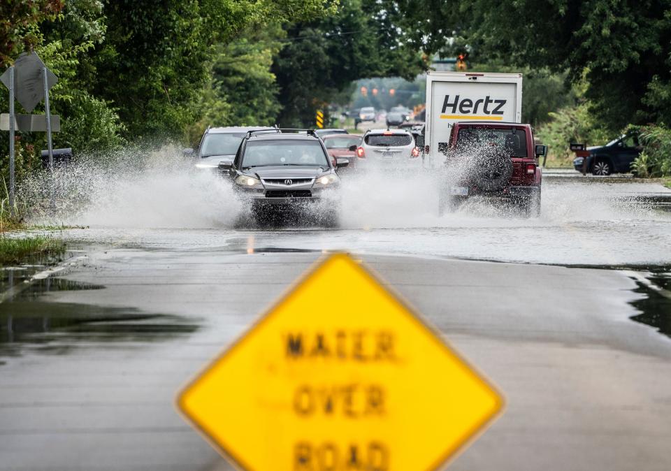
The system was taxed, she said, with 4-5 inches falling in an hour. She asked residents to call public works, not public safety, and not to drive through the water and not to kayak through the streets because it could lead to more safety concerns.
Costs of climate change
Dangerous weather has long been a concern, but some scientists are warning that climate change has consequences that go beyond hotter summers and colder winters. It raises the potential of more severe storms and more flooding.
"Floods are the most common — and among the most deadly — natural disasters in the United States," the Natural Resources Defense Council noted in a 2018 report. "They have brought destruction to every state and nearly every county, and in many areas they are getting worse."
The nonprofit environmental advocacy group predicted that extreme weather would grow America's floodplains by about 45% in the next few decades.
More recently, cities and utilities have acknowledged climate change is making it more difficult and costly to prevent and repair downed power lines, flooded streets and other structures.
And it likely will mean higher utility and insurance bills — and more inconvenience when storms strike.
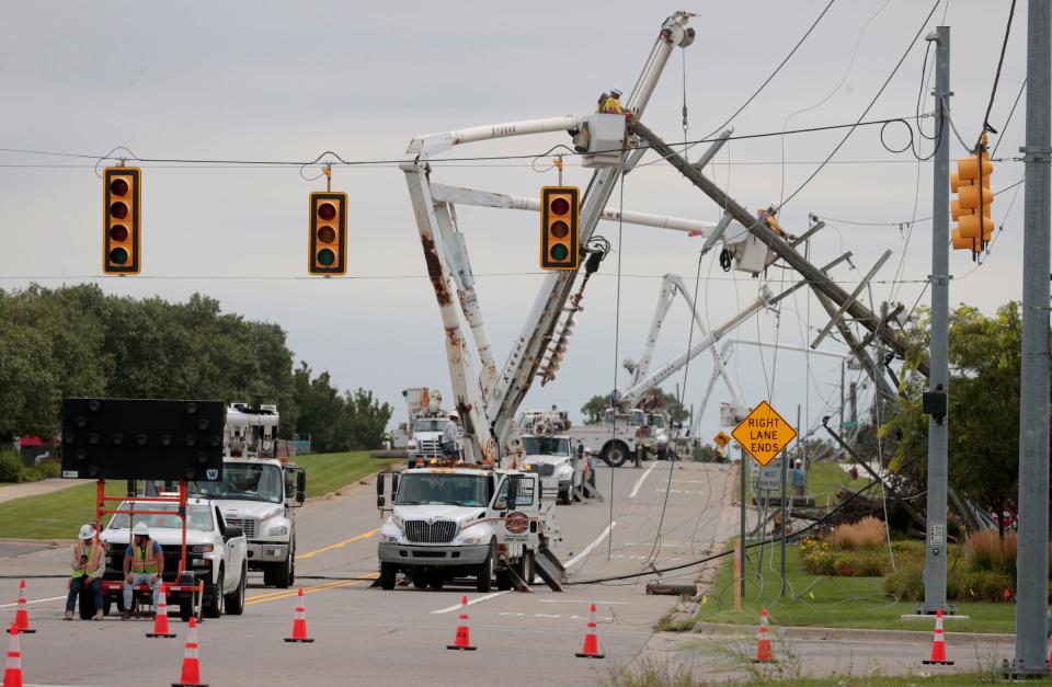
As of 11 p.m., the state's two largest utilities combined reported nearly 300,000 customers without power; DTE had about 103,000, and Consumers Energy, 194,000. DTE has said climate change is likely to be a factor in power outages and restoration efforts. With more storms overnight again, the number of Michigan customers without power could rise even more.
Michigan power outage map: How to check your status
New day, new forecast
Meteorologists said the water eventually should dissipate, but not before more rainfall.
National Weather Service meteorologists upgraded the chance for thundershowers for southeast Michigan on Thursday to an enhanced risk, meaning that residents should expect more damaging gusts and, for those in low-lying areas, even more flooding.

"We’ve had the same air mass the whole day," said weather service meteorologist Brian Cromwell at the agency's White Lake office. "The front has stopped moving, so that means we could definitely see something similar to last night."
Forecasters, Cromwell said, will be "watching everything very closely" with the greatest chance for severe thunderstorms from 7-10 p.m., but they could pop up any time after about 4 p.m. They are predicting 1½ inches of rainfall, but it could be more.
But, meteorologists said, Friday is a new day with a new forecast: cloudy with little chance for rain.
The Lansing State Journal contributed to this report.
Contact Frank Witsil: 313-222-5022 or fwitsil@freepress.com.
This article originally appeared on Detroit Free Press: Severe storms slam Michigan as Wayne County grapples with flooding

