Thousands lose power after storms move through Columbus area
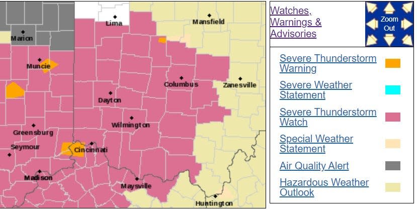
A severe thunderstorm watch was in effect Monday for central Ohio through 10 p.m.
The National Weather Service in Wilmington has issued the watch because of the chance of pop-up thunderstorms this evening and tonight, similar to what the area experienced Sunday night that caused major problems for special concert events and delayed the Crew game until after 11 p.m.
These storms can develop quickly, are slow moving and could bring heavy rains, high winds and hail in some places, the NWS warns.
Heavy downpours could cause flash flooding in some areas, the NWS says. Fairfield, Franklin and Licking counties are all under a flood advisory.
"Minor flooding is ongoing or expected to begin shortly in the advisory area. Between 1 and 2 inches of rain have fallen. Additional rainfall amounts of 0.5 to 1 inch are possible," NWS posted around 8:30 p.m.
Locations that may experience flooding include Columbus, Dublin, Westerville, Reynoldsburg, Grove City, Upper Arlington, Gahanna, Hilliard, Pickerington, Worthington, Bexley, Heath, Granville, Pataskala, Canal Winchester, Groveport, Baltimore, Buckeye Lake, Hebron and Minerva Park.
The pop-up storms are largely moving west to east, and a storm front appeared to be forming across the state line in eastern Indiana could impact central Ohio later this evening.
Residents should check in with the NWS Wilmington radar during the watch, which is less serious than a severe thunderstorm warning.
Ohio weather radar
Are there power outages around Columbus?
Here's a look at the AEP outage map.
What's the difference between a watch and a warning?
According to the National Weather Service:
A watch "is used when the risk of a hazardous weather or hydrologic event has increased significantly, but its occurrence, location or timing is still uncertain. It is intended to provide enough lead time so those who need to set their plans in motion can do so. A watch means that hazardous weather is possible."
A warning "is issued when a hazardous weather or hydrologic event is occurring, imminent or likely. A warning means weather conditions pose a threat to life or property. People in the path of the storm need to take protective action."
This article originally appeared on The Columbus Dispatch: Latest weather radar, power outage map as storms hit Columbus, Ohio

