Severe thunderstorm watch issued for eastern South Dakota by National Weather Service
A severe thunderstorm watch has been issued for parts of central and eastern South Dakota on Thursday night by the National Weather Service.
Threats include hail up to two inches in size, scattered wind gusts up to 70 mph and possible lightning, according to the NWS. Impacted areas include Sioux Falls, Brookings, Watertown, Mitchell, Huron and Pierre.
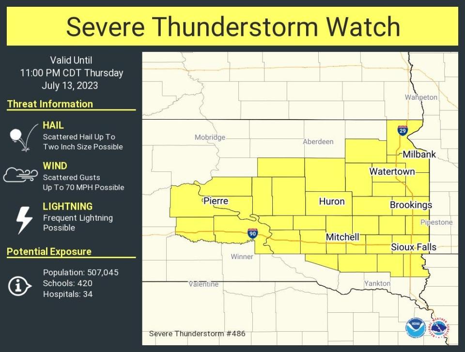
The watch is in effect until 11:00 p.m., according to the NWS.
Severe thunderstorms warnings have already been issued for portions of central South Dakota on Thursday afternoon, according to the NWS.
A severe thunderstorm WATCH has been issued for portions of the area.
Here's how to be prepared. pic.twitter.com/Ods9CAdbPj— NWS Sioux Falls (@NWSSiouxFalls) July 13, 2023
Slight risk of severe thunderstorms, high wind; no tornadoes expected
According to the NWS Storm Prediction Center, there's a slight risk of severe thunderstorms, wind gusts over 25 mph and hail in the Sioux Falls area and extending into western Minnesota.
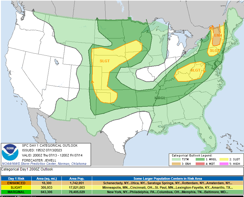
However, no tornadoes are expected in the Sioux Falls areas, according to the Storm Prediction Center. There's a low probability of tornadoes in a small part of southwestern South Dakota near the Nebraska border.
Your weekend forecast
Tonight: Slight chance of showers and thunderstorms after 8 p.m.. Partly cloudy with a low near 65. Windy with gusts up to 20 mph. Chance of precipitation is 20%.
Friday: Mostly sunny with a high near 83. Breezy.
Friday night: Slight chance of showers and thunderstorms between 8 p.m. and 11 p.m.. Partly cloudy with a low near 63. Breezy. Chance of precipitation is 20%.
Saturday: Sunny with a high near 83. Windy with gusts up to 25 mph.
Saturday night: Mostly clear, low near 59. Windy with gusts up to 20 mph.
Sunday: Sunny, high near 81. Breezy in the morning with winds increasing in the afternoon. Gusts up to 25 mph.
Sunday night: Mostly clear, low near 56.
This article originally appeared on Sioux Falls Argus Leader: Severe thunderstorm watch issued for Sioux Falls, Watertown, Pierre

