Severe thunderstorms possible later this week. Here's what forecasters are saying.
The National Weather Service says there's a chance of severe thunderstorms later this week.
"We are currently monitoring a low-end risk for a few strong to severe storms Thursday evening into early Friday morning with the arrival of a cold front," said a message from the agency's office in Paducah, Kentucky, which handles forecasting for the Tri-State.
While forecasters noted "some uncertainty" remaining in the outlook, "conditions will be the most favorable to support a few strong to severe storms across portions of Southeast Missouri and Southern Illinois."
Large hail and damaging winds are the main threats.
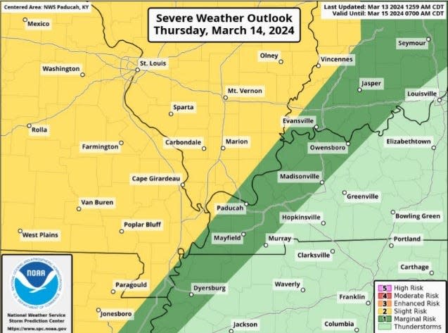
There is less certainty about the how much strength the storms will retain as they move into Western Kentucky and Southwestern Indiana.
Forecasters say heavy rainfall also will be possible with the storms, with up to an inch falling in the Evansville/Henderson area Thursday night into Friday morning. Some localized flash flooding is possible, the weather service said.
It also will be windy, with gusts out of the south reaching 30-35 mph.
This article originally appeared on Evansville Courier & Press: What is the weather forecast for Evansville, Indiana?