Severe weather expected in southern Wisconsin while multiple rounds of snow are likely up north
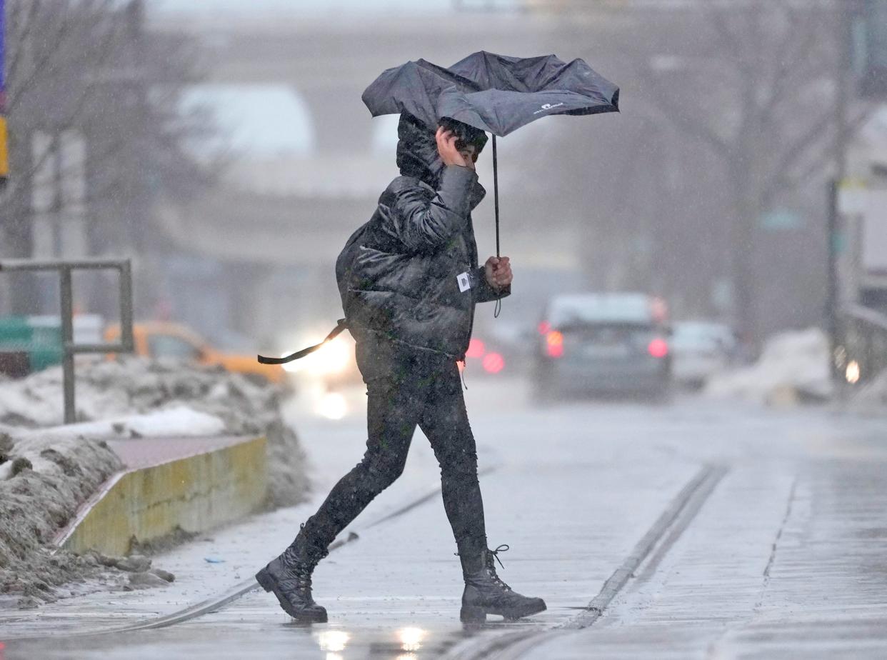
Severe weather is expected to affect the southern part of the state into the weekend as the Milwaukee area prepares for the possibility of thunderstorms.
Up north snow continues to make its way toward Green Bay and Appleton but is unlikely to make it to Milwaukee as temperatures continue to rise.
As a sporadic weather event continues to move into Wisconsin here is what to know.
Milwaukee area likely to see severe weather
Rain in the Milwaukee area is expected to start on Friday afternoon and continue into the early hours of Saturday. During the storm, the Milwaukee area will likely see between 0.75 inches to 1.25 inches of rain.
Snow is unlikely, but still possible in the early hours of Saturday, as temperatures are expected to start trending more mildly going into next week.
While Milwaukee is firmly in the path of the oncoming severe weather, experts at the National Weather Service say that the area is unlikely to bear the brunt of what the system is bringing, however, concern about severe weather has increased as the storm tracks closer to Milwaukee.
“It's still possible that some of these storms could move east and become severe even in Southeast Wisconsin. Again, the timing would probably be late — probably more late afternoon, evening for the Southeast Wisconsin Milwaukee area,” said national weather meteorologist JJ Wood.
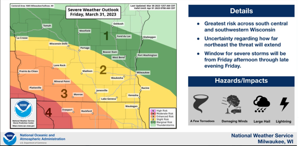
As the system moves in on Friday scattered thunderstorms are expected to start around 2 p.m. — these storms will bring high winds and possibly large hail. The more severe effects of the system will be felt on Friday night, between 5 and 9 p.m., and are expected to bring thunderstorms, large hail and damaging winds.
The area from La Crosse to Madison and Janesville is more likely to see the worst of the storm
The southwest portion of the state is currently the most likely area to see severe weather but the south-central portion, including Madison and Janesville, should still be prepared according to Wood.
“The best chances for severe weather are across southwestern and south central Wisconsin generally in the area from La Crosse over towards Madison to Janesville tomorrow afternoon and into the evening,” said Wood.
In these areas, a litany of severe weather conditions are possible including quarter to golf ball size hail hail, damaging winds that could get above 70 mph, thunderstorms and possibly tornadoes. Rain in these areas is also expected to range from 0.75 inches to 1.25 inches.
Up North expected to see multiple rounds of snow
Well north of Milwaukee, it's expected that snow will move into most places starting Thursday night. Areas in and around Rhinelander, Wausaukee and Eagle River are expected to see 7 to 12 inches of snow and possibly a quarter to half inch of ice.
Further south and east from there, Wausau, Green Bay, Door County and the Fox Cities are forecast to get around an inch, with little ice accumulation expected.
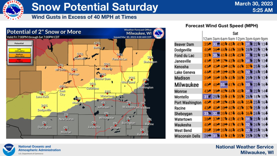
As we move from Friday night into Saturday, a second round of heavy, wet snow is forecast for areas north and west of the Fox Valley, with a 50-50 chance of over 2 inches of snow in a line from La Crosse to Fond du Lac, the NWS said.
Green Bay and the Fox Cities are likely to see 1-4 inches, but the Northwoods could see around 8-10 inches. The Saturday storm will also be accompanied by wind gusts of up to 40 miles per hour across the region, especially on Saturday morning.
Rebecca Loroff contributed to this story
Our subscribers make this reporting possible. Please consider supporting local journalism by subscribing to the Journal Sentinel at jsonline.com/deal.
DOWNLOAD THE APP: Get the latest news, sports and more
This article originally appeared on Milwaukee Journal Sentinel: Severe weather expected in Milwaukee area; snow likely up north

