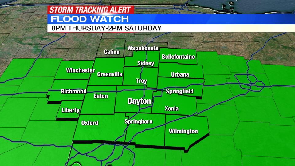
Widespread rain arrives tonight; Flood Watch issued for most until Saturday
A Flood Watch has been issued for Butler, Warren, Clinton, Montgomery, Preble, Greene, Miami, Clark, Darke, Logan, Shelby, Wayne (IN) and Union (IN) counties is in effect now until 2 p.m. on Saturday.
QUICK-LOOK FORECAST:
Passing storms today, hail possible
Widespread rain tonight through Saturday morning
Dry by the weekend
>> TRACK THE CONDITIONS WITH LIVE DOPPLER 7
DETAILED FORECAST:
OVERNIGHT: Widespread heavy rain arrives with a few embedded thunderstorms. Storm Center 7 Chief Meteorologist McCall Vrydaghs says temperatures will cool into the lower 40s by morning. Some minor flooding will be possible by then.
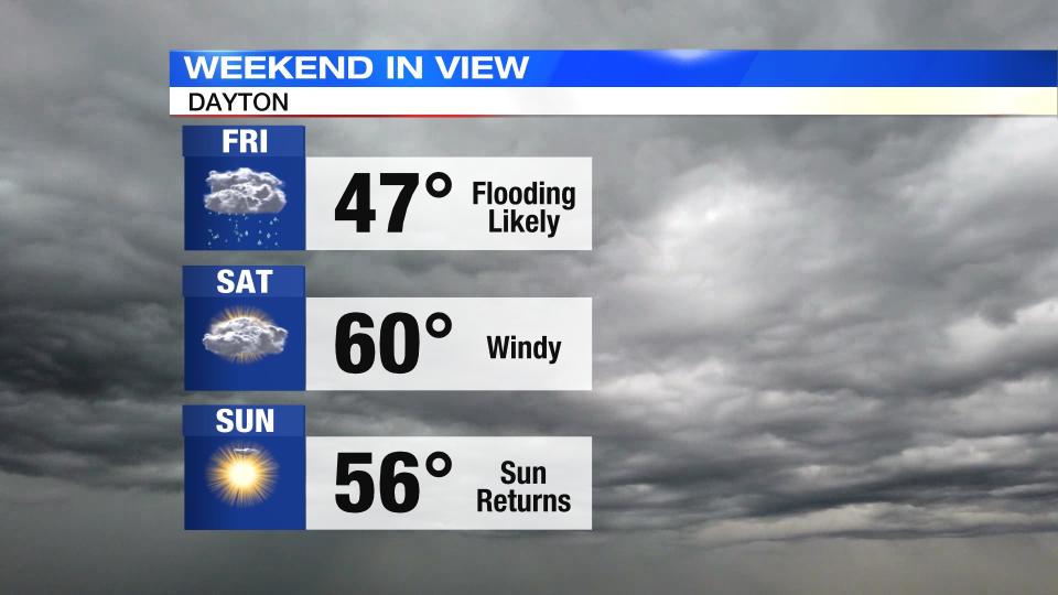
FRIDAY: Widespread rain, especially in the southern Miami Valley through midday, then a brief lull later in the afternoon. Temperatures will range in the 40s throughout the day.
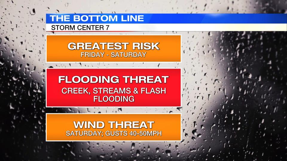
The flood threat increases into the night as another round of widespread rain and thunder across the entire Miami Valley into Saturday morning.
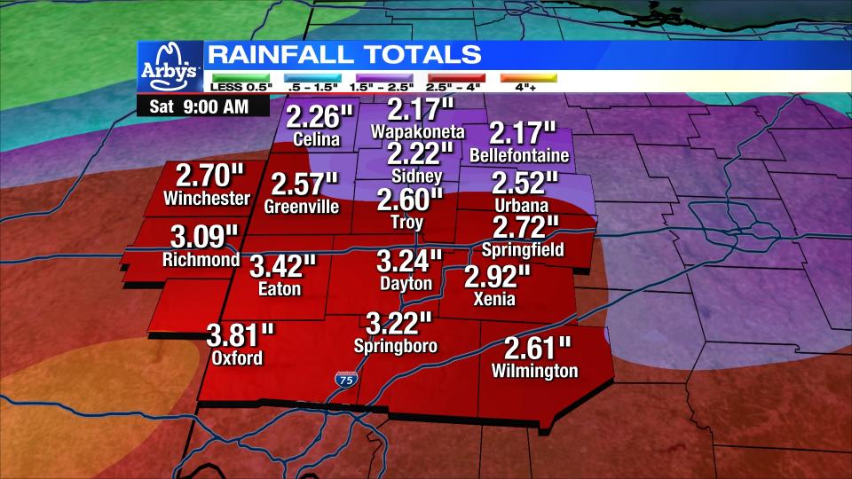
A two-day accumulated total of 2 to 5 inches of rain will be possible by Saturday morning which will cause rivers to rise, creeks and streams to flood and likely street flooding in low lying spots.
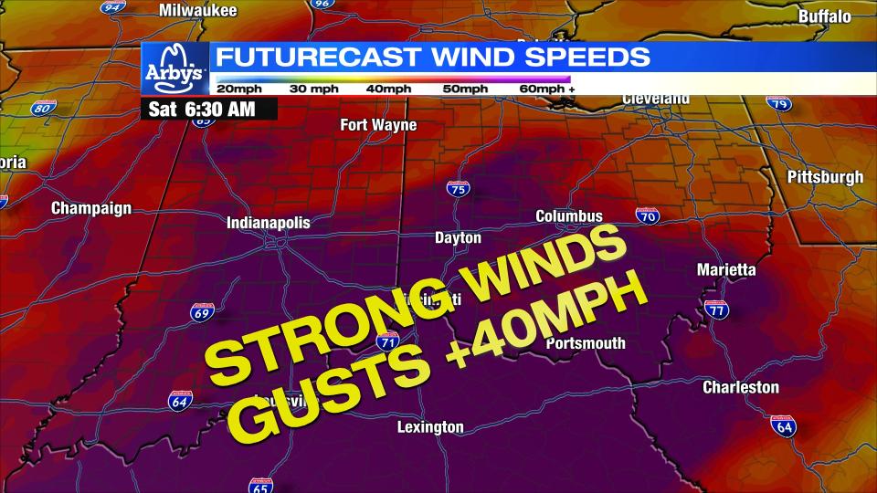
SATURDAY: Rain will lift north and east in the morning. This will allow for dry time into the afternoon. As the rain ends, the wind will increase with gusts between 40-50 m.p.h.! With a saturated ground, an increase threat for tree damage will increase and perhaps lead to a few power outages. Some minor river flooding will be possible as water rises downstream.
SUNDAY: Dry time for Sunday and near normal with highs in the middle 50s.
MONDAY: Another mainly dry day. Highs in the lower to middle 50s. Sun and clouds.
TUESDAY: Party cloudy and mild. Highs around 50 degrees.
WEDNESDAY: Dry with near normal temperatures in the lower 50s.
THURSDAY: Mostly cloudy and mild with a few showers possible on Thursday. Highs around 60 degrees.

