SLO County just had its rainiest winter on record. Here’s how much fell and what it means
If this winter’s rainstorms felt epic, that’s because they were.
In fact, San Luis Obispo County just experienced the wettest winter in its recorded history, according to new data from the National Oceanic and Atmospheric Administration.
The agency calculated that an average of 28.9 inches of rain fell over the county from December through March. That bests the previous record of 28.5 inches set in 1941, according to NOAA’s climate data, which goes back to 1896.
That’s more than double what the county typically sees, NOAA’s data show.
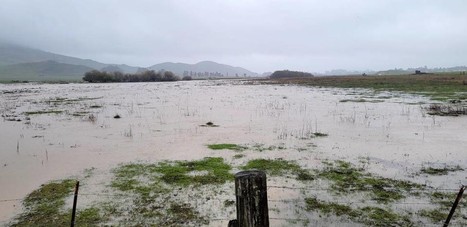
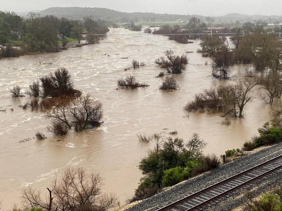
The inundation from the winter storms caused devastation across the county, including flooded homes and businesses and damaged roads and other infrastructure.
The storms also caused reservoirs to overflow for the first time in decades, brought long-dry streams and rivers back to life and helped ease groundwater supply concerns.
It’s certainly a cause of relief after years of extreme and persistent drought, officials at the county told The Tribune. But it isn’t the time for residents to let their guard down, they noted.
“This year’s rain has taken some of the pressure off, but we’re going to continue on the same track we’re on in terms of implementing our resiliency programs, optimizing the use of our existing resources and looking at new sources,” said San Luis Obispo County Water Resources Division Manager Courtney Howard. “We don’t really know for sure how long or intense the next drought will be — we do know that one will come.”
Howard and Blaine Reely, the county’s groundwater sustainability director, said they are working with local water purveyors to not only conserve the water the county has now, but also to devise new ways to boost supply in the future.
And right now, San Luis Obispo County has a lot of water on its surface.
Rain gauges across SLO County measured new record amounts
The winter atmospheric river storms dumped so much rain that some gauges measured more rain in four months than they typically see in two years.
One example is Rocky Butte, the 3,245-foot-tall coastal mountain northeast of Cambria.
There, 88.88 inches of rain have fallen since Dec. 1, according to data from the San Luis Obispo County Public Works Department. That’s the most the site has recorded since records began in 2000, and far more than the nearly 35 inches of rain the site typically sees in an entire year.
At a rain gauge off Highway 101 and Miossi Road at the base of Cuesta Ridge, 49.66 inches of rain were recorded from Dec. 1 through March, the county’s data show — again, another record rainfall measurement, and far above the site’s annual average of 19 inches of rain.
The North County wasn’t left out, either.
A Templeton rain gauge measured 32.29 inches of rain over the four months — besting the previous record of 27.15 inches, according to the county. The area normally sees about 13 inches of rain.
Take a look at the South County, and, again, it’s a similar story.
With 23.77 inches measured from Dec. 1 through March, an Oceano rain gauge beat its previous record of 20.33 inches recorded over the same period in 2016-17, the county’s data show.
Figuring out how to best use SLO County’s now-abundant reservoir water
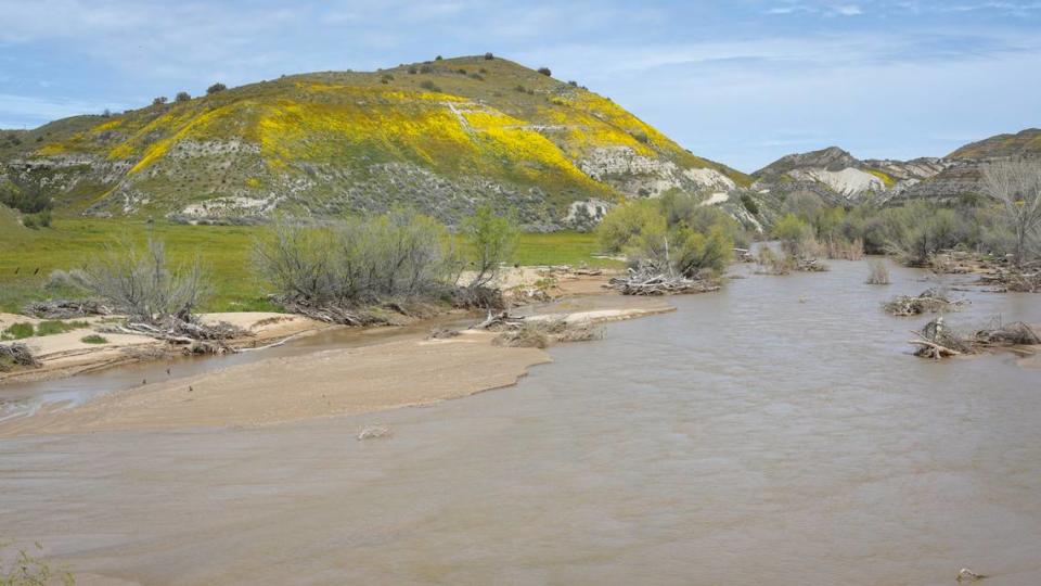
All of the water that fell had a few places to go: into the rivers and streams, reservoirs and groundwater aquifers.
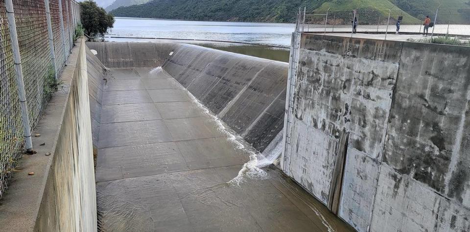
Santa Margarita Lake was the first reservoir in San Luis Obispo County to spill after the winter storms. The lake reached 100% capacity on Jan. 9 and hasn’t stopped overflowing since.
The county has been working with the U.S. Army Corps of Engineers to see if ownership of the Salinas Dam at the lake could be transferred to a local entity. The dam was built in 1941 to supply water to Camp San Luis Obispo to support training needs for the Army during World War II.
Although the city of San Luis Obispo has rights to 45,000 acre-feet of water from Santa Margarita Lake, the reservoir only has 23,843 acre-feet of capacity. That’s because when it was built, an extra gate in the spillway wasn’t constructed due to structural concerns, according to county Public Works.
Transferring ownership from the federal government to a local one would allow for further consideration on perhaps building the gate to increase the capacity of the reservoir, Howard said.
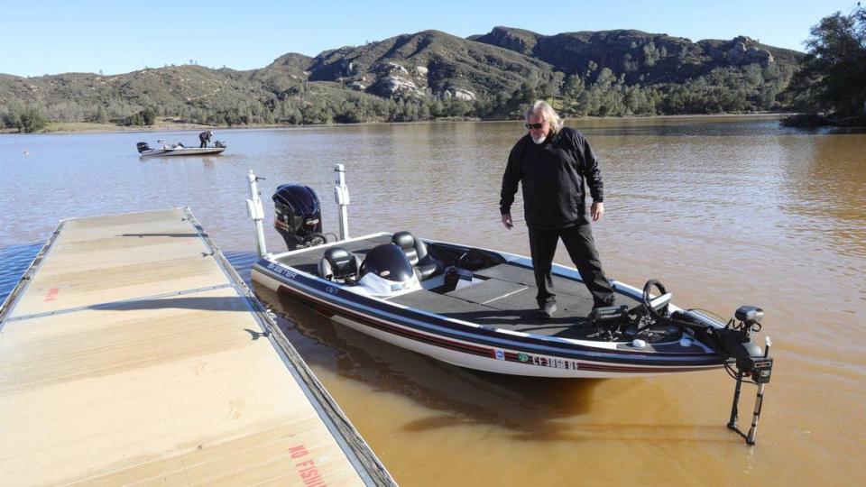
Another overflowing reservoir in the county, Lopez Lake, began spilling for the first time in more than two decades in late March.
In 2022, the San Luis Obispo County Flood Control and Water Conservation District worked with the cities that use Lopez Lake’s water — Grover Beach, Arroyo Grande, Pismo Beach, Oceano and Avila Beach — to allow them to abandon the previous “use it or lose it” policy for the resource.
Now, the purveyors can save up the water they are allocated from Lopez Lake and use it when needed in future years. This gives the purveyors an incentive to conserve the water for use during drought years.
“This is helping to optimize the use of that water,” Howard said. “If we don’t see rain next year like we did this winter, then we want to make sure the Lopez water can be stretched out as long as possible.”
Groundwater basins see some recovery but still have a long way to go
Below the ground’s surface, the water supply picture gets a little murkier, however.
County groundwater storage such as the Paso Robles, Los Osos and San Luis Obispo Valley basins have long been imperiled due to severe overpumping, as well as threats such as seawater intrusion and pollution.
Recently, plans have begun to be implemented as required under the California Sustainable Groundwater Management Act, enacted in 2014, to figure out how to bring the important underground resources into balance by 2040.
“We need to be thankful that we had such a wonderful, wet season and we have a lot of water on the ground,” Reely, the county’s groundwater sustainability director, said. “And thankfully, we’ve got a lot of water now in reservoirs stored. But our groundwater basins, they’re just a different animal.”
Water can take a long time to trickle down from the surface into aquifers deep underground, Reely said. In some areas, such as the sandier regions over the Los Osos and Atascadero groundwater basins, the water can reach the aquifer more quickly than in regions with clay-like soils such as over the Paso Robles basin, he added.
In the future, Reely said he hopes to begin implementing new stormwater capture projects, particularly over the Paso Robles groundwater basin. This would include identifying parcels of land next to creeks and rivers that flood during storms and figuring out how to slow that water down so it has more time to percolate down into the groundwater basin before it flows off to the ocean, Reely said.
“It’s a long process; these basins do not recover quickly,” Reely said. “That’s why SGMA has given us 20 years to reach a sustainable condition, because it’s just not practical to expect it to be done in a short amount of time.”
The county is currently conducting measurements of the groundwater basins in San Luis Obispo County to determine how much water may have been added after the winter storms, Reely said. That data will be available by early May, he added.
From his early looks at some of the data available to him, Reely said he’s seeing “a little bit of recovery; a little bit of improved conditions.”
He’s seeing that recovery particularly in the San Luis Obispo Valley and Los Osos groundwater basins, he said, and it’s a bit too early to tell for the Paso Robles basin.
“One wet season is not enough to get the basins healthy again,” Reely said. “You can’t let your guard down. You have to continue to conserve, continue to use water efficiently.”