Slow-moving cold front could bring up to 8 inches of rain, tornado threat to Tallahassee
A slow-moving cold front moving across North Florida is forecast to bring strong storms across the area today.
By 1 p.m., heavy rain continued to move across Florida's Big Bend in a slow-moving band. Up to 5 inches of rain has fallen over the past three to six hours, according to the National Weather Service Tallahassee.
At 10 a.m., 3 to 4 inches of rain had fallen, with another 2 to 3 inches forecast as the storms moved to the east.
Forecasters said a slow-moving line of torrential thunderstorms was expected to develop in the morning, roughly along a line from Apalachicola to Tallahassee to Valdosta.
The isolated clusters of thunderstorms are developing and moving through the Panhandle.
1:00pm ET Feb 10 - Heavy rain continues across the FL Big Bend in this slow moving band. Heaviest rain amounts over the last 3-6 hrs have been around 3-5". While dry antecedent conditions have absorbed a lot of rain, these amounts are causing local flooding issues. #FLwx #GAwx pic.twitter.com/lCVda9zhVI
— NWS Tallahassee (@NWSTallahassee) February 10, 2023
A few could become strong enough to spin up a weak tornado or produce damaging winds, according to the Florida Public Radio Emergency Network. About 9:30 p.m. Thursday, a tornado warning was issued for the Fort Walton Beach area.
The National Weather Service Tallahassee warned residents of the following impacts from today's storms:
3-4 inches of rain, with some areas seeing more than 6 inches
Wind gusts up to 60 mph are possible today and Saturday
A tornado or two are possible today and Saturday
Flash floods, along with urban and small stream flooding possible
Multiple rounds of heavy rain are expected today from the cold front. Another storm system passing through the area Saturday is forecast to bring more rain to the area.
The rounds of heavy rain are forecast to add up to 3 to 4 inches over a wide area. Localized totals of 6 to 8 inches are possible, especially in places where thunderstorms repeatedly train over the same areas, such as along Interstate 75 in South Georgia and adjacent areas of the Florida Big Bend.
Watches and warnings in effect for Tallahassee
If you can't see any local weather warnings here, you'll need to open this story in a web browser.
Flood watch
When: until 5 p.m. today. Flash flooding caused by excessive rainfall is possible.
Where: Coastal Franklin, coastal Gulf, coastal Jefferson, coastal Wakulla, Gadsden, Inland Franklin, inland Gulf, inland Jefferson, inland Wakulla, Leon, Liberty and Madison counties.
Impacts: Excessive runoff may bring flooding of rivers, creeks, streams and other low-lying and flood-prone locations. Flooding may occur in poor drainage and urban areas.
Flash flood warning
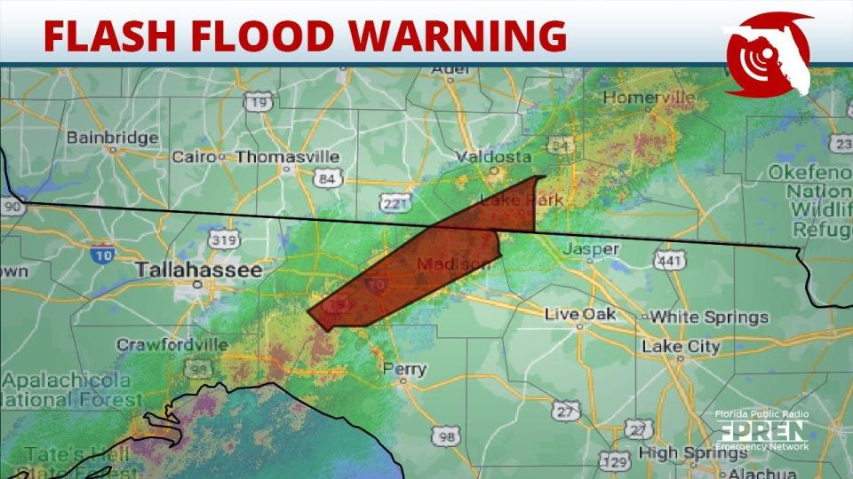
When: until 3:45 p.m. today.
Where: Jefferson and Madison counties.
Weather radar for Tallahassee
Storms could arrive in Jacksonville later today
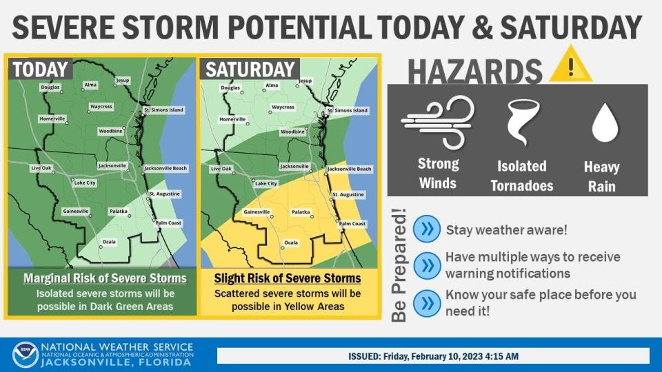
The National Weather Service Jacksonville told residents waves of showers and storms are expected to reach the area this afternoon and continue into Saturday.
Isolated strong to severe thunderstorms are possible with potential hazards of strong winds, tornado and heavy rain with localized flooding.
Jacksonville weather radar
This article originally appeared on Tallahassee Democrat: Tallahassee weather forecast: Expect tornado threat, strong winds, rain

