Slow recovery continues with Gaston County under threat for more snow
The final flake of snow may have fallen in Gaston County late Sunday evening, but as midweek approached icy spots remained on many main roads and some secondary roads remained covered in ice and snow.
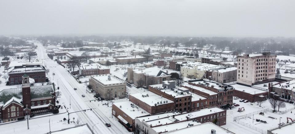
Although only around 3 inches of snow was recorded across Gaston County Sunday, Monday brought only limited melting on a day marked by cold temperatures, partly-to-mostly cloudy skies, and a brisk northwest wind.

Temperatures plunged into the lower 20s Tuesday morning, resulting in icy spots even on many main roads where snowmelt had occurred but was then refrozen. Secondary roads remained snow-covered, particularly in shady areas and those that had not been scraped.
The icy local roads led to an unexpected holiday for students in Gaston County Schools, with the decision to cancel school on Tuesday coming late Monday afternoon.
The school system had not responded by mid-day Tuesday to questions from The Gazette as to if, or when, the missed day will be made up.
No school or a delay is also possible for Wednesday, with the National Weather Service warning that very cold temperatures Wednesday morning will again result in a "black ice" situation across all of Gaston County.
In addition to the public schools, Gaston College was closed on Tuesday as was the Gaston County Courthouse and Gaston County government buildings.
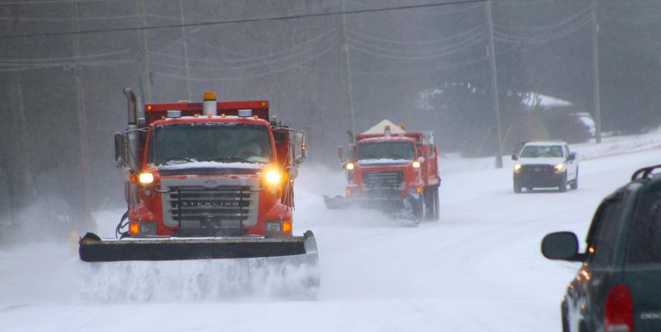
As of mid-day Tuesday, the North Carolina Department of Transportation reported I-85 mainly clear, but with a few icy spots, with the same conditions reported for U.S. 321 and main state highways as well.
Most of the county's secondary roads were still reported as "covered with snow and ice."
While both Tuesday and Wednesday afternoons promise temperatures well above freezing, it's not yet time to breathe a sigh of relief and say, "Thank goodness that is over."
Instead, the National Weather Service is predicting yet another "winter weather event" for the upcoming weekend, although the particulars are not yet clear.
As of noon Tuesday, the official forecast, issued by the NWS office in Greenville, South Carolina, reads:
Thursday night: A chance of rain before 9 p.m., then a chance of snow. Cloudy, with a low around 24. Chance of precipitation is 40%.
Friday: A 50% chance of snow. Mostly cloudy, with a high near 32.
Friday Night: A 50% chance of snow. Mostly cloudy, with a low around 20.
Asked for particulars, staff meteorologist Harry Gerapetritis said, "It's really challenging right now to provide those."
Gerapetritis said the computer models which the Weather Service relies on to develop its forecasts are in disagreement right now.
"We expect a cold front to pass through the area on Thursday bringing some rain," he said. "Temperatures will be colder behind the front. The front is expected to stall to our southeast and waves of low pressure are expected to move along it, bringing moisture into the area on top of some very cold air."
Some models say it will be a lot of moisture, Gerapetritis said, while others say not so much.
Meanwhile, the Weather Channel, which is typically more bullish on winter weather than is the National Weather Service, offers this forecast.
Friday: Snow showers early will become steadier snow in the afternoon. High around 30. Chance of snow 70%. Snow accumulating 1 to 3 inches.
Friday night: Variable clouds with snow showers. Low around 20. Chance of snow 50%, with 1 to 3 inches of snow expected.
Bill Poteat, who would love to take his dog Bo for a hike in the snow on Friday, may be reached at 704-869-1855 or bpoteat@gastongazette.com.
This article originally appeared on The Gaston Gazette: Slow recovery continues with Gaston County under threat for more snow

