Winter weather updates: storm warning over, State Police respond to more than 40 crashes
This article is available free as a public service. If you can, please subscribe to IndyStar to support our work.
The winter storm warning for Central Indiana has come to an end, according to the National Weather Service.
The warning was originally in place until 7 p.m. Wednesday. By the afternoon NWS meteorologists began updating their outlooks as snowfall tapered.
See the storm: Indianapolis traffic cams, photos show snowy road conditions
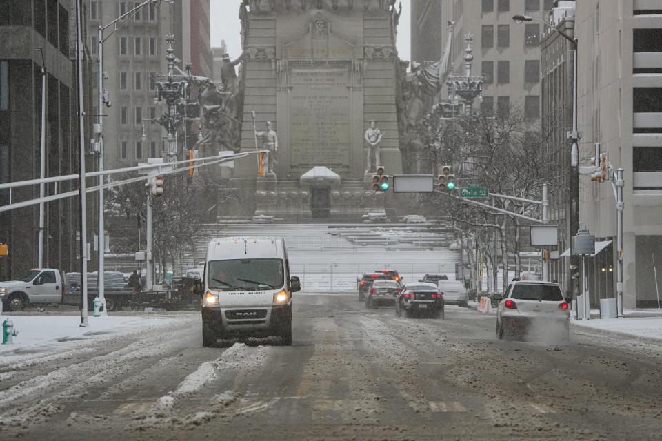
Snowfall totals were expected to vary across the state. Indianapolis residents were expecting 5-8 inches; by noon the city recorded about three inches.
Residents in the area north of Interstate 70 to Interstate 69 were expecting the most snow, with totals in Lebanon predicted at 6-10 inches, according to NWS.
Temperatures were toasty compared to those from the deep freeze that accompanied the Christmas-week storm a few weeks ago. As the snow moved through Wednesday, the high was estimated to reach about 35 degrees in Indianapolis. Colder air arrives on Thursday with a high near 32 degrees.
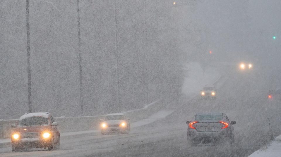
The impacts from the snowfall Wednesday were expected to be greatest from 4 a.m. until noon, according to NWS.
For updates on school closings in the Indianapolis-area, click here. For updates on storm impacts, other closings and travel advisories, see below:
3:10 p.m.: Winter weather advisory has ended for Central Indiana
NWS has ended its winter weather advisory for Central Indiana.
"Now that the majority of the snow has ended, and conditions appear to be improving across the area, basically, there's no need for those headlines anymore," meteorologist Mike Ryan told IndyStar.
"There's still some snow showers out there," Ryan added. But, he said, "it's light (and) we're not expecting a lot of impact from it."
Ryan said they're expecting scattered snow showers Thursday, with accumulation in some areas that could reach half an inch.
The weekend forecast was less clear at this point, he said.
"I do think there are some chances for snow going forward through the weekend and into early next week, but we'll have a lot more detail on that once we get into the weekend."
2:30 p.m.: Indiana State Police respond to 44 crashes since 4 a.m.
Since 4:00 a.m. Troopers in the Indianapolis District have responded to numerous calls including…
🔹 44 Crashes, 6 with injuries
🔹 27 Slide Offs
🔹 28 Motorist Assists
🔹 8 Traffic Hazards (something in the road)— Sgt. John Perrine (@ISPIndianapolis) January 25, 2023
1:40 p.m.: Marion County, Central Indiana storm warning downgraded to advisory
NWS has downgraded Marion County and much of Central Indiana above the I-70 from a winter storm warning to a winter weather advisory.
The Winter Storm Warning has been replaced with a Winter Weather Advisory along and north of I-70 as the snow gradually tapers off. Additional light snow tonight with up to a half inch in spots. #INwx pic.twitter.com/FTVAcx6z3I
— NWS Indianapolis (@NWSIndianapolis) January 25, 2023
For Central Indiana, a warning can mean six inches or more of snow in under 12 hours, or eight inches or more in under 24 hours, according to NWS. An advisory ranges from two to five inches of snow within 12 hours.
12:30 p.m.: NWS updates on progress of the snow storm
Snow showers continue along and north of the I-70 corridor. The heaviest snow is wrapping up with compaction and melting causing lower snow amounts. Hazardous travel will remain a concern through the afternoon, so take it slow! #INwx pic.twitter.com/tI8vBH79Ps
— NWS Indianapolis (@NWSIndianapolis) January 25, 2023
12:20 p.m.: How much snow has Indianapolis gotten today?
Indianapolis had about 2.8 inches of snow, as of 12:20 p.m., from Wednesday's storm, said NWS meteorologist Andrew White.
"Due to the melting and compacting of the snow, we probably won't end up with too much more than what we have now," White said of snow accumulations in the city.
Snow totals in the city have been lower than predicted due to warmer temperatures than expected and compaction of the snow. Even as additional snow has fallen over the past hour, snow totals have slightly decreased due to the heavy snow compacting on top of itself, White said.
Heavy snowfall should be over by around 2 p.m., but flurries will continue intermittently during the next few days in Indianapolis, according to NWS.
12:10 p.m.: Indy PDW updates on snow storm plan
"Our plan continues to be all hands on deck," Indianapolis Department of Public Works spokesperson Imani Keith told IndyStar. "We currently have 60 trucks and over 100 crew members out addressing roads in 12 hour shifts. This will continue as weather conditions persist....We are continuing to urge residents to limit themselves to necessary travel only. This will allow crews to continue to treat the roads as quickly as possible."
11:35 a.m.: Marion County issues travel advisory
Marion County has issued a travel advisory.
All other Central Indiana counties previously issued travel advisories, according to the Indiana Department of Homeland Security.
Hamilton and Johnson counties have travel watches in place, which means conditions are threatening to the safety of the public. In a travel watch, only essential travel, such as to and from work or in emergency situations, is recommended.
Hendricks, Hancock, Madison, Boone, Shelby and Morgan counties have travel advisories in place. A travel advisory is the least severe level and means that routine travel or activities may be restricted in areas because of a hazardous situation. Individuals should use caution or avoid those areas during a travel advisory.
11:02 a.m.: NWS updates on progress of the snow storm
A heavier snow band continues in portions of central Indiana where visibilities of less than 1/4 mile have been noted. The rain/snow band to the SE continues to push slowly northward. Precipitation is expected to lighten up by early afternoon. #INwx pic.twitter.com/paD6EpvYXa
— NWS Indianapolis (@NWSIndianapolis) January 25, 2023
10:55 a.m.: Sidewalks and roads remain slushy and slippery
I ventured out into the snow (totally out of character for me). Like a lot of places this morning, Mass Ave and the streets and sidewalks near the Bottleworks are a slippery, slushy mess. The snow in the streets has already turned brown. pic.twitter.com/zTou6JcWbt
— Alexandria Burris (@AllyBurris) January 25, 2023
And lastly a plow going down Mass Ave! pic.twitter.com/3GhSxV7p6V
— Alexandria Burris (@AllyBurris) January 25, 2023
10:40 a.m.: Power outages reported in Indianapolis
About 550 AES customers were without power as of 10:40 a.m., according to the company's outage map.
10:16 a.m.: Road conditions remain slushy in Indianapolis
Here’s 38th St., where plenty of thick wet snow is coming down heavily. Cars are traveling OK at reduced speeds. It’s slushy but not icy underneath at this point. pic.twitter.com/xzFju0ZZR7
— Domenica Bongiovanni (@DomenicaReports) January 25, 2023
10:04 a.m.: IMPD reports vehicle crashes in the city
As the snow has picked up so have the number of accidents. Please slow down, give yourself plenty of distance between vehicles, and give yourself plenty of time to get where you are going. #TrafficAlert pic.twitter.com/6wle0MCx3k
— IMPD (@IMPDnews) January 25, 2023
10:05 a.m.: Snow continues falling as downtown Indianapolis is quiet
It’s quiet downtown….church bells tolling. Fresh footprints in the snow. This is the road situation, with a few pedestrians unfazed by the gentle dusting of snow that’s building up on roads. Indianapolis snow day everybody. pic.twitter.com/PWVXuS5XUM
— Ko Lyn Cheang (@kolyn_cheang) January 25, 2023
10:02 a.m.: Snow continuing in Fishers and Broad Ripple
This was Fishers about 30 minutes ago. It has since settled down a bit. pic.twitter.com/l7nGy2CN1I
— Rory Appleton (@RoryDoesPhonics) January 25, 2023
In my 15-minute walk to Broad Ripple, I experienced a smorgasbord of precipitation- big white flakes, dense drippy snow, sleet, and little ice balls, all of it cold and wet.
— Shari Rudavsky (@srudavsky) January 25, 2023
Looking like a stove popcorn and hot cocoa kind of day: pic.twitter.com/S7yvrNG9Ux
— Shari Rudavsky (@srudavsky) January 25, 2023
10:00 a.m.: ISP asking drivers to slow down
Road conditions continue to deteriorate quickly, please slow down if you must travel. Our call volume is increasing quickly and we are responding to numerous crashes in the Indianapolis Area pic.twitter.com/1EjJSKkCHt
— Sgt. John Perrine (@ISPIndianapolis) January 25, 2023
10:00 a.m.: Prosecutor's office, courts will remain closed Wednesday
*Update*
Due to inclement weather the Marion County Prosecutor’s Office and the Marion County Circuit and Superior Court will be closed Wednesday, January 25.
The office will reopen tomorrow 1/26 at 8:00 a.m. pic.twitter.com/jspKQQYTk5— Marion County Prosecutor’s Office (@MCProsecutors) January 25, 2023
9:40 a.m.: Indy DPW crews continue clearing the roads
More than 60 Snow Force trucks and 100 Indy DPW crew members are still out clearing snow. Residents can see which streets have been plowed and when at: https://t.co/NWiTV96viQ
— Indy Snow Force (@IndySnowForce) January 25, 2023
9:34 a.m.: Downtown Indianapolis quiet as schools closed due to storm
It’s quiet near Benjamin Harrison School 2 in downtown Indy as snow falls. Kind of peaceful. @IPSSchools is closed for an e-learning day due to the snow. @indystar pic.twitter.com/nyPi39ITdZ
— Claire Rafford (@clairerafford) January 25, 2023
Weather closures:Here's which Marion county schools are closed on Wednesday
9:30 a.m.: Indianapolis Emergency Medical Services provides info on treating frostbite and hypothermia
Do you know how to help someone with #frostbite or #hypothermia? Get the affected person into a warm room or shelter, and warm them under dry layers of blankets and clothing. Please view and share #WinterSafetyTips from @CDCgov: https://t.co/9tAx2R9ZQZ
— Indianapolis EMS (@IndianapolisEMS) January 25, 2023
9:25 a.m.: Snow continues to steadily fall on the south side of Indianapolis
coming down at a steady pace on the south side. my lights just flickered. i think i’ll listen to christmas music. pic.twitter.com/EFDCp6Fien
— Holly Hays (she/her) (@hollyvhays) January 25, 2023
9:10 a.m.: Roads in Indianapolis are slushy as snow continues
Twitter is having trouble uploading my video so here’s a picture. This is the commute right now on the main roads: slushy and kinda slippery, but manageable if you have good tires. (This is Washington) @indystar pic.twitter.com/rDrhSpcbSE
— Kayla Dwyer (@kayla_dwyer17) January 25, 2023
9:07 a.m.: Heaviest snow of day thus far happening in Indy, NWS tweets
Heaviest snow of the day ongoing across the #Indy metro. Avoid travel for the next few hours if possible. #INwx
— NWS Indianapolis (@NWSIndianapolis) January 25, 2023
8:52 a.m.: Band of heavy snow pivoting to the northwest of I-70
A band of heavy snow is north of I-70 and is slowly pivoting northwest. Visibilities of less than 1/4 mile have been noted within the band with snowfall rates well over an inch per hour at times. Further south, the rain/snow line is approximately along the black line. #INwx pic.twitter.com/dX65BNqcfo
— NWS Indianapolis (@NWSIndianapolis) January 25, 2023
8:50 a.m.: Snowfall is becoming more steady in Indianapolis
Snow is picking up in downtown Indy with more noticeable accumulation. The most intense snowfall is supposed to be done by noon here in the city, according to NWS. pic.twitter.com/r4yqT3opcM
— Jake Allen (@Jake_Allen19) January 25, 2023
8:45 a.m.: Three vehicle crashes reported in Hancock County
8:45 am - Uneventful thus far
3 accidents - no injuries
2 slide offs
Snow changing between large flakes with low visibility, to light snow. Grass covered now pic.twitter.com/3zp1NLbTpr— Hancock County 911 (@HancockIN911) January 25, 2023
8:41 a.m.: Shelby County issues travel advisory
Shelby County has issued a travel advisory. Several other Central Indiana counties previously issued travel advisories, according to the Indiana Department of Homeland Security.
Hamilton and Johnson counties have travel watches in place, which means conditions are threatening to the safety of the public. In a travel watch, only essential travel, such as to and from work or in emergency situations, is recommended.
Hendricks, Hancock, Madison, Boone and Morgan counties have travel advisories in place. A travel advisory is the least severe level and means that routine travel or activities may be restricted in areas because of a hazardous situation. Individuals should use caution or avoid those areas during a travel advisory.
8:35 a.m.: Indiana State Police responding to vehicle crashes in Indianapolis
Since 4am, Troopers in the Indianapolis District have responded to:
12 crashes, 1 with injuries
5 Slide Offs
8 Motorist Assists (disabled vehicles)
These calls are rapidly increasing in the past 20 minutes or so
Please slow down & drive carefully pic.twitter.com/4NpBA4DmwP— Sgt. John Perrine (@ISPIndianapolis) January 25, 2023
8:30 a.m.: Indianapolis libraries closed due to the weather
All Indianapolis Public Libraries will be closed on January 25 due to inclement weather. Don't forget about one of the hundreds of activities, books, or resources you can access on our website at https://t.co/rYvmvz3b3n! pic.twitter.com/uw31fyzYLW
— Indianapolis Public Library (@indylibrary) January 25, 2023
Central Library is quiet outside save for a couple of men shoveling snow. All libraries are closed today due to the weather. pic.twitter.com/EbQyEf4r66
— Ko Lyn Cheang (@kolyn_cheang) January 25, 2023
8:20 a.m.: Snow is continuing in South Central Indiana
Still snowing in Bloomington. pic.twitter.com/QqKIxonW2I
— Jenny Porter Tilley (@JennyLynnePT) January 25, 2023
8:15 a.m.: Some Central Indiana road conditions are deteriorating, ISP says
Road conditions update, I-69 near Noblesville https://t.co/n9vooc5gD0
— Sgt. John Perrine (@ISPIndianapolis) January 25, 2023
Troopers in the Indianapolis-area are responding to several crashes, said ISP Sgt. John Perrine.
8:15 a.m.: Thundersnow in Johnson and Brown counties
Something unusual just occurred in our CWA! A network of lightning sensors confirmed there was recently some thundersnow in Johnson and Brown county. Did anyone happen to hear this? #INwx #Thundersnow pic.twitter.com/5lifZhUyFS
— NWS Indianapolis (@NWSIndianapolis) January 25, 2023
More:Thundersnow in Central Indiana? What to know about the rare occurrence
7:57 a.m.: Snow creating slushy conditions in Indianapolis-area
It is snowing. pic.twitter.com/VO5pJrtx63
— Nat Newell (@NatJNewell) January 25, 2023
7:35 a.m.: Boone and Morgan Counties issue travel advisories
Boone and Morgan counties have issued travel advisories. Several other Central Indiana Counties previously issued travel advisories, according to the Indiana Department of Homeland Security.
Hamilton County has a travel watch in place, which means that conditions are threatening to the safety of the public. In a travel watch, only essential travel, such as to and from work or in emergency situations, is recommended.
Hendricks, Hancock, Madison and Johnson counties have travel advisories in place. A travel advisory is the least severe level and means that routine travel or activities may be restricted in areas because of a hazardous situation. Individuals should use caution or avoid those areas during a travel advisory.
7:25 a.m.: Band of heavy snow set up north of I-70, drifting north and reducing visibility
A band of heavy snow has set up north of I-70 and is slowly drifting to the north. Visibilities of less than 1/4 mile have been noted within the band with snowfall rates well over an inch per hour at times. The rain snow line is approximately along the black line. #INwx pic.twitter.com/NkMicVuOGe
— NWS Indianapolis (@NWSIndianapolis) January 25, 2023
6:40 a.m.: Madison County issues travel advisory
Madison County has issued a travel advisory. Several other Central Indiana Counties previously issued travel advisories, according to the Indiana Department of Homeland Security.
Hamilton County has a travel watch in place, which means that conditions are threatening to the safety of the public. In a travel watch, only essential travel, such as to and from work or in emergency situations, is recommended.
Hendricks, Hancock and Johnson counties have travel advisories in place. A travel advisory is the least severe level and means that routine travel or activities may be restricted in areas because of a hazardous situation. Individuals should use caution or avoid those areas during a travel advisory.
6:10 a.m.: Heavy and wet snow begins falling on downtown Indy
Heavy, wet snow falling in downtown Indy. Not much accumulation on the ground as the most intense snowfall is expected from now until noon, according to @NWSIndianapolis pic.twitter.com/kUajPur8cg
— Jake Allen (@Jake_Allen19) January 25, 2023
6 a.m.: Most intense snowfall to begin now and end around noon, NWS says
Heavy wet snow will continue to build into central Indiana with 1 to 3 inches already reported south of Indianapolis. The most intense snowfall rates will occur between now and noon, before the snow begins to taper off in the afternoon. #INwx pic.twitter.com/0Z2ZOJM7HD
— NWS Indianapolis (@NWSIndianapolis) January 25, 2023
5:55 a.m.: Indianapolis Public Schools switches to e-learning for Wednesday
IPS Families! Due to weather conditions, today (Wednesday, January 25), IPS is on an e-learning day. pic.twitter.com/hEhCwQotDU
— IPS (@IPSSchools) January 25, 2023
5:50 a.m.: ISP troopers respond to slide-offs and minor crashes as road conditions worsen
Expect hazardous conditions and slow down during your morning commute, said ISP Sgt. John Perrine.
Road Conditions Update: https://t.co/VUQmdvTI4J
— Sgt. John Perrine (@ISPIndianapolis) January 25, 2023
5:30 a.m.: Travel advisories issued in Central Indiana counties, watch issued in Hamilton County
Several Central Indiana Counties have issued travel advisories, according to the Indiana Department of Homeland Security.
Hamilton County has issued a travel watch, which means that conditions are threatening to the safety of the public. In a travel watch, only essential travel, such as to and from work or in emergency situations, is recommended.
Hendricks, Hancock, and Johnson counties have issued travel advisories. A travel advisory is the least severe level and means that routine travel or activities may be restricted in areas because of a hazardous situation. Individuals should use caution or avoid those areas during a travel advisory.
4:30 a.m.: Road conditions worsening in northern Hamilton County
Same spot as my live video 30 minutes ago, at which time the road was just wet
Please be safe if you must get out today pic.twitter.com/rYIm9En3Lh— Sgt. John Perrine (@ISPIndianapolis) January 25, 2023
The roads began transitioning from wet to snow-covered and slick around 4:15 a.m., said Indiana State Police Sgt. John Perrine.
"Stay home if you can, but if you are out please, please slow down," Perrine said.
Find real-time traffic conditions here.
2:30 a.m.: NWS tweet shows snow-covered roads in southern Indiana, rain beginning to turn to snow in Indianapolis
INDOT cameras are showing snow covered roads across southern portions of central Indiana now. Rain will change to snow further north across the Indianapolis area shortly. Travel will be impacted across the entire area early this morning. Drive carefully! #INwx pic.twitter.com/FklT80uRGS
— NWS Indianapolis (@NWSIndianapolis) January 25, 2023
NWS Indianapolis updates ahead of snowstorm
The snowfall is expected to impact morning commuters in Indiana.
Heavy snow is expected to fall between 7 a.m. and noon in Indianapolis Wednesday. Indy residents will see 5-8 inches of snow, according to the latest forecast.
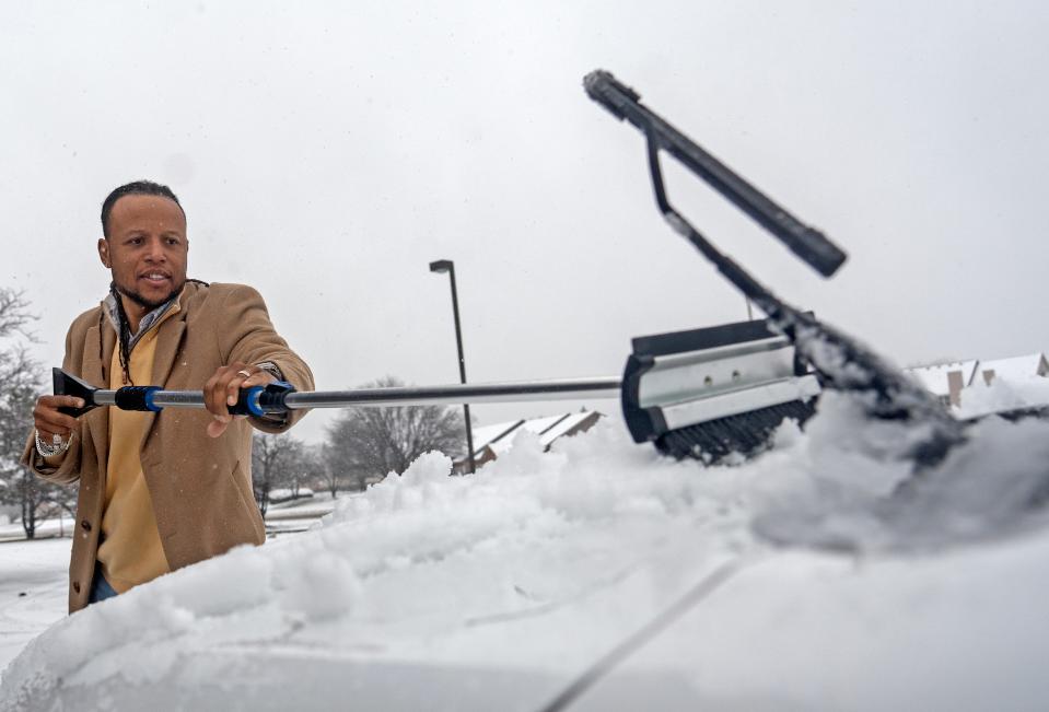
Meteorologists are cautioning residents to pace themselves and take breaks while shoveling. The snow will be heavy and wet, according to forecasters.
A Winter Storm Warning is in place for much of central Indiana with two waves of snow expected. The first is focused south of I-70 and the second to the north. Amounts will be highest between Greencastle and Kokomo. #INwx pic.twitter.com/TWYZAIYuyC
— NWS Indianapolis (@NWSIndianapolis) January 24, 2023
Snow Force drivers pre-treat roadways Tuesday evening
The Indianapolis Department of Public Works will activate 60 Snow Force drivers to pre-treat roadways.
With significant snow in the forecast beginning tonight, Indy DPW will have 60 Snow Force drivers pre-treating roadways.
When the snow begins falling tonight, more than 100 crew members will be working 12-hour shifts to clear roadways.— Indy Snow Force (@IndySnowForce) January 24, 2023
Beginning at 11 p.m. Tuesday, Indy Snow Force will have 60 trucks and more than 100 team members working 12-hour shifts to address the roadways. The Indy Snow Force Viewer Map will be live, which shows where roads along standard routes have been recently plowed or treated with salt.
Snow in Indianapolis:Snow and ice are back, Indiana. In case you forgot, here's how to drive in it
Marion County courts to operate on a delayed schedule
The Marion County Circuit Court, Marion County Superior Courts, Marion County Small Claims Courts and Marion County Clerk’s Office will delay opening until noon on Wednesday due to the winter storm, according to an order from Judge Amber Collins-Gebrehiwet.
Indianapolis winter storm:When snow plowing, trash pickup will happen during storm
This article originally appeared on Indianapolis Star: Snow storm: Indiana, Indianapolis snow totals, forecast, more updates

