Snow could drop in Willamette Valley overnight, but will it disrupt school and work?
Snow will become possible in the Willamette Valley overnight Monday into Tuesday, but meteorologists say it’s unlikely to cause a lasting impact.
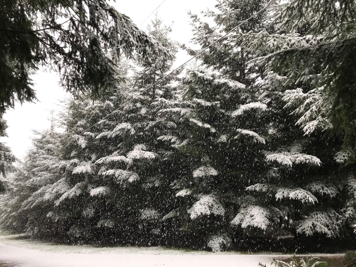
Snow levels are forecast to drop as low as 200-400 feet in Salem and Portland, which could lead to flakes accumulating in the grass at the lowest elevations and greater amounts in the higher hills.
“The ground has stayed fairly warm so we’re expecting any of the snow that falls to melt pretty fast, especially on the roads, and because we’re forecast to stay above freezing, we’re not expecting much in the way of ice,” National Weather Service meteorologist Miles Higa said.
“Once you get above 500 feet, there could be a little more accumulation, but it would be more hit or miss. We’re not expecting high rates of precipitation — more like showers. That could look like some neighborhoods getting a little bit more snow and other areas not getting much or any.”
It's possible that schools at higher elevations, in the Cascade Foothills or Coast Range, could have a delayed start or impact. But, because temperatures warm up fairly quickly on Tuesday, snow is not expected to last.
“It could have some brief impacts tomorrow morning, but it’s most likely to be a short-term kind of thing,” Higa said.
In other words, keep an eye out for school announcements late Monday and early Tuesday.
Any concern about valley or low-elevation snow dissipates late Tuesday and into Wednesday, but snow levels are forecast to gradually drop toward the Willamette Valley again later in the week and into the weekend.
“We could have more of this borderline valley snow question by Thursday and Friday, but we’re still working to refine that forecast,” Higa said.
Little if any snow expected in Eugene, lower elevations
Little if any snow is forecast in the Eugene and southern Willamette Valley area, according to forecasts.
Snow levels are forecast to drop closer to 1,000 to 1,500 overnight and into Tuesday, meaning a slightly lesser chance of impact.
Heavy snow piles up in mountains throughout the week
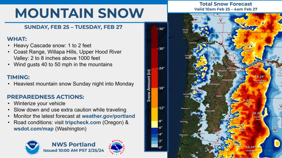
Meanwhile, plenty of snow is piling up in the foothills and mountains above 1,500 feet across the Cascade and Coast ranges.
Over a foot of snow has already fallen on Cascade Range passes and more is expected, making travel difficult throughout Monday. A winter storm warning expires early Tuesday, but roads are likely to remain snowy in the mountains, and snow is forecast every day on the Cascade passes.
The best window for travel appears to be later Tuesday and Wednesday before Thursday brings another hit of potentially heavy snow.
Anyone traveling across the Cascade passes should be prepared for winter travel and check Tripcheck.com before heading out.
Zach Urness has been an outdoors reporter in Oregon for 15 years and is host of the Explore Oregon Podcast. To support his work, subscribe to the Statesman Journal. Urness is the author of “Best Hikes with Kids: Oregon” and “Hiking Southern Oregon.” He can be reached at zurness@StatesmanJournal.com or (503) 399-6801. Find him on Twitter at @ZachsORoutdoors.
This article originally appeared on Salem Statesman Journal: Snow could drop in Willamette Valley overnight, but how much?

