Winter weather continues with snow; temperatures to warm later in the week
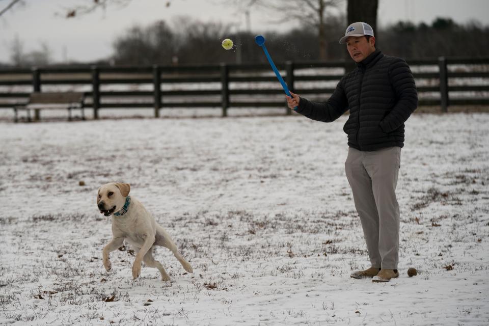
The winter weather is still here.
After a weekend of frigid temperatures and rolling blackouts, snow arrived again in Middle Tennessee on Monday. The National Weather Service in Nashville had a winter weather advisory in place until 12 p.m. CT on Monday and officials warned that with temperatures still below freezing, roads could be slick and dangerous.
Accumulations of about 1 inch or less were expected, the National Weather Service said.
In Nashville, NDOT crews will be turning to neighborhood roads after primary and secondary roads. NDOT requests can be made through HubNashville, found here.
'Low probability' of rolling blackouts being reinstated
As of 11 a.m., intermittent power interruptions have not been reinstated, according to the Nashville Office of Emergency Management, but there is still a "low probability" that they may be reinstated.
The Tennessee Valley Authority had called for temporary energy load reductions, or "rolling blackouts," throughout the weekend's subzero temperatures to help stabilize the overwhelmed regional power grid − the first time in its 89-year history such a call was made.
Blackouts:Tennessee Valley Authority CEO: Federal agency 'fell short' during cold; blackouts preserved system
Power demand:TVA halts Saturday's rolling blackouts, for now
Nashville Electric Service has reported that as of Monday morning, all known power outages due to the storm have been restored.
According to NES data, about 72,000 customers within the NES service area lost power at the peak of this weekend's storm.
Customers are asked to report any new outages due to the weather at nespower.com/outages or call 615-234-0000.
NES has also asked customers to continue helping with voluntary reduction of power. Suggestions include:
Delaying the use of heavy power-using appliances like washing machines, clothes dryers and dishwashers.
Adjusting your thermostat to 68 degrees or lower and bundling up in a cozy sweater, warm socks or a blanket.
Turning off and unpluging appliances when not in use.
Switching ceiling fan direction to clockwise to shift warm air down into the room. Turning off ceiling fans when not in that room.
Keeping your garage door closed to buffer colder outdoor air from trickling into your home.
Using exhaust fans sparingly to avoid pulling extra warm air out of your home.
Opening your curtains or blinds on south-facing windows during the day to allow natural sunlight to heat your home.
Keeping the fireplace damper closed unless a fire is burning.
Setting your water heater’s temperature at 120° F.
Piedmont Gas has reported no service interruptions, and crews remain on standby for any emergencies.
There have also been no interruption to either Fire or EMS services for Metro Nashville or Davidson County.
Cold Patrol on the move; shelters still open
OEM Emergency Support Unit members will be conducting cold patrols on Monday evening, providing blankets, gloves, hand warmers and other care items to those who would like them.
Transportation to The Extreme Cold Weather Overflow Shelter or other sheltering options will also be arranged for people who want to get out of the cold.
The cold patrols will continue Monday evening.
The Cold Patrol distributed 38 blankets, 80 pairs of socks, 10 pairs of gloves and five coats Sunday.
Metro’s Extreme Cold Weather Shelter is open at 3230 Brick Church Pike, with free rides offered on WeGo Transit Line Route 23B from 7 p.m. to 11 p.m. Free pick-up locations for transport to WeGo Central can be found at:
Brookemeade Park: 7002 Charlotte Pike
Walmart Supercenter: 4040 Nolensville Pike
Dollar General Market: 301 East Thompson Lane
City Road Chapel UMC: 701 Gallatin Pike Street
Metro overflow shelter is accessible for men, women, couples and people with pets.
Metro Water Service to see damage
Metro Water Services is preparing to see whether there is further damage to water mains as the temperatures rise later in the week.
Residents are asked to be on the lookout for "water coming up from the roadway" or "water flowing in unusual places."
Nashville power:NES aims to restore all power by Christmas, halts rolling blackouts for now
Historic cold:What we know: TVA ordered rolling blackouts for the first time in 90 years amid freezing temps
If these signs of a water main break are seen, or customers are without water or have low pressure, please contact MWS at 615-862-4600 as soon as possible.
Current break investigations or active break repairs can be viewed on the MWS Outage map at Metro Water Services Outage Map.
Trash and recycling collection has also been stopped for Monday as neighborhood roads and alleys are unsafe for the trucks, according to the city.
Collection will resume Tuesday on the regular schedule.
Temperatures to rise into holiday weekend
A Winter Weather Advisory is in effect until noon. Light snow showers will move through the area-accumulations 1" or less. Roads will quickly become snow-covered and potentially slick, possibly causing travel issues. Please be patient if you have to travel. pic.twitter.com/0nBZTG54oF
— NWS Nashville (@NWSNashville) December 26, 2022
Temperatures on Monday are expected to reach highs in the upper 20s to mid 30s, the weather service forecast. Here's a look at Monday night and Tuesday.
Tonight: There's a slight chance of snow showers. Lows in the lower 20s.
Tuesday: Mostly sunny with highs in the lower to mid 40s.
Later in the week, Middle Tennessee residents can expect to see conditions lighten up, with temperatures getting into the 60s mid-week. Here's a projected breakdown for the remainder of the week and into the holiday weekend:
Wednesday: Sunny, with a slight breeze and temperatures around 53 degrees.
Thursday: The clouds are returning, but temperatures will reach a high of 61 degrees. Rain can be expected Thursday night, mostly after midnight.
Friday: Rain likely, but with temperatures still holding strong around 62 degrees.
Saturday, New Year's Eve: Rain chances are still high, with temperatures going up to around 65 degrees.
Sunday, New Year's Day: The New Year will start off with a partially sunny day, with a high around 63 degrees.
Weather
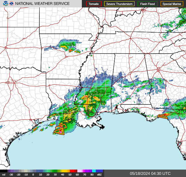
Embedded content: https://radar.weather.gov/ridge/standard/SOUTHMISSVLY_loop.gif?6daa1080d3c777cd737d51508c464b35
This is a developing story. Check back for updates.
This article originally appeared on Nashville Tennessean: Snow in Nashville: Winter weather advisory in place until noon

