Snow, flooding, tornadoes: Storm systems bringing severe weather to US: Updates
Winter storm warnings and advisories impacted most of the country Sunday as three different systems put millions at risk.
The first major storm began Saturday and brought heavy snow and strong winds to northeastern states and the central Appalachians, according to the National Weather Service. The second system is expected to heavily impact the Midwest while the third will arrive over the Pacific Northwest on Sunday night.
The major winter storms are forecast to bring severe weather conditions through midweek.
As much of the country prepared for more snow, a tornado appeared to touch down in Fort Lauderdale, Florida, on Saturday evening, hitting structures and power lines, according to videos posted on social media.
Here's how the weather will impact the nation over the next week.
Tornado touches down in South Florida
A tornado touched down in downtown Fort Lauderdale on Saturday, shortly after the National Weather Service issued a warning for the area.
The twister formed over land and hit ground around 6 p.m. just west of Las Olas Boulevard and the Intracoastal Waterway, according to the city’s account on X, formerly Twitter. Fire crews continued to assess damage Sunday as Florida Power & Light began restoring power to some affected areas.
There have been no reports of injuries, so far, but city officials warn the public to be cautious of debris and downed powerlines.
Videos posted on social media show flashes of light as the tornado ripped through some powerlines in the downtown area.
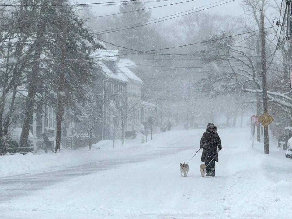
More snow, wintry mix in the Northeast
Winter storm warnings and watches were in effect throughout the Northeast, and icy roads made for hazardous travel as far south as North Carolina.
About 60 million residents in the Northeast were being impacted by the snow, according to Accuweather. "In portions of New England, upstate New York and in parts of Pennsylvania, the snow will fall at the rate of an inch per hour or more, and that could be difficult for road crews to keep up with," Accuweather chief meteorologist Jonathan Porter said.
Ice arrived early Saturday to some western North Carolina and southern Virginia areas, ranging from a fine coating to around a quarter-inch. Watauga County, North Carolina saw some of the highest amounts, said meteorologist Dennis Sleighter of the National Weather Service’s Blacksburg, Virginia, office.
In Pennsylvania, the National Weather Service said a foot of snow was reported in parts of Monroe County and more than 11 inches reportedly fell in Jim Thorpe. Sussex County in New Jersey had 11 inches.
While warnings were being canceled and highway reduced-speed limits and other restrictions were lifted Sunday, forecasters were still cautioning motorists of spotty freezing rain and black ice that made for hazardous driving in parts of southeast Pennsylvania and northern New Jersey.
The storm brought mostly rain to New York City, but counties to the north and west saw double-digit snow totals by Sunday morning. Millbrook in Dutchess County, about 75 miles north of New York, recorded a foot of snow. Port Jervis in Orange County measured 13 inches.
In Massachusetts and parts of Rhode Island, the National Weather Service declared a winter storm warning from 4 p.m. Saturday through 1 a.m. Monday.
Some communities in Massachusetts had already recorded nearly a foot of snow by Sunday morning, according to the weather service. More than 16,000 electric customers in the state were without power.
Hundreds of flights at Logan International Airport were delayed or canceled Sunday, according to tracking website FlightAware.
Snow totals were lower for coastal communities; Boston reported just a couple of inches. The snow was expected to continue throughout the day, and some areas could top out at more than a foot.
The storm reached into Maine, and some locations saw snow totals of up to 12 inches − with locally higher amounts over southern New Hampshire and southwestern Maine. Wind gusts up to 35 mph could add to blowing and drifting snow. Moderate to heavy snow was expected to continue in Vermont, and total accumulations could hit 6 to 12 inches.
The National Weather Service said the “major winter storm” would continue into Sunday evening. Snow was expected in parts of New England and rain and freezing rain were likely in the central Appalachian mountains.
Snow, strong winds expected in Pacific Northwest
Back-to-back powerful storms will cross the Pacific Northwest Monday night and Tuesday night, according to the National Weather Service. Heavy snow and strong winds are expected.
For the Cascade Range, snow levels will rise to around 5,000 feet Monday night with an atmospheric river, the weather service said. But it will "quickly fall" to between 1,500 and 2,500 feet behind a cold front on Tuesday, which will lead to considerable impacts for many mountain passes with the second storm.
High surf and strong onshore winds are also expected early this week on the coastlines of Washington and Oregon.
Sierra Nevada could see 20 inches of snow
In the West, a winter storm warning had been in effect through late Saturday in the Sierra Nevada from south of Yosemite National Park to north of Reno, where the weather service said as much as 20 inches of snow could fall in the mountains around Lake Tahoe with winds gusting up to 100 mph over ridgetops.
The California Highway Patrol said numerous spinouts and collisions forced the temporary closure of I-80 for several hours from west of Truckee, California, to the state line west of Reno, Nevada, where more than 27,000 homes briefly lost power in high winds at midday.
More than 13,000 electric customers in California were still without power by Sunday morning.
The weather service said that system continued to bring heavy mountain snow and coastal rain overnight before moving into central and Southern California, then off to the Southwest and the southern Rockies.
Western states face cold temperatures, strong winds
The storm system passing through Arizona was projected to be more potent in the north, creating snow-packed roadways and low visibility conditions.
Transportation officials said several highways in northern parts of the state — including Interstate 40 near Williams and State Route 64 near Grand Canyon National Park — were closed Sunday afternoon due to weather-related crashes and slide-offs from snowfall.
The weather service said Flagstaff was expected to get 4 to 8 inches of snow by Sunday night. And areas between 3,000 and 5,000 feet could see anything from light dustings to 3 inches of snow.
In Nevada, the weather service said the wind chill dropped to 32 degrees at Harry Reid International Airport in Las Vegas around 7:30 a.m. Sunday. Winds were gusting to 37 mph.
Blizzard conditions in the Midwest
The storm system is likely to reorganize over the Southern Plains on Monday, bringing heavy snow and strong winds over the Midwest Monday and Tuesday. The highest totals of snow are likely to exceed 12 inches in some Midwestern states, according to the National Weather Service.
Meteorologists warn blizzard conditions are likely in the southern High Plains and Central Plains. Wind gusts could exceed 50 mph, causing near-zero visibility and dangerous travel conditions.
Winter storm watches are in effect for parts of the southern High Plains, Central Plains and middle Mississippi Valley.
Flooding in the Gulf Coast
Forecasters also warned of another storm Tuesday into Wednesday that is expected to bring up to 6 inches of rain and some flooding as well as high winds and coastal flooding.
Powerful onshore winds will lead to widespread coastal flooding along the eastern Gulf Coast and most of the East Coast, and significant flooding is expected in the Carolinas and mid-Atlantic.
AccuWeather and weather service meteorologists warned that the cold northern front will clash with the warmer southern front, bringing a risk of severe thunderstorms Monday across parts of southeast Texas, southern Louisiana, southern Mississippi, southern Alabama, and the western Florida panhandle.
Wind gusts and tornadoes are also possible across those areas late Monday night, and wind gusts could exceed 50 mph in the eastern Gulf Coast, possibly leading to power outages.
“A piece of robust energy will bring disruptive thunderstorms that can produce damaging winds, hail and tornadoes to the Gulf Coast states," said AccuWeather Meteorologist Alexander Duffus. "An inflow of moisture along the Gulf of Mexico from eastern Texas and southern Louisiana will aid in the development of thunderstorms across the region."
Contributing: Dylan Wickman, Arizona Republic; Associated Press
Contact Adrianna Rodriguez at adrodriguez@usatoday.com
This article originally appeared on USA TODAY: Snow, flooding, tornadoes: Storms bring dangerous weather to the US

