Snow flurries may follow severe weather Tuesday night

ST. LOUIS — Record or near record high temperatures are likely Monday and Tuesday as temperatures soar into the upper 70s to lower 80s. Today’s record high is 78, set in 1996. Tuesday’s record high is 79, set in 1981.
Storm timeline
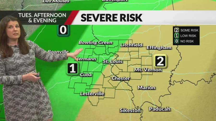
A very strong cold front will cross the region Tuesday night, bringing a chance for a few strong to severe storms. The greatest concern for strong storms will be just east and southeast of metro St. Louis in southern Illinois and southeast Missouri.
St. Louis radar: See a map of current weather here
The timing is most likely in the 9 p.m. to 12 a.m. timeframe in metropolitan St. Louis and 11 p.m. to 3 a.m. for areas southeast of St. Louis. The main threat from these storms will be strong wind gusts in our area. This is a level 2 out of 5 risk. The main area of concern for severe weather is southeast of St. Louis.
Temperature drop
Behind the front, a major temperature drop will take place very rapidly. Temperatures will fall from the 70s into the 30s in a very short period of time. Additional moisture and energy will lag the front back in the cold air and there is a chance for a quick burst of snow in our northwest counties between 3 a.m. and 6 a.m. This will be well northwest of metropolitan St. Louis. Some flurries cannot be ruled out, even in the St. Louis area before sunrise.
Road conditions should not be an issue. Temperatures will have been in the 70s only a few hours prior to the flurries.
Wednesday will be windy and cold. Temperatures will stay in the 30s for most of the day.
For the latest news, weather, sports, and streaming video, head to FOX 2.


