Snow? Ice? Frozen roads? How Horry County is preparing for winter weather this weekend
One of the biggest winter storms in years is on its way to Myrtle Beach, a place that isn’t used to, well, winter storms.
Winter storm effects will start Friday morning. The storm has the potential to bring sleet, freezing rain, ice accumulation and (maybe) some snow, according to the National Weather Service.
“The main threat at this time is the potential for dangerous ice accumulations, which could cause downed trees/limbs, power outages and hazardous travel,” the NWS said in a written briefing Wednesday evening.
The areas closest to the coast are expected to see 0.01-0.1 inches of ice and inland areas could see 0.25-0.5 inches of ice. However, even small amounts of ice can be dangerous, the NWS warns.
“Even a quarter inch of ice can add a tremendous amount of weight to trees and powerlines,” the NWS said in the briefing.
There is little chance of snow from the storm in Horry County. The county is likely to see wind gusts of 25-30 mph, especially along the coast. The NWS said those gusts could add stress to trees and powerlines already weighed down by ice.
“Santee Cooper is monitoring the forecast and preparing for another round of winter weather. Our main goals include being prepared, keeping our crews and customers safe, and keeping the lights on for all of our customers across the state,” Santee Cooper’s chief customer officer Mike Poston said in a press release Wednesday. “We will begin restoration efforts as soon as we safely can if we experience outages from this winter weather.”
Residents can report outages online at stormcenter.santeecooper.com or by calling 888-769-7688.
Wintry precipitation is expected to stop by the end of the day Saturday.
It will stay chilly after the storm, with morning lows in the 20s Saturday through Monday. Saturday’s high will be in the mid-30s and in the mid to upper 40s on Sunday and Monday.
What to know about driving through the storm
Need to head somewhere in the next few days? Here are some tips from South Carolina Highway Patrol.
Slow down. With ice on the road, it’s easy to lose control or end up needing to stop quickly (like if a crash is ahead). Stopping is easier to do if the car isn’t going 75 miles per hour.
Make sure the car is topped off with gas before heading out, even if it’s not a long drive. Plenty of people stuck on I-95 in Virginia were just trying to commute home.
Have supplies: cell phone charger, blanket!, bottles of water and a few snacks.
Check weather apps before heading out. Maybe there isn’t freezing rain at your house, but there might be some along the way.
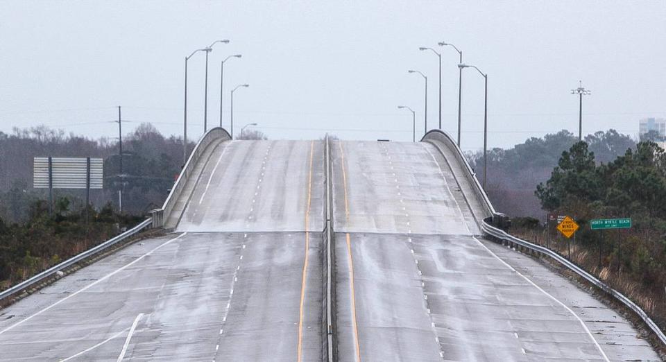
Avoid bridges when possible. They accumulate snow and ice first.
Watch out for black ice, otherwise known as when there is an (often) invisible layer ice on the road. Because it can’t easily be seen, black ice is one of the many reasons it’s important to slow down when driving during winter weather.
The state Department of Transportation has plenty of methods for taking care of South Carolina’s roads. Ahead of and during the storm, the agency will be out prepping roads and de-icing them.
Horry County Public Works also has equipment to “remove and mitigate the effects of snow/ice” and has been out treating “key county roads and bridges,” county emergency management spokesman Thomas Bell said in an email.
As for driving, it’s still a good idea to avoid the roads if you can, Highway Patrol Master Trooper Brian Jones said.
And yes, Jones has heard it before: You grew up driving in snow! You’re a pro at this.
Snow is very different than ice. South Carolina’s warmer climate means we more often get ice, which creates slick and incredibly dangerous roads compared to the gritty snow-covered streets (that still provide good traction) drivers from, well, places with snow might be used to, Jones said.
“Whenever we see accumulation then freezing overnight, ice forms. It makes for a dangerous driving experience,” Jones said. “So whenever we see a winter weather event, we see our call volume increase drastically. We respond to a lot more collisions than we ordinarily would. So our message there is if you don’t have to be out on the roadways, save yourself the trouble to stay home.”
Keep in mind that there is also a chance that any accumulated water on the ground can also refreeze during the evening, especially on Saturday night, when it will be the coldest. That will create dangerous road conditions Saturday night and into Sunday morning until all of the precipitation melts and drains away in the coming days.
For those who have to drive, keep an eye out for people working on de-icing the roads. The Department of Transportation has loads of resources for helping melt ice on roads and keeping them from freezing. This week, they’ll be out in full force working to keep the state’s roads safe. Slow down to make sure they can do their work safely. Keep in mind that salt trucks and snow plows tend to move pretty slowly, so they can cover the entire roadway.
“The safest solution is for drivers to stay off the roads if at all possible. If you must drive, slow down and watch for crews performing de-icing and plowing operations,” Department of Transportation Secretary Christy Hall said in a statement.

