Snow lovers rejoice: East Coast to receive a Valentine's Day nor'easter
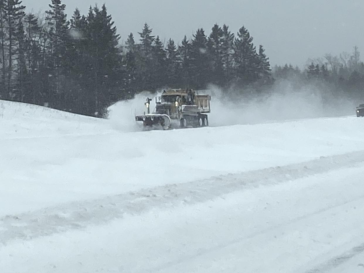
Those weary from last weekend's snowfall thump in Nova Scotia will need to brace themselves for the next storm. It could be a doozy, and has a good chance of disrupting Valentine's Day plans.
RELATED: Pattern flip next week to bring Canada colder air, possible snow
Even though we’re still several days out from this storm, the setup has the telltale markings of a nor'easter.
It’s been a quiet winter so far, in terms of classic nor’easters across Atlantic Canada, that is. You can thank, in part, the lack of arctic air flooding across the continent.
Things are going to change. Here’s what you need to know about the next storm.
What lies ahead
A powerful storm in the Atlantic by mid-next week is expected to fulfill the criteria for a weather bomb. This storm has the potential to be a major snowstorm for parts of the region during Tuesday and Wednesday, and possibly even a blizzard for southeastern Newfoundland.
MUST SEE: PHOTOS: Record-setting snowstorm drops 100+ cm of snow on Nova Scotia
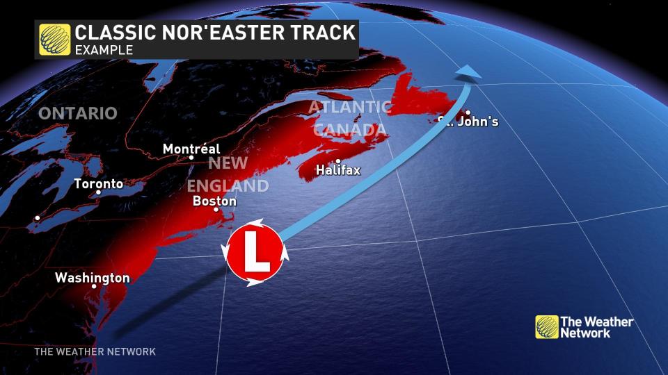
What’s a nor’easter? First, a primer.
These areas of low pressure are coined by their famous wind direction, but the most important factor is the supply of continental, cold air delivered by the polar jet stream. Once this cold air interacts with warmer flows off the Gulf Stream, a low-pressure system forms generally within a couple hundred kilometres off the U.S. Eastern Seaboard.
Coincidently, they also move northeast and tend to peak in intensity as they hurdle towards Atlantic Canada.
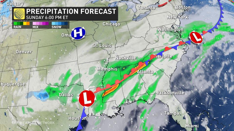
Sunday: Humble beginnings
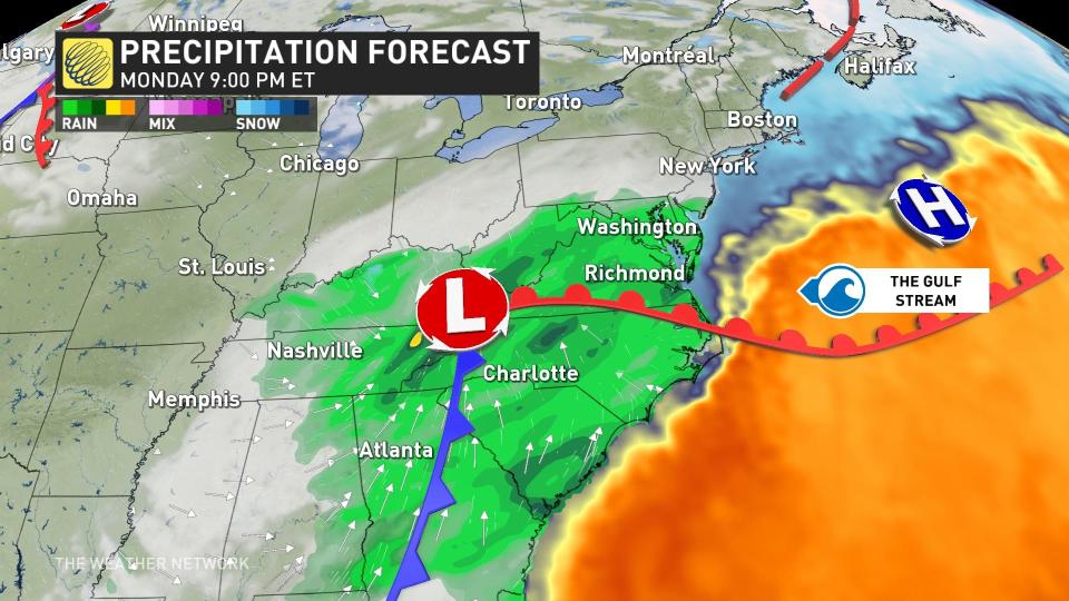
On Sunday, the weather charts highlight a frontal boundary across the U.S. Southeast, with a weak surface low developing in eastern Texas.
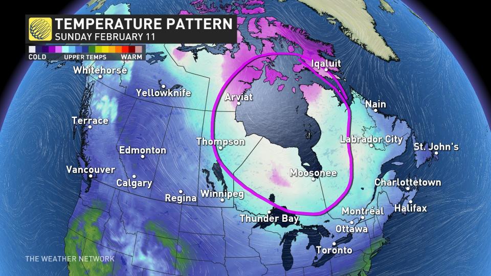
The pieces of the ingredients needed to develop a powerful nor’easter are beginning to coalesce across North America, including the critical ingredient –– cold air.
A healthy supply of cold, continental air is situated over Hudson Bay. We’ll get to this later.
Monday: Low ignition
By Monday, the upper-level winds have steered the disturbance out of Texas and over the southeastern U.S., where a more organized low-pressure system has organized.
As the low lumbers through Tennessee and North Carolina, it’s getting closer to the fuse that’ll begin to rapidly develop the mid-Latitude low. That's the warm Gulf Stream.
Tuesday: Low liftoff and Canadian impacts
By Tuesday morning, the atmospheric pressure is dropping like a rock off the Eastern Seaboard, as the weaker inland low has transformed its energy into a single, powerful, developing nor’easter.
But, let’s check in on that cold air, that necessary ingredient required to continue to fuel the low as it lifts northeastward. A lobe of the chilliest air descended from Hudson Bay extends across Quebec and Atlantic Canada.
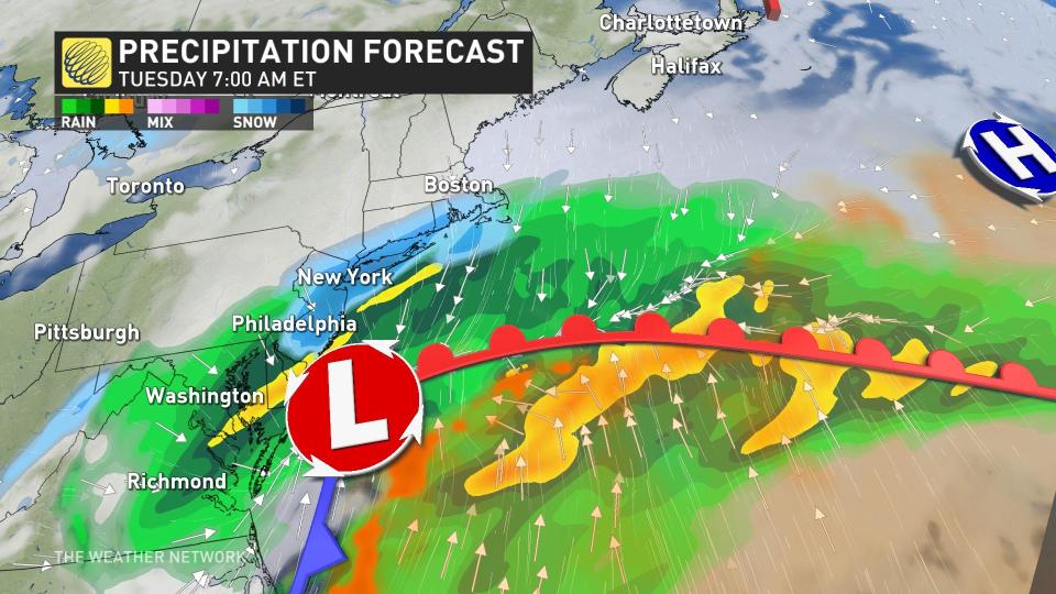
The cold air will wrap into the low-pressure system, the cold conveyor belt, and continue to intensify the nor’easter through Tuesday, while the warm conveyor belt lifts out ahead of the system.
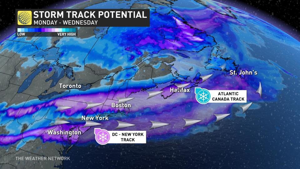
Later Tuesday evening, the low will pass offshore of Nova Scotia, and the Maritimes are guaranteed to remain on the cold side of this low, meaning snow is the only viable precipitation type. There’s still about a 25 per cent chance the precipitation remains mostly offshore of Nova Scotia, but it’s not the favoured solution.
Heavy snowfall, blowing snow and limited visibility are all hazards with this nor’easter, but we’ll revise snowfall forecasts later this weekend.
Valentine's Day: Peak intensity
The nor’easter is forecast to reach the deepest low pressure on Wednesday, below 970 hPA as the centre of the low passes south of the Avalon.
This has the making of a classic nor’easter with widespread issues for Atlantic Canada, so keep checking back with us at The Weather Network for the latest forecast updates.

