Snow risk inches into southern Ontario as May starts on chilly note
Get ready for an unwelcome visitor across parts of southern Ontario as the calendar flips to May on Monday.
The cold side of a sluggish storm inching its way over the Great Lakes region will sweep into southern Ontario early this week, bringing chilly temperatures and a chance for accumulating snow to begin the new month.
DON’T MISS: Record-breaking low pressure set to swirl across Eastern Canada
Ontario’s been socked in clouds and precipitation for days as a slow-moving series of upper-level lows dances through Central Canada. Bouts of rain will continue cycling through southern and eastern Ontario into the day Monday and Tuesday as this pattern takes its time moving east.
A budding low-pressure system rapidly strengthening near the Ontario/Quebec border will influence our weather to start the new workweek. This system will grow unusually strong for this time of the year, likely breaking monthly air pressure records for communities in both provinces.
That record-breaking system’s path will place southern Ontario in line to feel an unseasonable chill as northwesterly winds swoop across the lakes.
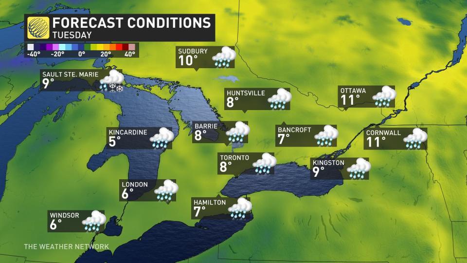
Temperatures will fall into the single digits for much of the region by Tuesday as chilly northerly winds dominate.
MUST SEE: All the rain gear you need to stay as dry as possible this spring
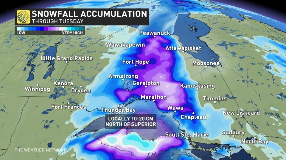
This setup will lead to plenty of snow across northern Ontario, with 10-20 cm in the forecast north of Lake Superior. Travel will be difficult along swaths of the Trans-Canada Highway through Monday as the snow piles up.
Snow won’t stop north of the lakes, unfortunately, and it looks like accumulating snow is on the way for southern portions of the province—and pushing uncomfortably close to the Greater Toronto Area (GTA).
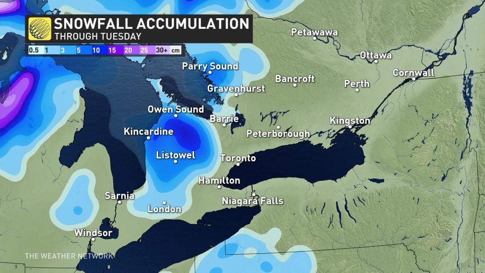
The best opportunity for accumulations will remain confined to the shores of Lake Huron and Georgian Bay, but a chance for a dusting could stretch as far south as London.
5-10 cm of accumulation is possible under heavier bursts. Fortunately, the rising sun angle will make it tough for snow to stick around very long, especially on paved surfaces.
Conditions will finally start to ease up behind this system as the upper-level pattern responsible for the gloom pushes east.
The constant clouds and rain will start to break up by the middle of this week, likely revealing more sun than clouds as we head toward the first full weekend of May. We're looking ahead to the potential for a period of warmer and drier conditions to arrive in Ontario by the second week of the month.
Thumbnail image courtesy of Lorraine Parow.
Stay tuned to The Weather Network for the latest on conditions across Ontario.

