Snow to spread through Great Lakes, northeastern US prior to Christmas
A storm may bring just enough snow to cause slippery travel from the upper Great Lakes to the Northeast through Christmas Eve.
An Alberta clipper storm will race southeastward across the upper Great Lakes and Northeast into Monday night.
Snowfall will tend to be light and spotty in nature, given the lack of moisture associated with this storm.
However, people should not let their guard down, as enough snow to create slippery spots on secondary roads and stretches of interstates 75, 79, 80, 81, 86, 87 and 90 is expected.
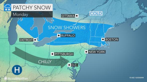
Areas from the northern Great Lakes to the northern Appalachians have the best chance of picking up an inch or two of snow, according to AccuWeather Senior Meteorologist Alex Sosnowski.
Locally higher amounts up to 4 inches are possible where snow showers persist downwind of lakes Erie and Ontario for much of Christmas Eve.
Snow can also leave a coating, mainly on grassy surfaces, across southeast New England into Monday afternoon.
While much of the snow will wind down by Monday evening, snow showers may linger around the Syracuse area into the first few hours of Monday night.
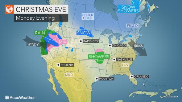
Anyone heading out for Christmas Eve services or family and friends gatherings should use caution on the roadways and sidewalks, as untreated, wet surfaces can develop icy spots as temperatures plummet Monday night.
Download the free AccuWeather app to see the forecast for Christmas Eve and Christmas Day in your area.
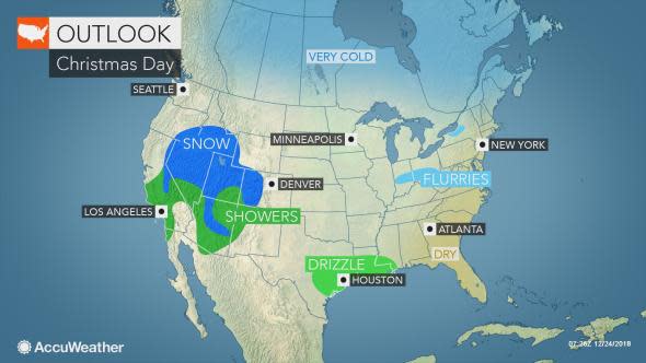
The weather is predicted to turn tranquil for Christmas Day, with partial sunshine and seasonably high temperatures.
Dry conditions should prevail for much of the remainder of the week in the Northeast before the next storm, which will unleash a wide array of weather in the Central states at the week's end.
