Snow storm NJ: Mostly rain at the Shore and hazardous snowfall for North Jersey
Snow is coming to New Jersey this weekend but whether you’ll be impacted depends on where you live — or travel.
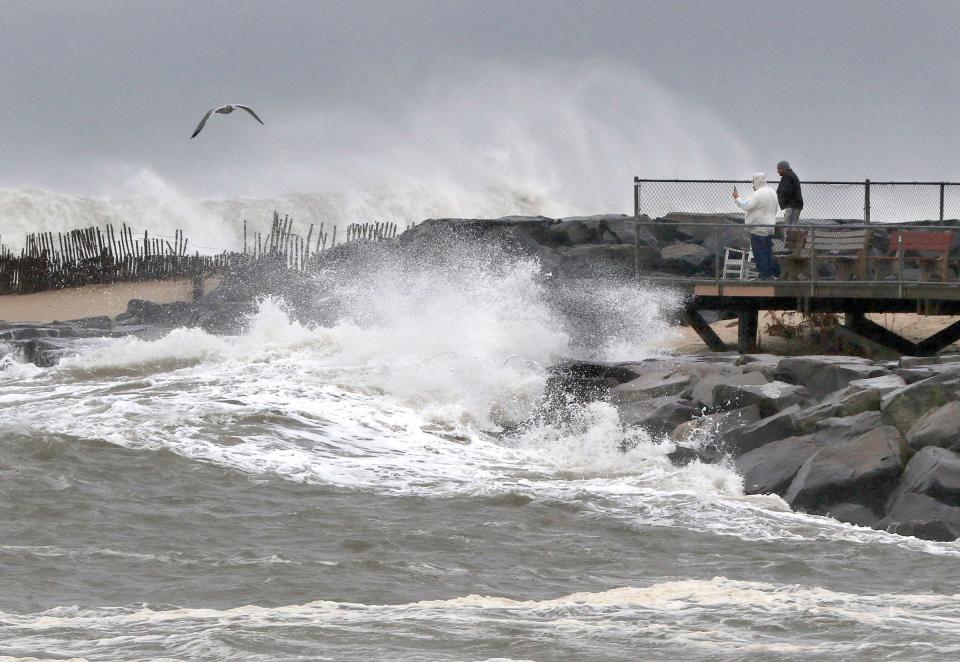
Very little or no snow accumulation is expected for the Shore region this weekend as higher coastal temperatures around the 40s will keep precipitation in the form of rain, said Amanda Lee, a meteorologist with the National Weather Service, Mount Holly.
The Shore is expecting up to 1.5 inches of rain this weekend along with heavy wind gusts, which will peak on Saturday night at 45 mph in Ocean County and 30 mph in Monmouth County.
North Jersey is expected to receive 4 to 12 inches of snow, with the highest accumulation in the northwest part of the state.
Coastal flooding is expected in Ocean County between 2 a.m. and 8 a.m. Sunday. Up to one half foot of inundation above ground level is expected in areas near shorelines and tidal waterways, the National Weather Service said.
Precipitation should to leave the area by Sunday morning. By Sunday evening thewhole region will be dry. But more rain will come on Tuesday into Wednesday as a rain storm will approach the region bringing up to 4 inches of rain with potential for more flooding, the National Weather Service said.
How much is it going to snow, rain across NJ?
For the Jersey Shore area a brief period of snow at the beginning ofstorm Saturday afternoon is possible, but it will quickly turn into all rain. Up to 1.5 inches of rain is expected with little to no snow accumulation, forecasters say.
Western parts of Bergen and Passaic counties are predicted to see between 4 and 8 inches, while the eastern parts of the counties may see up to 4 inches.
Morris County is expected to see between 6 and 8 inches of snow. Sussex County could see between 8 to 12 inches.
Northern areas of Hunterdon county might receive from 3 to 6 inches of snow, specially in highly elevated areas above 500 feet.
Mercer, Somerset and Hunterdon counties are expected to receive both rain and snow.
Asbury Park weather — and Eastern Monmouth County region
Saturday- A slight chance of rain and snow before 1 p.m., then rain. High near 43. Chance of precipitation is 80%. Little or no snow accumulation expected.
Saturday night- Rain. Low around 36. Windy, with an east wind 20 to 30 mph becoming north after midnight. Chance of precipitation is 100%. New precipitation amounts between three quarters and one inch possible.
Sunday- Rain likely, mainly before 10 a.m. Cloudy, with a high near 41. Northwest wind around 15 mph. Chance of precipitation is 70%. New precipitation amounts of less than a tenth of an inch possible.
Sunday night- Mostly cloudy, then gradually becoming mostly clear, with a low around 31.
Monday- Sunny, with a high near 43.
Monday night- Partly cloudy, with a low around 31.
Tuesday- Breezy and rainy, mainly after 1 p.m. High near 55. Chance of precipitation is 90%.
Tuesday night- Rainy and windy. The rain could be heavy at times. Low around 43. Chance of precipitation is 100%.
Wednesday- Partly sunny and windy with a chance of showers before 1 p.m. High near 53. Chance of precipitation is 40%.
Wednesday night- Breezy and partly cloudy, with a low around 33.
Thursday- Mostly sunny, with a high near 46.
Thursday night- Partly cloudy, with a low around 34.
Friday- Partly sunny, with a high near 47.
Toms River weather — and Ocean County region
Saturday- Rain, mainly after 1 p.m. High near 42. East wind 5 to 15 mph, with gusts as high as 25 mph. Chance of precipitation is 90%. New precipitation amounts between a quarter and half of an inch possible.
Saturday night- Rain, mainly before 1 a.m. Low around 36. Windy, with an east wind 25 to 30 mph becoming north 15 to 20 mph after midnight. Winds could gust as high as 45 mph. Chance of precipitation is 100%. New precipitation amounts between three quarters and one inch possible.
Sunday- Cloudy and rain likely, mainly before 8 a.m. High near 41. Northwest wind 10 to 15 mph. Chance of precipitation is 60%. New precipitation amounts of less than a tenth of an inch possible.
Sunday night- Mostly cloudy, then gradually becoming mostly clear, with a low around 29. Northwest wind gusts could be as high as 20 mph.
Monday- Sunny, with a high near 44. Northwest wind around 10 mph, with gusts as high as 20 mph.
Monday night- Partly cloudy, with a low around 29.
Tuesday- Breezy and rain, mainly after 1 p.m. High near 57. Chance of precipitation is 90%.
Tuesday night- Windy and rainy. The rain could be heavy at times. Low around 43. Chance of precipitation is 100%.
Wednesday- Windy with a chance of showers before 1 p.m. Partly sunny, with a high near 54. Chance of precipitation is 30%.
Wednesday night- Breezy and partly cloudy, with a low around 32.
Thursday- Sunny, with a high near 47.
Thursday night- Partly cloudy, with a low around 31.
Friday- Partly sunny, with a high near 48.
Source: National Weather Service
This article originally appeared on Asbury Park Press: Snow storm weather forecast: Mostly rain but, heavy snowfall in others

