Soaking rain, dangerous surf expected along Florida's Atlantic coast


Drenching rain and persistent winds could hamper plans for residents, travelers and snowbirds across the Sunshine State into next week.
Florida's Atlantic coast has been no stranger to wet weather this year, with places like Fort Lauderdale, Florida, eclipsing its rainiest year to date with over 109 inches observed as of Dec. 12.
In stark contrast, just 100 miles to the west in Naples, Florida, the driest year to date is underway, with less than 24 inches of rainfall observed as of Wednesday morning.
 |
The upcoming weather pattern should add to both of those annual totals, as a major influx of moisture is expected to surge out of the southwestern Atlantic and Gulf of Mexico later this week and this weekend. The moisture surge will be prompted by a storm diving in from the southern Rockies.
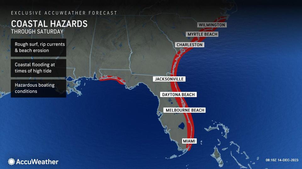
Gusty onshore winds along Florida's east coast are already prompting red flags at area beaches. Through the end of the week, persistent onshore winds and expanding coverage of dangerous beach conditions up the Southeast coast will make trying to plan a trip to the beach even more difficult.
 |
Because of the long duration of this event, water can flood into east-facing shoreline areas, back bays and tidal rivers.
"The persistent easterly flow from the ocean will not only cause water to pile up on southern Atlantic beaches, but also lead to water backing up on the tidal rivers, including the St. Johns in Florida, the Savannah in Georgia and the Congaree in South Carolina," AccuWeather Senior Meteorologist Alex Sosnowski stated.
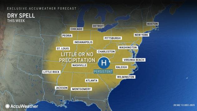
One of the main drivers for the wet and windy weather along Florida's Atlantic coast will stem from an expansive area of high pressure across the central and eastern United States, which will barely move through the remainder of the week.
 |
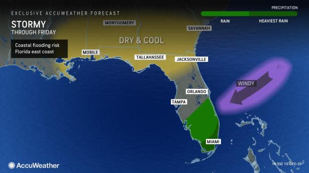
In addition to the wind through the rest of the week, showers and thunderstorms rolling in from the Atlantic can also increase the flood risk across southern and eastern Florida.
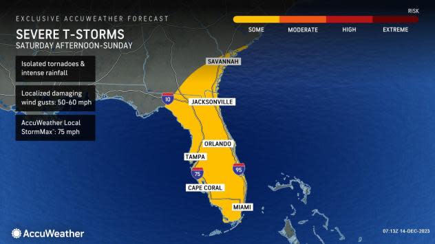
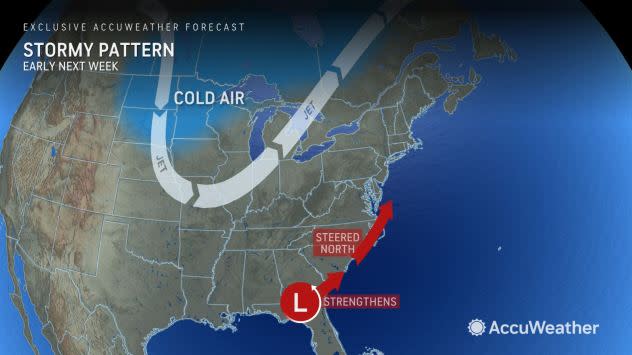
The exact track of the storm system will determine the extent of severe thunderstorms that could bring tornadoes and powerful wind gusts. The most likely time for severe thunderstorms in southwestern Florida will be Saturday afternoon and in much of the balance of the Florida Peninsula from Saturday night to early Sunday. Dangerous storms are expected to continue to track northward on Sunday as the storm lifts toward the mid-Atlantic states.
 |
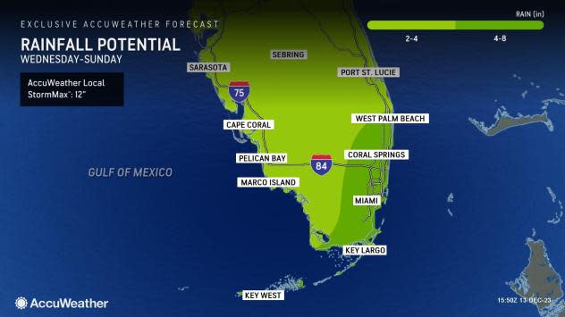
Despite no direct tropical impacts across southeastern Florida this season, some impressive heavy rain events have taken place. On two separate occasions this year, Fort Lauderdale experienced double-digit rainfall totals, with a whopping 22.50 inches of rain on April 12 and a long-duration rain event between Nov. 14-16 when 10.66 inches of rain fell.
The upcoming weather pattern has the potential to rival the event that occurred back in November.
Over the weekend, the risk for heavy rain and flooding is expected to peak across Florida as a developing storm in the Gulf of Mexico can threaten a complete washout across the peninsula. This feature will continue to be closely monitored by our expert team, as this could not only dampen outdoor plans but may threaten lives and property.
 |
AccuWeather meteorologists are focusing on the period through Saturday night for potentially flooding rainfall. "Rainfall rates could be similar to a tropical depression or storm passing through the region and could exceed 2 inches per hour," Sosnowski said.
There is a slight chance that the system briefly evolves into a subtropical storm.
Beyond the weekend, questions remain regarding the track and intensity of the storm near the Southeast coast. The likelihood exists for it to curl northward up the East Coast, bringing another round of rain and gusty winds for the same areas that just dealt with a formidable storm a few days ago.
 |
There is also the potential for a major nor'easter to evolve. However, many atmospheric ingredients will need to line up in order for that to occur. Check back with AccuWeather often for the latest information and forecasts.
Want next-level safety, ad-free? Unlock advanced, hyperlocal severe weather alerts when you subscribe to Premium+ on the AccuWeather app. AccuWeather Alerts™ are prompted by our expert meteorologists who monitor and analyze dangerous weather risks 24/7 to keep you and your family safer.
