No-name storm swamps South Florida with flooding, high winds. Recovery is under way
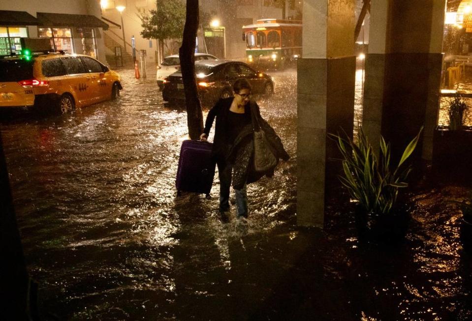
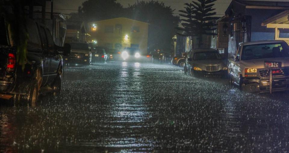
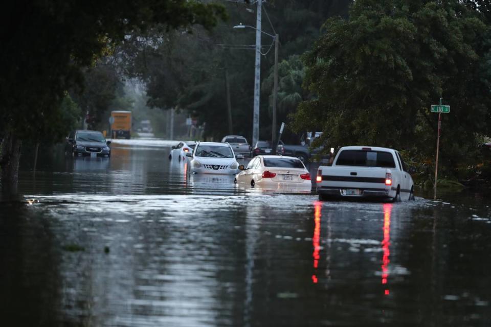
South Florida awoke Thursday to downed trees, roads closed due to debris and flooding, homes taking on water and massive puddles everywhere. Tens of thousands of homes were without power.
The cause? A no-name storm, one that swept the region over two days and dumped up to 14 inches of rain in some spots, with gusts as high as 75 mph at Government Cut and Port Everglades. The damage was enough to rival some tropical storms that have swept the region in recent years, according to the National Hurricane Center. And it even showed a broad area of circulation on radar as it rolled past South Florida early Thursday morning.
Senior Hurricane Specialist Robbie Berg said that although the center tagged the storm as a low worth watching, it did not officially meet the definition of a tropical depression or tropical storm. That’s because the system had a ridge of cool air, also known as a frontal boundary, attached to it that left parts of Miami in the 60s overnight after the rain swept through.
“One of the hallmarks of a tropical system is that it cannot have frontal boundaries attached to it,” he said. “If it does, it’s extratropical.”
No-name storm swamps South Florida
Named or not, Wednesday night’s storm clearly was a whopper for some parts of South Florida. Broward County closed its schools for the day, and the Henry E. Kinney tunnel in Fort Lauderdale was closed.
The runways at Fort Lauderdale-Hollywood International Airport were swamped again, the second time this year. Even into Thursday night, taxiways were still flooded over.
Fort Lauderdale Airport might as well be called Fort Lauderdale Seaport!
The taxiways have turned into CANALS! pic.twitter.com/Igj5Hfp1f5— Noah Berger (@Trainboy100) November 16, 2023
It was a mess but did nowhere near the damage of the “rain bomb” that swamped Fort Lauderdale with nearly 26 inches in a 12-hour period in April.
Social media accounts of downed trees on homes and cars, along with flooded homes, piled up Thursday.
Raining nonstop in downtown Fort Lauderdale tonight!#fortlauderdaleflooding #Florida #flooding pic.twitter.com/IlnWbgFdtl
— Florida Drone Cleaning LLC DOUGLAS THRON (@douglasthron777) November 16, 2023
November Hurricane in Fort Lauderdale! pic.twitter.com/BggeEogM2D
— Chris Nelson (@ReOpenChris) November 16, 2023
#Flooding in Southwest Ranches on Dykes Road, South of Griffin Road #Florida (8am)@BrandonOrrWPLG @WeatherWithLaur @AnthonyDuarte03 @CBSMiami @NWSMiami #flwx #wx #wxtwitter pic.twitter.com/1mugm2mTSk
— Hurricane Chaser Chase (@hurricane_chase) November 16, 2023
READ MORE: Disturbance affecting South Florida and the Keys while another threatens the Caribbean
The Miami office of the National Weather Service reported a “palm tree split down the middle” in Oakland Park. And as of 10 a.m., nearly 90,000 customers were without power in Miami-Dade, Broward and Palm Beach, according to Poweroutage.us.
Utility companies brought a vast majority of those without power back online — about 32,400 were still without power as of 7:30 p.m.
While many areas felt the brunt of the storm, it won’t be causing any long term delays to daily life. Broward County Public Schools announced classed would be back in session on Friday.
“We’ve got some damages, but nothing so significant that we can’t fix in the next 24 hours,” Superintendent Peter Licata said Thursday.
READ MORE: Broward Schools to reopen Friday: ‘Nothing so significant we can’t fix in 24 hours’
How much rain fell?
Exactly how much rain fell is still an open question, but the South Florida Water Management District reported two-day rain totals as high as 12 to 14 inches in southeast and east-central Broward. And CoCoRahs, a volunteer network of rain gauges, reported two-day totals as high as 13.31 inches in Lauderdale-by-the-Sea.
The weather service posted on X its preliminary rainfall totals for Tuesday and Wednesday. Broward saw the highest amount of rain, with some areas, like Oakland Park and Wilton Manors, having over 12 inches.
In Miami-Dade, Biscayne Park saw the worst of it with over 10 inches of rain. Other regions hovered between 7 to 10 inches, including North Miami, Coral Gables and Kendall.

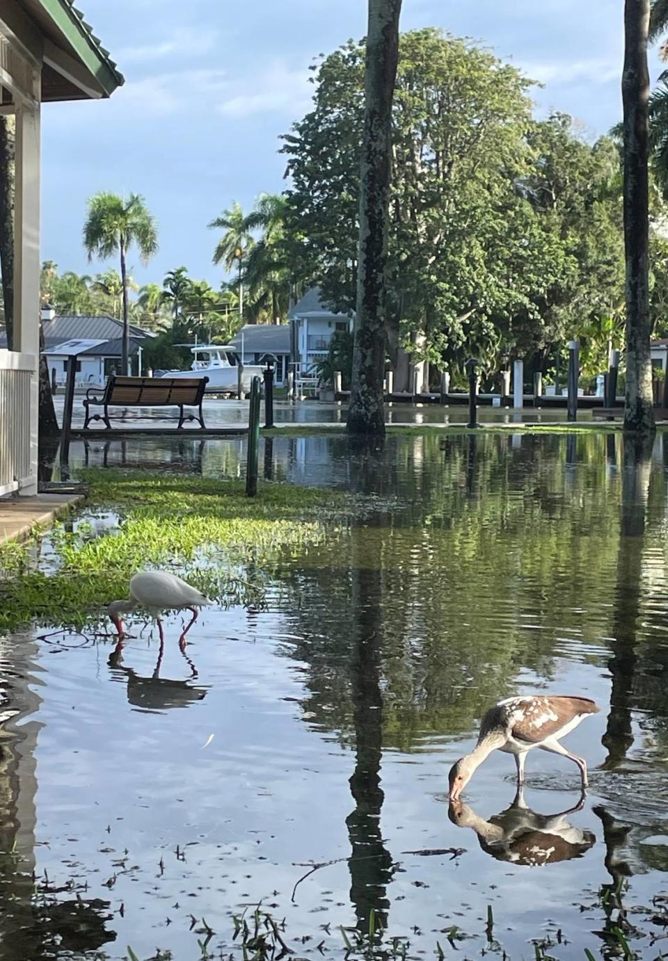
South Florida’s flood control systems are typically designed to handle about six inches a day. Most areas escaped serious flooding, though there was still plenty of standing water in low-lying areas that frequently flood.
Damage in Miami Beach from last nights non-tropical storm- near Meridian and Flamingo Park @NWSMiami pic.twitter.com/Q4AR5J9hoP
— Eric Blake (@EricBlake12) November 16, 2023
Flooding in some spots also was worsened by higher-than-average tides, known as king tides, that peaked late Wednesday and mid-morning Thursday, giving the water little space to drain away.
“In terms of combined wind and rain impacts in Biscayne Park, this no-name storm is a close second behind Irma (2017) since I moved here in early 2012. Power is off and on, internet is out, water main breaks, etc. This was a very significant event,” Brian McNoldy, a senior research associate at the University of Miami Rosenstiel School of Marine, Atmospheric, and Earth Science posted on X, formerly Twitter.
The Florida Keys, particularly around Key Largo and Ocean Reef, also took a hit from the heavy downpours and wind gusts stemming from the storm that drenched South Florida, with at least one gust topping 86 mph, hurricane force.
READ MORE: Tens of thousands lose power in Miami area during storms. Here’s FPL’s latest update
Berg, with the hurricane center, said that whether or not they named this storm, residents should pay attention to the watches and warnings issued by the local weather service. Several flash flood warnings were issued Wednesday night that blanketed nearly all of Miami-Dade and eastern Broward County.
“If it has a name or not, it doesn’t really matter. What we really want people to listen to is the local watches and warnings,” he said. “They’re put out for a reason.”
Miami Herald reporters Ashley Miznazi and Devoun Cetoute contributed to this report.

