Here’s when South Florida counties could start feeling tropical storm conditions from Eta
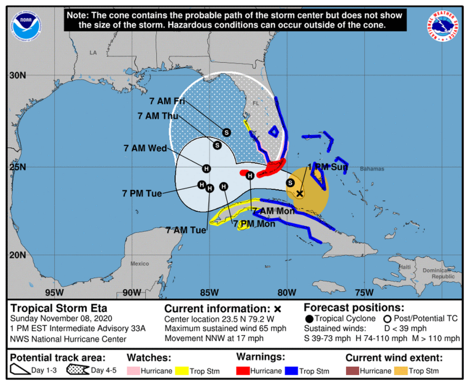
With Tropical Storm Eta making its way over Cuba and approaching the southwest tip of Florida and the Keys, South Florida should expect to start feeling tropical storm conditions late Sunday and throughout Monday morning, forecasters say.
On Sunday afternoon, parts of Miami-Dade, Broward and Palm Beach counties were already feeling strong wind gusts of up to 48 miles per hour, but those are expected to increase to up to 61 mph gusts and 44 mph sustained winds by midnight, according to the National Weather Service Forecast Office.
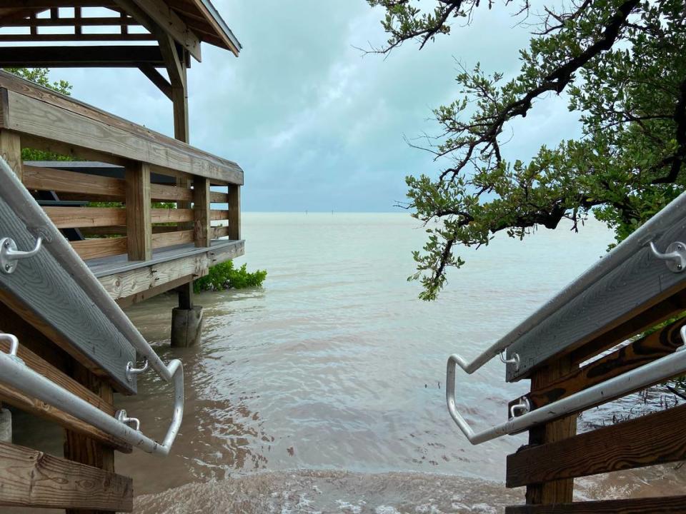
In Monroe County, hurricane-strength gusts could swirl through the Keys in the early morning, between 3 a.m. and 7 a.m. The county will get high sustained winds of up to 60 mph. By Sunday afternoon, beaches in the Upper Keys had already begun to see the storm surge.
Eta is expected to grow into a Category 1 hurricane before reaching the Florida Keys, bringing with it heavy rainfall and potentially hazardous flooding.
Even though it’s not expected to hit Miami-Dade directly, the weather service issued a hurricane watch from southern Florida to Bonita Beach on the Southwest coast and Deerfield Beach in Palm Beach County, as the growing storm will create similar weather conditions for the Tri-County area.
“Because you have that expanding wind field, you’re going to have these stronger winds going across a wider area,” said NWS forecaster Paxton Fell.
Miami-Dade, Broward and Palm Beach counties will feel the earliest onset of storm winds on Sunday afternoon and into the evening, with overnight hours as the main window of concern, said Fell.
“The main timeline will be late tonight during overnight hours for everyone,” she said.
But don’t be fooled by a sudden calm after the storm on Monday morning, Fell said. There’s still a possibility gusty winds will continue into tomorrow afternoon.
Water spouts and tornadoes also could threaten mostly coastal areas in South Florida as early as Sunday evening.
The primary concern, however, is flooding.
“For coastal locations, not only do you have to worry about heavy rainfall and rain-induced flooding, you also have to worry about coastal flooding,” said Fell.
A storm surge of about 2 to 4 feet is expected for Miami-Dade and Monroe counties. In Broward and Palm Beach, the surge could be between 1 and 2 feet.

