South Jersey saw midday snow, will it carry into the weekend?
We'll have to wait and see about a white Christmas, but let's start with a weekend forecast.
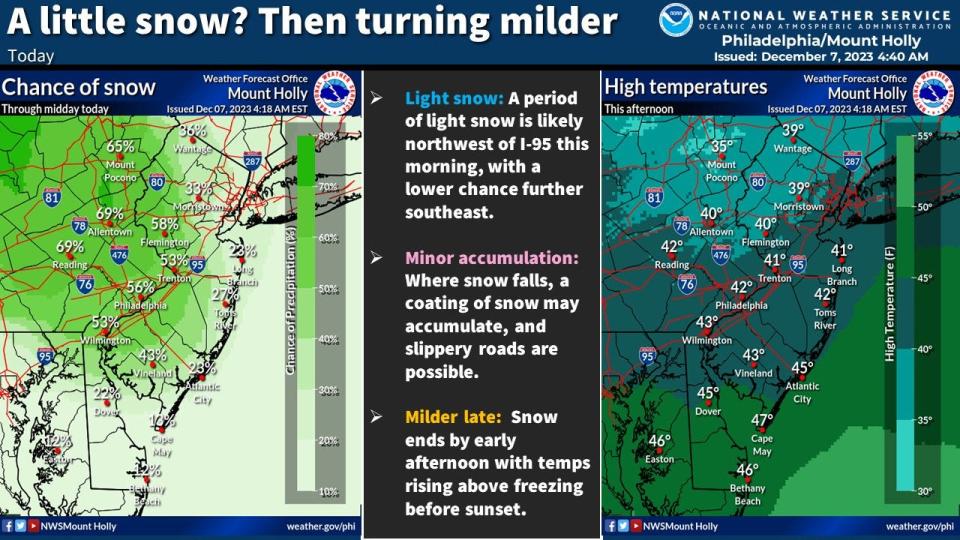
Snow showers made their way through the Lehigh Valley and Poconos in northeastern Pennsylvania on Thursday, but it looks like South Jersey is still waiting to become a winter wonderland, according to the National Weather Service.
Snow showers are working their way into the Lehigh Valley and Poconos this morning. Snow will eventually make its way into New Jersey. Take it slow out there if you encounter any snow! And as always, feel free to leave your snow reports here! Thank you! #NJwx #PAwx #DEwx #MDwx
— NWS Mount Holly (@NWS_MountHolly) December 7, 2023
Based on forecast images from NWS, snow predictions in the 50 to 60 percent range just touched our state's eastern border, and weather reports show light flurries making their way through the region.
Don't get used to the chill just yet though.
Temps are rising for the weekend, hitting highs in the 50s on Friday and Saturday and up to the low 60s with rain showers on Sunday.
Coastal portions of Atlantic County are included in a hazardous weather outlook through early next week, specifically for windy conditions that may cause tree damage and power outages on Sunday.
Kaitlyn McCormick writes about trending issues and community news across South Jersey for the Courier Post, The Daily Journal and the Burlington County Times. If you have a story she should tell, email her at kmccormick@gannett.com. And subscribe to stay up to date on the news you need.
More: The holidays are here: When are you mailing your packages?
More: Winter is coming, is your home prepped? Follow these tips to stay safe ... and warm
More: COVID stats rise as new variant surges
This article originally appeared on Cherry Hill Courier-Post: Will Thursday's midday snow showers stay for the weekend?

