Southeast Michigan forecast: Heavy rainfall, storms, then bye-bye humidity
Southeast Michigan has sweated through intensely hot, muggy weather since mid-July, but the humidity will finally be coming to an end after intense rains push through the state on Monday.
The National Oceanic and Atmospheric Administration warned on Sunday that the severe heavy rainfall was headed into metro Detroit due to high moisture content in the air.
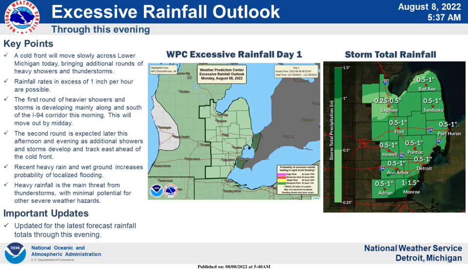
And according to the National Weather Service in White Lake, localized heavy rain — an inch or more in some spots — and flash flooding is possible. Storms with wind gusts of 50-60 mph are likely early Monday evening, the agency said, with "frequent cloud-to-ground lightning as they move from west to east at 25 mph."
The Great Lakes Water Authority already is urging metro Detroiters in flood-prone areas to remove items from the basement and prep in advance for any potential issues.
But on the bright side, the weather service said, the rest of the week is expected to be less muggy than the week before, with not much rain.
July's average temperature was 85 degrees — higher than the average of 83.7 degrees. And August is likely to be above-normal as well, according to the weather service.
More: Heavy rain expected through Monday in Southeast Michigan
More: Gas prices in Michigan fall to nearly $4 a gallon, expected to keep dropping
The weather service also is reminding motorists of its campaign urging drivers who spot water over the roadway to "turn around, don't drown," or risk being submerged.
Drivers can lose control of their vehicles or stall out if they travel through six inches or more of standing water, the agency said.
This article originally appeared on Detroit Free Press: Southeast Michigan to see rain, flooding before humidity finally eases

