Frigid storm to slam California: Blizzard warning for local mountains, snow at low elevations
A powerful storm is expected to sweep across California this week, bringing cold temperatures, cutting winds and snowfall at remarkably low elevations nearly statewide.
"This is shaping up to be a very unusual event," UCLA climate scientist Daniel Swain said in a virtual briefing Tuesday morning. "We are going to see low [elevation] snow all the way from the Oregon border to the Mexican border — it's just a question of how low."
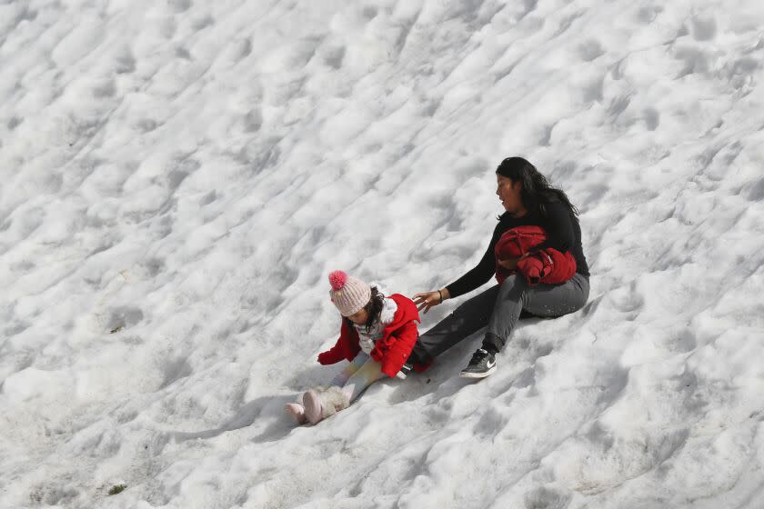
Though snow is not expected to accumulate in major cities, hills near the San Francisco Bay Area and the high desert around Los Angeles could see snow by Wednesday or Thursday, at elevations that don't typically see much, if any, Swain said.
"Just about everybody who lives in California will probably be able to see snow, at least on the nearby hills — and, in most cases, in the very nearby hills — probably on Friday morning," Swain said.
In a sign of the potential power of the storm, the National Weather Service issued a blizzard warning for some L.A. and Ventura county mountains through Thursday, forecasting "heavy snow with winds gusting up to 75 mph, and near zero visibility."
For perspective, my current view is that just about any place in the "yellow or higher" areas on this topographic contour map of California (i.e., ~900-1000ft) has a decent shot at accumulating snowfall overnight Thu into Fri. Definitely includes some unusual places... #CAwxpic.twitter.com/HhVlYf3Rv2
— Daniel Swain (@Weather_West) February 20, 2023
Parts of Southern California could see snow starting early Wednesday at elevations as low as 1,500 feet, and even lower in parts of Northern California, some forecasters said.
As of Tuesday afternoon, forecasts showed the Antelope Valley getting a dusting by late Wednesday, with some models suggesting that snow could fall across Santa Clarita and possibly on the highest peaks of the Santa Monica Mountains. In Los Angeles County's higher mountains, including along the Grapevine, Wednesday could bring up to 4 inches of snow and significant traffic disruptions, weather officials warned.
The week of winter weather began Tuesday, with a "dynamically strong cold front" traveling down California, bringing extremely high winds and a dramatic drop in temperatures, Swain said. Winds in the Bay Area — the National Weather Service warned of gusts up to 60 mph — quickly created issues Tuesday afternoon, when a massive tree fell near the Oakland Bay Bridge.
A high-wind warning was also in effect late Tuesday for much of northern Los Angeles County and the Southern California coast, with 70-mph gusts possible in the Antelope Valley.
The most unusual period of the storm, and the most unpredictable, will begin Thursday, Swain said, when a "modified Arctic air mass" will move into Northern California after sweeping through the Pacific, picking up moisture.
Most of that low-elevation snow could come late Thursday through Saturday, Swain said.
In the Bay Area and northern Sacramento Valley, snow could fall at elevations as low as 1,000 feet, Swain said — "very low" for those regions.
Widespread sea-level snowfall is not likely, Swain said, but the northern coast could see "accumulating sea-level snow in places like Eureka and Arcata" Thursday, with the potential for "historic" levels of snowfall.
Forecasters emphasized Tuesday that predictions for the following few days — especially those for snowfall — remain unclear because of the unusual nature of the weather event.
A winter storm warning was already in effect for much of the week from the state's most northwest corner down to the San Diego County mountains, alerting Californians to the possibility of heavy snowfall at high elevations and possible accumulation in areas closer to sea level later in the week.
The event is expected to be "a snowmaker of the likes we have not seen for many years," said Andrew Rorke, senior forecaster with the National Weather Service office in Oxnard.
Plan on significant impacts to travel at the coast and across the mountains in Northwest California during mid week. Heavy low elevation snow as well as numerous coastal hail showers will occur Tuesday afternoon through Thursday afternoon.https://t.co/RglzVDHhq4pic.twitter.com/N3o1Zx2SfX
— NWS Eureka (@NWSEureka) February 20, 2023
"All of the major coastal mountain peaks in the Bay Area will likely see snow — potentially significant snow," Swain said. "It's more common to get dustings around 1,500 or 2,000 feet in the Bay Area; that happens just about every year. But the most substantial accumulations are unusual."
Higher elevations, including areas along the Big Sur coast and the Santa Lucia Mountains, could see several inches, according to the National Weather Service, while the lower Sierra foothills could see accumulating snow in "very low places that don't typically see snow," Swain said.
Southern California's highest mountain areas, including Big Bear and Lake Arrowhead, could see a "disruptively heavy snow event" at the end of this week, with multiple feet of accumulation — amounts more common for the central Sierra Nevada, Swain said.
Forecasted storm totals have increased, but confidence remains low on exactly how much to expect. However, the higher snow accumulations make it even more imperative to take extra care when traveling or commuting around foothill, desert, and mountain roads. #LAsnow#CArain#CAwxpic.twitter.com/KKOf1d2TAe
— NWS Los Angeles (@NWSLosAngeles) February 21, 2023
"The mountains certainly will see significant snowfall. The deserts and some of the highest inland valleys might even see a little bit of flurries, although accumulation is less likely," Swain said. "Really, the only place in California that's going to see snow levels not get much below 2,000 feet is going to be right down near San Diego — but that's still really low."
Even if lower elevations don't see much snowfall, Swain said, frozen precipitation is likely, including small hail or graupel, a type of crystal than can look like snowflakes.
The systems will also stir up dangerously high waves, rising from 10 to 18 feet on the Central Coast and 7 to 10 feet — with local sets up to 14 feet — in L.A. and Ventura counties.
The storm comes as millions across the United States brace for severe winter weather, with the potential to cause major travel disruptions from coast to coast.
The Los Angeles County Department of Public Health on Tuesday issued a cold weather alert for the Antelope Valley, the Santa Clarita Valley and Mt. Wilson for Wednesday through Saturday, with temperatures expected to drop below freezing.
“Children, the elderly and people with disabilities or special medical needs are especially vulnerable during cold weather," Dr. Muntu Davis, the county's health officer, said in a statement. "Extra precaution should be taken to ensure they don’t get too cold when they are outside."
Davis reminded residents in these areas to seek shelter and public facilities if needed and to not use stoves, grills or ovens to heat homes due to the risk of carbon monoxide poisoning.
This story originally appeared in Los Angeles Times.
