Southern Maine coast prepares for Hurricane Lee: 'Expecting the worst, hoping for best'
YORK COUNTY, Maine — Coastal communities in southern Maine are preparing and bracing for the expected effects of Hurricane Lee this weekend.
Ogunquit Harbormaster Erin Gatt was at Perkins Cove on Thursday, working with others to slip storm lines through the sterns and bows of boats floating in the water.
According to Gatt, such a “spider web of ropes” is needed in a “tiny, tight” harbor like Perkins Cove because boats do not attach to single moors with enough room to slosh about if the water turns rough.
“The ropes take a lot of the pressure,” Gatt said.
Connecting boats with storm lines is a standard practice in the wintertime and is mandatory whenever winds climb to roughly more than 35 mph at any time, Gatt said. But he added that he and boat owners do not usually find themselves with such a task in September, however.
“It’s rare for this time of year,” he said. “We’re expecting the worst and hoping for the best.”
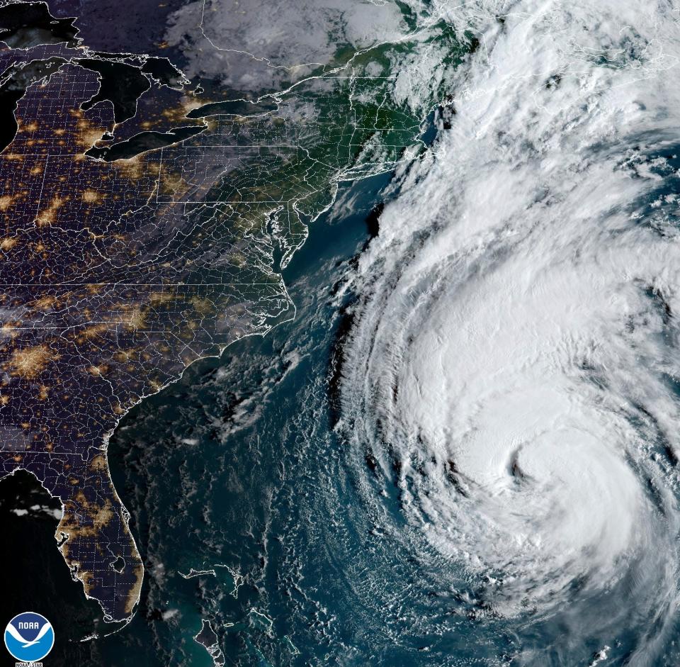
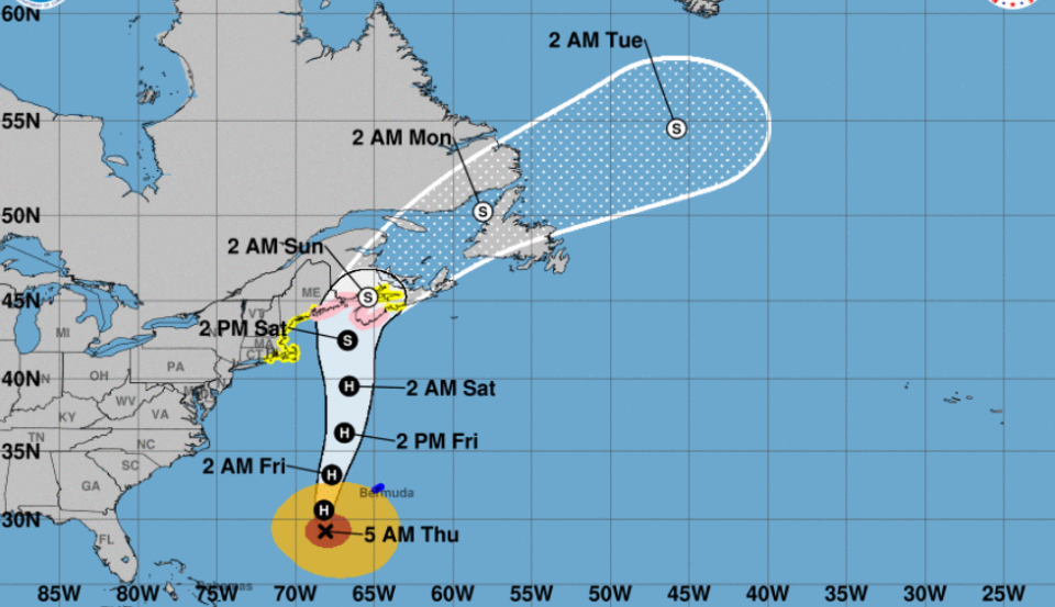
Lee, classified as a Category 2 storm on Thursday, is expected to weaken enough to arrive as a tropical storm once it hits land on Friday going into Saturday, according to the National Weather Service in Gray.
Tropical storm-force winds, coastal flooding, and high surf are among the potential impacts Lee could have on the region.
Previous story: Boaters advised to haul their vessels out of the water
Hurricane Lee's latest forecast and what Mainers should expect
The National Weather Service is forecasting Kennebunk and surrounding communities are seeing a 50% chance of showers late Friday night, with winds potentially between 10 and 20 mph, and gusts as strong as 35 mph.
On Saturday, more showers and winds between 30 and 45 mph are predicted, according to the weather service. Wet and windy is the forecast for the evening, too.

Lee is expected to leave the scene overnight. The weather service is predicting that residents can look forward to sunshine and temps in the 70s on Sunday.
In Kennebunkport, the town announced that the Public Works Department would be placing large rocks at the foot-path entrances at Goose Rocks Beach to help mitigate the potential storm damage and clean-up.
“This will be a temporary measure and will be moved as soon as appropriate,” the town said.
The town temporarily opened its newly acquired public boat launch on Langsford Road to allow people to take their boats out of the water, ahead of the storm and without the need for a reservation.
The town will reinstate its online reservation service at KPortBoat.com after the storm passes.
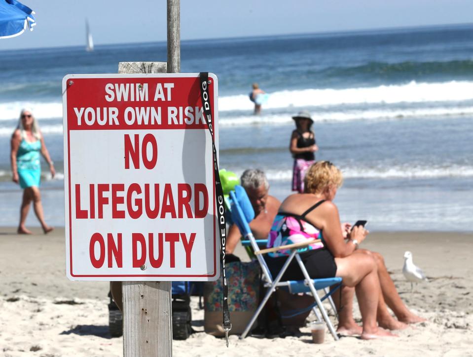
On its website, the town of Kennebunk alerted residents that public service employees are in the process of removing portable trash cans and toilets, benches, stairs, ramps and more from all beaches.
Similarly, the town of Wells issued an early advisory on its website, informing residents that efforts were underway to secure such coastline items as trash, receptacles, portable restrooms, and lifeguard stations. The town also is placing barricades throughout the community, in case road closures become necessary.
Lee is expected to arrive less than a year since the last time the weather truly battered the region and created flooding and damages. A storm swept the area on Dec. 23, 2022, flooding and damaging the region from the seawall at St. Ann’s Episcopal Church on Ocean Avenue in Kennebunkport to Perkins Cove, with its shops and restaurants, in Ogunquit. In Wells, a police officer needed to assist a woman who was on the Mile Road while it was underwater.
Hurricane Lee path tracker: New Hampshire could see tropical storm-force winds
Should you expect power outages in Maine?
On Wednesday, Gov. Janet Mills and the Maine Emergency Management Agency urged people to prepare for the storm in advance. MEMA has been monitoring Lee’s path and progress and has been coordinating with local, state and federal officials, as well as Maine’s utility companies.
Central Maine Power (CMP) this week raised concerns about the health of trees following this summer’s frequent and heavy rainfall. Such consistent wet weather has increased soil saturation, flooding, and nutrient runoff that has led to weakened or rotted roots, according to Mills and MEMA.
CMP said that Maine could see worsened impacts to the power grid because of trees falling or losing limbs.
“We urge Maine people to exercise caution and to take common-sense steps to ensure they have all they need to stay safe as the storm draws closer moving into the weekend,” Mills said.
Lee is poised to hit Maine smack dab in the center of the Atlantic Ocean’s typical hurricane season, which runs from June 1 through Nov. 30.
In Maine, hurricanes don't happen often
Maine does not get many hurricanes, according to MEMA, but they do happen here in Vacationland and can be impactful when they strike. History records Hurricanes Carol and Edna in 1954, Hurricane Donna in 1960, Hurricane Gloria in 1985, and Hurricane Bob in 1991 as storms of consequence in the state.
Warm ocean waters, moisture in the atmosphere, and light winds aloft are the recipe for tropical storm events, according to MEMA. An average, 10 tropical storms develop over the Atlantic Ocean, the Caribbean Sea, and the Gulf of Mexico each year.
In her press release, Mills encouraged Mainers to get familiar with the Hurricane Evacuation Dashboard on MEMA’s homepage. For timely information about safety and preparedness, find MEMA on Facebook or Twitter or visit www.Maine.gov/MEMA.
This article originally appeared on Portsmouth Herald: Hurricane Lee's path: Southern Maine coast expects rain, wind

