Southern Ontario's chilly spell ends with toasty October finish
Tuesday October 3, was the last mainly sunny for all of Ontario and since then we've been dodging countless systems and bouts of cloud for the majority of October.
October is typically the month where we really see the increase of hours of cloud cover across southern Ontario, but a surprising trend is taking place this week.
After Monday, our first mainly sunny day in nearly three weeks, the temperatures reverse course from the typical seasonal decline, and we are going to be running a pretty profound temperature anomaly.

SNEAK PEEK: What El Niño means for Canada's upcoming winter season
First, what's average?
For the final week of October, highs average only around 12°C for the Greater Toronto Area (GTA), but falls to 10°C as you work your way towards Ottawa, and even lower up towards North Bay, where the average high this time of year is just 7°C.
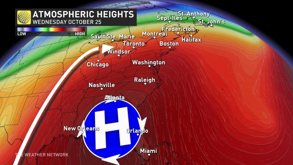
To crack 20°C this time of year, we typically need to import warmer air, and the strong high pressure that develops across the southeastern U.S. will guide a mild southwest flow originating from the Gulf of Mexico.

SEE ALSO: Weather partly to blame (or thank) for Canada's fall foliage variations
Don't expect wall-to-wall sunshine though - this pattern draws tropical moisture from what was once Hurricane Norma in the eastern Pacific.
Windsor will be the first to see 20°C this week on Tuesday.

By Wednesday morning this anomalous warmth spreads all across throughout southern Ontario, due to a gusty and mild southwest flow. Temperatures will hover 10°C-12°C above normal throughout much of this warm spell.
The overnight lows will also be exceptionally warm for this time of year, sometimes remaining well beyond what our average daytime highs are typically sitting at.

RELATED: How nature can help with Seasonal Affective Disorder
Widespread 20°C temperature readings are possible on Thursday as well, as a low-pressure system developing arcs north. Some places will likely hit 20°C back-to-back-to-back, particularly up the 401 in eastern Ontario.
Remember how warm the start of October was? Keep in mind, that Ottawa and most of southern Ontario just see a few days above 20°C in October. Most regions are at 6 days, with the potential to tack on a couple more this week.
Make the most of this warm-up, as copious amounts of Arctic air are draining across the Prairies this week. There’s a huge amount of uncertainty when that cold air oozes across Ontario next weekend, but if you’re planning Halloween costumes, go for a warmer option.
Stay tuned to The Weather Network for more forecast updates for southern Ontario.

