Spot ospreys and eagles at Haile Farm Preserve, once a key spot for agriculture: Walking RI
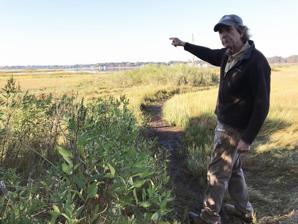
WARREN — Rock Singewald gestures across the wide, flat marshland where farmers for hundreds of years swung scythes to harvest salt hay to use as livestock fodder and to sell in local markets.
The salt hay became a valuable crop for generations of families that farmed the land along the Palmer River, says Singewald, president of the Warren Land Conservation Trust, which manages the Haile Farm Preserve.
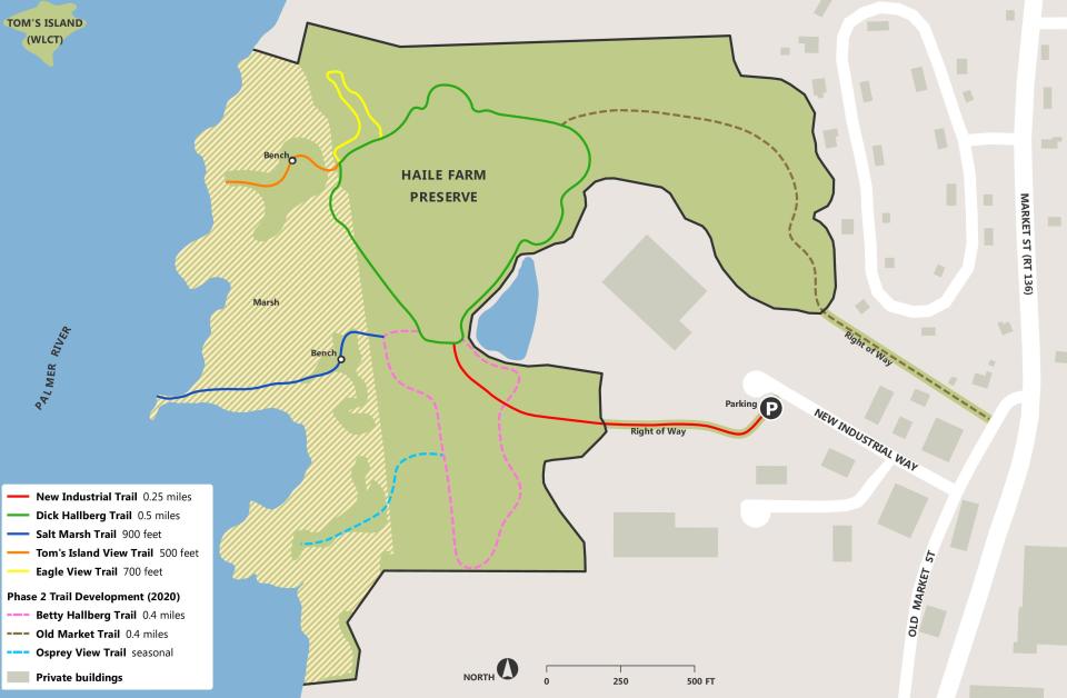
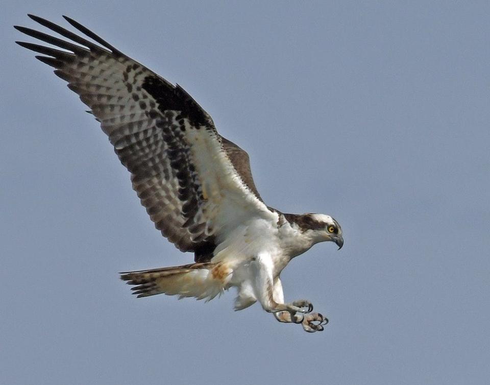
The nonprofit group maintains a network of trails that run through the 61-acre sanctuary that includes wooded uplands and paths to the river, where hikers can cross the marsh and see salt sparrows, ospreys and, if you’re lucky, an eagle soaring overhead.
“The preserve is a great asset and easily accessible,” Singewald told me.
Walking RI: What's so special about 'Quonnie' Beach? Discover its beauty in the offseason
Walking RI: Hike through unique Ice Age terrain at Dr. John Champlin Glacier Park
On a crystal-clear early morning, Singewald and I walked the trails at Haile Farm after driving through a small industrial area off Market Street to the trailhead near the entrance of Jade, a local manufacturer.
We began by heading west on a right-of-way through private property that is covered in places with wood chips.
The trail entered a dense area of invasive plants, including autumn olive, bittersweet, multiflora rose and mugwort, that crowd out native species unless they are cut back.
As we walked, the terrain changed from bushes to stands of boxelder and a few gray birch trees. We crossed a red maple swamp on board bridges built by volunteers and local Boy Scouts.
Walking RI: Up for a hiking challenge? Tackle this section of the North South Trail in Exeter
Walking RI: What's missing from Tiverton's Basket Swamp? A key tree for Native peoples
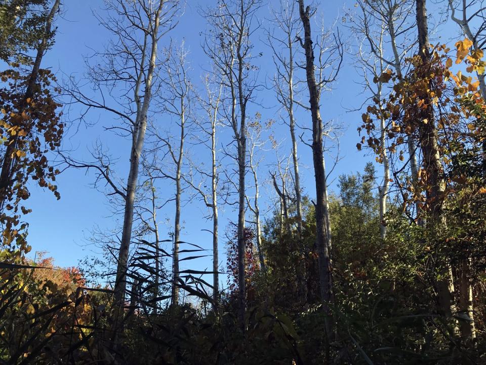
Turning left on the red-blazed trail, we paused at a small, interesting circle of tall, quaking aspen trees and then continued through some fallen trees blown down by heavy winds.
A blue-blazed trail on the left would have taken us to the river but is currently closed to protect ospreys and their nest.
The area turned wet, and we crossed bog bridges through patches of cinnamon ferns and witch hazel before turning from the red-blazed trail, named for Betty Hallberg, onto the green-blazed trail, named for Dick Hallberg. The Hallbergs founded the Warren Land Conservation Trust.
More: Fall bird migration is in full swing in Rhode Island. Here's the best birding spots.
Walking RI: Discover a hidden gem of forest, ponds and wetlands in Little Compton
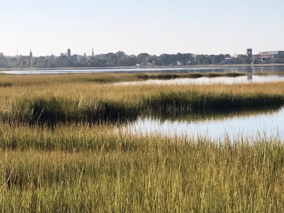
A short distance later, we took a left on a trail that ran over some raised land covered with pitch pines and other small trees and shrubs. We passed a sitting bench and then walked down to the salt marsh on the eastern shore of the Palmer River, a brackish waterway that flows south into the Barrington River and then the Warren River before reaching the ocean.
Along the shore to the left is a wooden pole topped with an osprey nest. To the south is downtown Warren and the old brick American Tourister Factory. To the east across the placid river are tree-lined banks and some cottages in Barrington.
Walking RI: Spectacular bay views and Colonial and tribal history at Mount Hope Farm
More: Walking RI: Discover why hikers and anglers love the 'wild and scenic' Beaver River
Land was once the province of the Pokanoket Tribe
As far as the eye can see from the marsh, and beyond, the Pokanoket, led by Massasoit Ousamequin, lived for thousands of years on the rich land called Sowams. The Native Americans planted the area upland from the marsh with corn, beans and squash, fertilized with fish from the river.
After the brutal King Philip's War (1675-1676) between the settlers and Native Americans, the remainder of the tribe was driven off the land, which was divided and parceled out to English Colonists, according to a history by Barbara Andrews Hail, of Warren, a descendant of the Haile family.
In 1682, Obadiah Bowen, the first land owner, built a story-and-a-half farmhouse with a steeply pitched gable roof that still stands off Market Street (Route 136) near the entrance of the preserve. Bowen sold the land in 1708 to Richard Haile, whose family farmed the land for about 170 years.
Walking RI: Follow in the footsteps of Trappist monks in Cumberland
Walking RI: Tillinghast Pond's trails are part of something special and well worth a visit
In the mid-1800s, the property was called Judge Haile Farm after Levi Haile, an 1821 Brown University graduate who served as a justice on the Rhode Island Supreme Court. That’s the court that tried Thomas Dorr, the leader of the Dorr Rebellion in 1842.
Later, Manual Nunes ran the farm from 1911 to 1988. After a developer abandoned plans to build condos there, the Town of Warren took the title and turned the property over to the Warren Land Conservation Trust.
A key farm for growing salt hay, a valuable cash crop for early Colonists
Haile Farm was one of many saltwater livestock farms that grew up along Narragansett Bay and other shores across New England.
The early coastal farmers learned that it was more profitable to raise animals than crops. A livestock farm required less labor, and the salt hay that grew in the salt marshes and low-lying meadows could be cut to feed cattle and dairy cows or be sold to buyers up and down the coast. Salt hay, supplemented with English hay that was grown in upland meadows, became one of the most valuable crops in the first century of English settlement in New England.
The harvesting of the salt hay usually took place every August. Some of the cut hay was loaded on small, flat-bottomed sailing barges, called gundalows, and shipped downriver to markets.
Walking RI: Looking for a great birdwatching spot? Try this former Navy site in North Kingstown
Walking RI: A step-by-step guide to beautiful Stepstone Falls
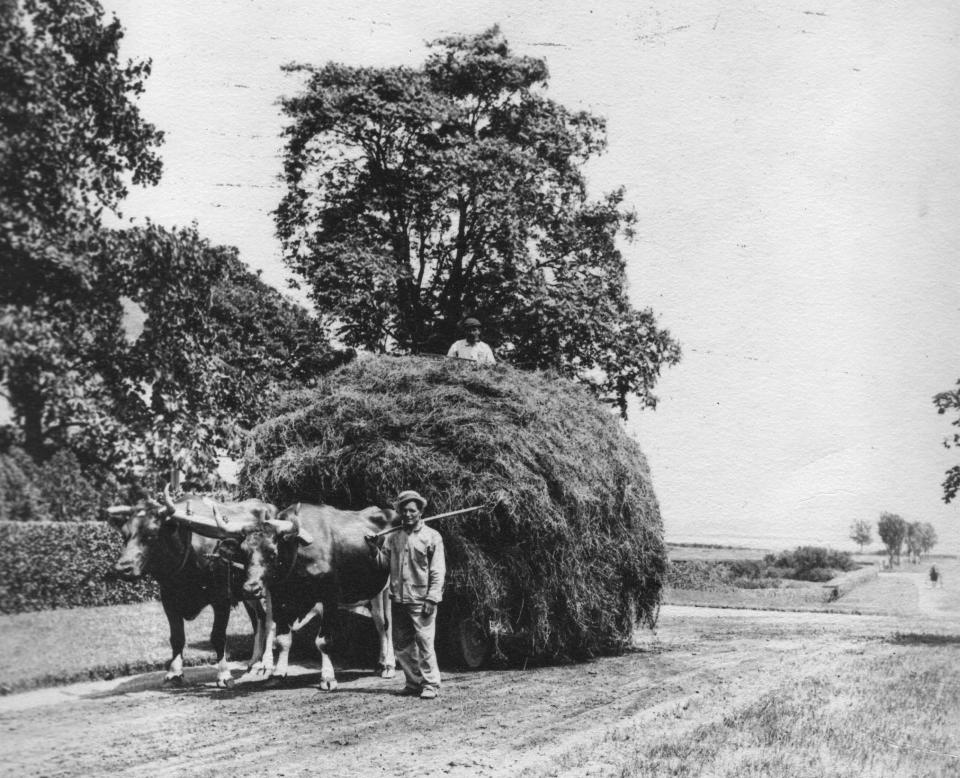
Sometimes, wagons hauled the salt hay over roads built up over the wetlands. The horses that pulled the wagons were fitted with special wide, flat-bottomed shoes so they wouldn’t get mired in the marsh.
And sometimes the farmers stacked the hay on stands in the marsh called “staddles,” which were built by driving stakes into the ground about 2 or 3 feet above the marsh. The salt hay dried there and was carried away on sleds over the frozen marsh in mid-winter to be stored in upland barns.
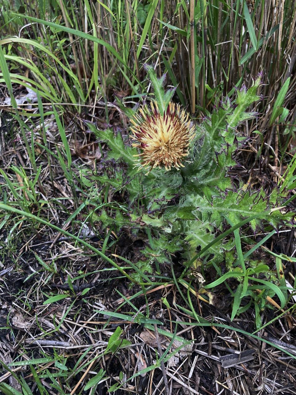
After discussing that history, Singewald and I retraced our steps back to the green-blazed trail and headed north on a path lined in a few places with yellow thistle, which flowers in the spring.
Tucked in the dense brush on the left is a solar-powered station on a short, wooden pole set up by Rhode Island School of Design students to monitor climate change issues.
Walking RI: Retracing Thoreau's 1854 hike through Providence
Walking RI: Rediscover Providence's Roger Williams Park on a serene hike around its ponds
Turning left on an orange-blazed trail, we passed another sitting bench before arriving at the river again. Just offshore to the northeast, we could see tiny Tom’s Island, also called Three Trees Island.
Through the trees to the north, the Swansea Golf Club is visible.
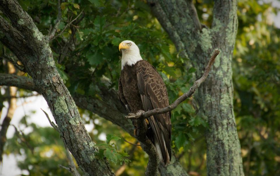
Where will you see ospreys and eagles?
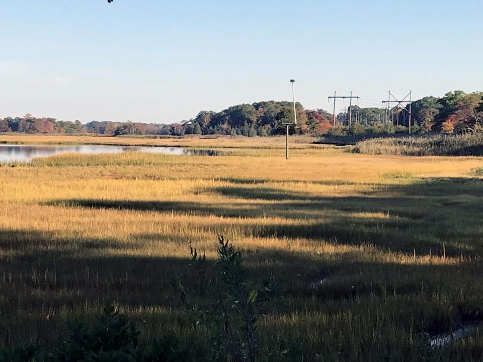
Returning to the green-blazed trail, we took a short, yellow-blazed loop, called Eagle View, across some sandy soil and under power lines that run north and south across the preserve. We spotted more osprey nests, including one on top of a utility pole.
Singewald said eagles can sometimes be seen here perched in the tops of the trees, but they tend to live on the far western side of the river. After the ospreys leave, though, the eagles spend more time on the eastern side of the river and can be seen sometimes on top of the poles where the osprey build their nests.
Back on the green-blazed trail, we headed east under mature oaks and tupelo trees and along stone walls that once enclosed pastures for the livestock. We also passed a line of beech and willow trees.
The trail bent south and then ran along the top of an earthen berm on the western edge of a pond. The water was stagnant and covered in places with algae.
Years ago, a housing developer built the dike to form a pond to catch runoff from houses, planned condos and some business to the north and east. The developer, however, never completed the project, but the water from the pond is draining under the berm to the salt marsh, which is being damaged by the polluted water. Singewald said the Warren Land Conservation Trust is planning a remedial action, and looking for funding, to solve the problem.
After studying the pond and the runoff issue, we picked up the red-blazed trail and returned to where we'd started.
In all, we walked about 2.5 miles over 90 minutes.
Haile Farm Preserve is the largest property managed by the land trust and attracts students, botanists, birders, historians, walkers and others.
Singewald, a former steward of the preserve, said more work always needs to be done at Haile Farm, including cutting back the invasive species, building more board bridges and solving the pond runoff issue. He hopes the improvements attract more people to enjoy the views and learn about the history.
John Kostrzewa, a former assistant managing editor/business at The Providence Journal, welcomes email at johnekostrzewa@gmail.com.
This article originally appeared on The Providence Journal: Hike historic Haile Farm in Warren, RI, a haven for nature lovers

