Springfield area has a slight tornado risk but most likely thunderstorms, hail, high winds
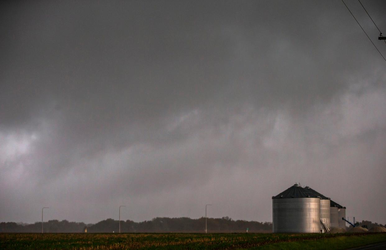
Warm temperatures and high humidity will give way to stormy weather later Tuesday, including a slight risk of tornado activity in Springfield and central Illinois.
The risk for tornadoes is at about 2%, according to Kirk Huettl, a meteorologist with National Weather Service in Lincoln.
The greatest chance of activity is from 5 p.m. Tuesday to 2 a.m. Wednesday, Huettl said. Sangamon, Logan, Cass, Menard, Scott and Morgan counties are all in that slight risk area.
Illinois primary: Sangamon County 'exceeding expectations' in early voting. Here's why
The rain will move into the Illinois River Valley northwest of Springfield by mid-to-late afternoon before pushing into the Springfield area into the later evening hours.
Thunderstorms and showers could produce up to two inches of rain through Thursday morning, he said.
There is a more pronounced risk, Huettl added, of ping-pong-size hail and straight-line winds up to 70 mph accompanying storms Tuesday night.
The projected high temperature for Springfield Tuesday is 89 degrees, though it will be humid and breezy ahead of the cold front that will move in. The record high temperature for May 31 is 101 degrees in 1934.
Storms won't be as severe Wednesday and temperatures, Huettl said, will be more moderate with highs in the 70s through Friday.
The next round of rain will come in late Saturday night with thunderstorms a possibility Sunday afternoon, Huettl said.
Cooling centers open
The following locations have been designated as cooling centers in Springfield during regular business hours.
* Municipal Center East, 800 E. Monroe St., Mon.-Fri., 8 a.m. to 5 p.m.
* Municipal Center West, 300 S. Seventh St., Mon.-Fri., 8 a.m. to 5 p.m.
* Lincoln Library, 326 S. Seventh St., Mon.-Wed. 10 a.m. to 8 p.m.; Thurs.-Sat. 10 a.m. to 5 p.m.
* City of Springfield Office of Community Relations, 1450 Groth St., Mon.-Fri., 8 a.m. to 4:30 p.m.
* St. John’s Breadline, 430 N. Fifth St., Sun.-Sat., 10:30 a.m. to 1:30 p.m.
* Salvation Army (main campus), 1600 Clear Lake Ave. (entrance off Martin Luther King Drive), Mon.-Fri. 8 a.m. to 3 p.m.
* Salvation Army Overflow Shelter, 221 N. 11th St. Overnight Shelter, Sun.-Sat., 7 p.m. to 7 a.m.; Day Center Mon.-Fri. 10 a.m. to 3 p.m. (88 degrees or higher), Sat.-Sun. hours subject to staff and heat index
* Washington Street Mission, 408 N. Fourth St., Mon.-Fri. 7:30 a.m. to 10:30 a.m.
* Walmart Supercenter (South), 1100 Lejune Drive, Sun.-Sat., 7 a.m. to 11:00 p.m.
* Walmart Supercenter (North) 2760 N. Dirksen Parkway, Sun.-Sat., 7 a.m. to 11 p.m.
* Walmart Supercenter (West) 3401 Freedom Drive, Sun.-Sat., 7 a.m. to 11 p.m.
* White Oaks Mall, 2501 Wabash Ave., Mon.-Thurs., 11 a.m. to 7 p.m., Fri.-Sat., 11 a.m. to 8 p.m.; Sun., noon to 6 p.m.
This story will be updated.
Contact Steven Spearie: 217-622-1788, sspearie@sj-r.com, twitter.com/@StevenSpearie.
This article originally appeared on State Journal-Register: Stormy weather, thunderstorms push into Springfield IL area

