What is a squall?
If you've ever been warned that a squall is on the way, it may sound ominous. But what, exactly, is a squall?
In the early 20th century, a squall was a sudden windy cold front. The term can still refer to a sudden strong wind that increases by 16 knots (18.4 mph, or 29.6 km/h) and sustains 22 knots (25.3 mph, or 40.7 km/h) for at least a minute, according to the National Oceanic and Atmospheric Administration.
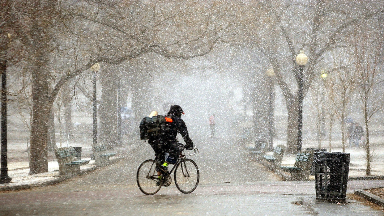
In 2018, the National Weather Service started using the term "snow squall" to warn travelers and commuters of short-term bursts of heavy snow and high winds that can cause sudden white-outs and ice roads over in minutes.
But most often, experts use "squall" as shorthand for "squall line," a line of thunderstorms.
Oftentimes, storms "aren't just individual little isolated clouds," said Adam Varble, an atmospheric scientist at the Pacific Northwest National Laboratory in Richland, Washington. "They like to form these structures." A squall line is one way thunderstorms organize. It's a thin and long — though not perfectly straight — line of storms. You've likely watched a meteorologist point to such lines of storms inching across a map.
Related: Bombogenesis: What's a 'bomb cyclone'?
Squall lines are common in the U.S. east of the Rockies, according to the National Weather Service. They can extend hundreds of miles in length but are typically only 10 to 20 miles (16 to 32 kilometers) wide. If a squall line passes over you, you'll likely experience high winds, heavy rain and cool air. That's because the squall line occurs along the boundary between cold and warm air in the storm, Varble said.
Under the right temperature and moisture conditions, rising air will condense water vapor to form a cloud, Varble said. That condensation releases heat — the same heat that drives storms. Under the right conditions, the heat can cause the cloud to become more buoyant and rise, as it is lighter than the colder air around it. This causes the rising air to pick up speed.
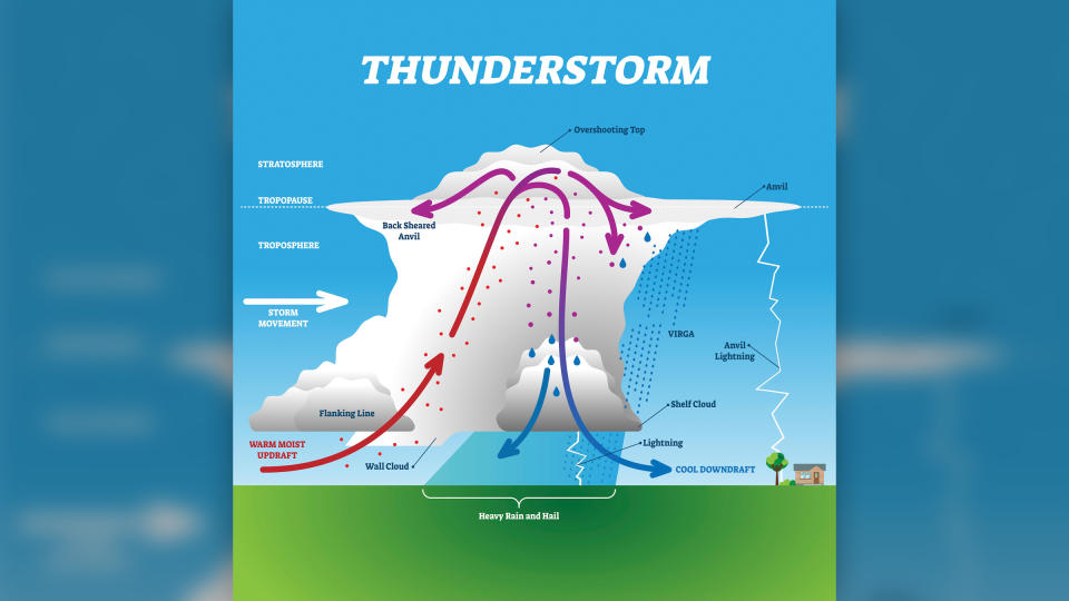
When the condensed drops of water or ice grow large, they begin to fall as precipitation. Evaporating precipitation cools air, making it denser than the surrounding warm air. This cooler air sinks and flows outward at the ground creating a cold-air boundary (also known as the gust front). The dense cooler air forces lighter warm air up which fuels the growth of new storms. This collection of connected storms along the gust front is a squall line.
Related Stories
—Is climate change making the weather worse?
—What's the longest lightning bolt ever recorded?
"As long as there are the right temperature and moisture conditions to support buoyant upward-moving air in clouds, the storm squall will keep propagating outward," Varble said. It will produce heavy rains, sharp winds and even an occasional tornado.
Squall lines affect more than just weather. Storms heat and dry the atmosphere, but different storm structures produce different heating and drying impacts, Varble said. Current research is investigating these differences because they influence local climate and weather patterns, he said.

