Flood worries rise on the East Coast as soaking rains push through
This weekend won't be a time to spend much time, if any, outdoors in Atlantic Canada with prolonged heavy rain and howling wind gusts likely to keep you indoors for the duration.
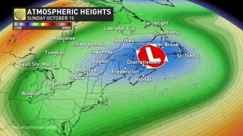
Two low-pressure systems moving over Eastern Canada will merge into one large, upper-level disturbance in the days ahead, bringing an extended period of wet, windy conditions to the region.
Areas hit hardest by repetitive bouts of heavy rain could see localized flooding with totals of 75-100+ mm possible, along with some blustery wind gusts.
RELATED: How a super typhoon will alter Canada's late-October weather
A soggy, windy fall weekend on tap
Areas: Atlantic provinces and the Gaspé Peninsula
Timing: Through Monday
We’ll see persistent cloudy skies alongside periods of rain, which may grow heavy at times and even feature a rumble of thunder in spots.
The system will peak on Saturday as a slug of rain sets up across eastern sections of New Brunswick and Nova Scotia, the Gaspé Peninsula, as well as southern Newfoundland. These areas will see the best opportunity for persistent showers.
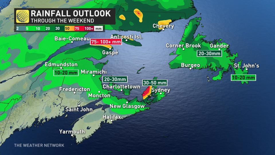
Onshore flow will enhance rainfall totals in portions of Cape Breton Island and the Gaspé Peninsula, where we could see 75-100+ mm of rain through the weekend.
Localized flooding is possible in areas hit by the heaviest rainfall, and special weather statements are in effect ahead of this potential.
We’ll also contend with gusty winds throughout Atlantic Canada as this low-pressure system strengthens this weekend.
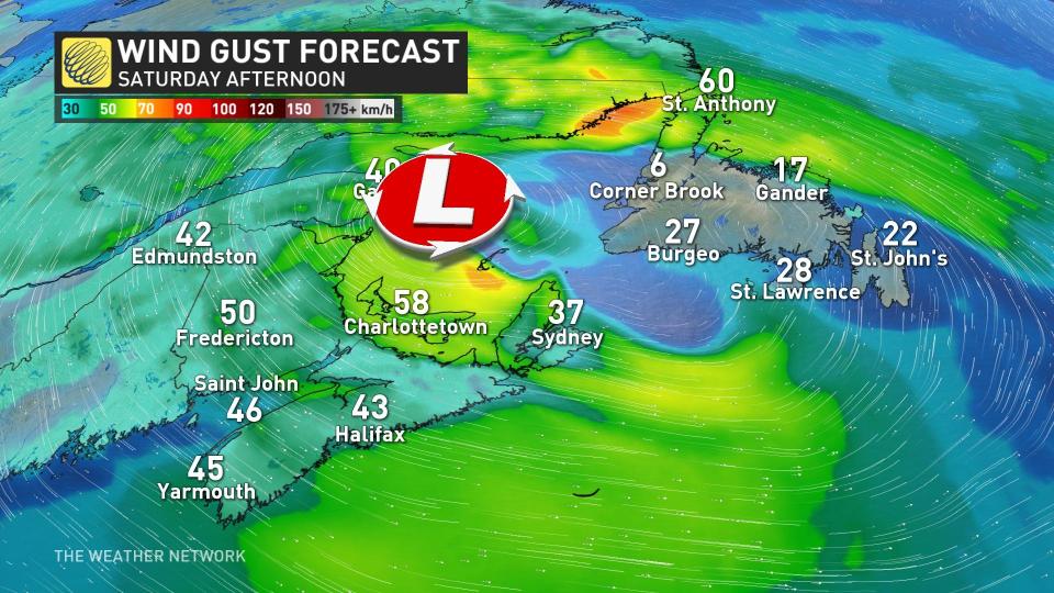
Prince Edward Island and the Gaspé Peninsula will take the brunt of the strongest winds, where gusts of 60+ km/h are expected by Saturday afternoon. Gusts along the P.E.I. coastline could reach 80-90 km/h into the evening hours.
Sunday will feature some gradual improvement even as conditions remain unsettled, with clouds and off-and-on showers pinwheeling across the region as we close out the weekend.
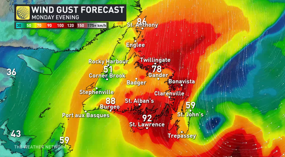
Another, much stronger system takes aim at Newfoundland early next week, phasing with the upper low to bring another round of persistent rain to the region. This low-pressure system will deepen as it slides northeast past Sable Island, with barometric pressure falling below 970 hPa.
Thumbnail courtesy of Getty Images-1440768791.
Stay with The Weather Network for all the latest on conditions across Atlantic Canada.

