Starr County residents scramble to make sense of new border wall maps

- Oops!Something went wrong.Please try again later.
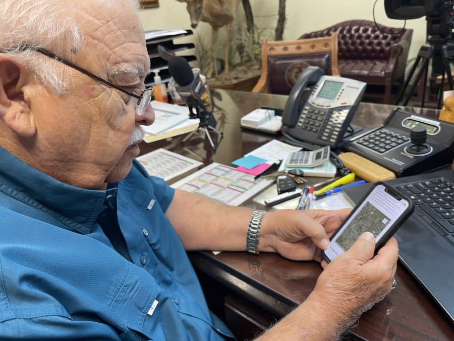
RIO GRANDE CITY, Texas (Border Report) — Starr County Judge Eloy Vera borrowed a reporter’s phone and tried to decipher a U.S. Customs and Border Protection map showing where about 20 miles of new federal border wall is to be built in this rural county in the Rio Grande Valley.
Vera says federal officials did not tell him they were waiving 26 environmental laws last week in order to expedite construction of border barrier in Starr County.
New border wall Biden OK’d for Starr County has residents up in arms
“I’m sure the federal government has very qualified engineers to design this wall. But it certainly would be nice if we would be shown what is being proposed and the footings and the foundations, and how they’re going to be working in this area of which we haven’t seen anything,” Vera told Border Report from his Rio Grande City offices.
This is the first time the Biden administration has waived environmental regulations in order to build new barrier on the Southwest border with Mexico. Some of the waived laws include: the Endangered Species Act; the Clean Air Act; the Safe Drinking Water Act; the Migratory Bird Treaty Act, and the Native American Graves Protection and Repatriation Act.
An announcement in the Federal Register on Wednesday by Homeland Security Secretary Alejandro Mayorkas said the wall is needed in Starr County because “there is presently an acute and immediate need to construct physical barriers and roads in the vicinity of the border of the United States in order to prevent unlawful entries into the United States in the project areas.”
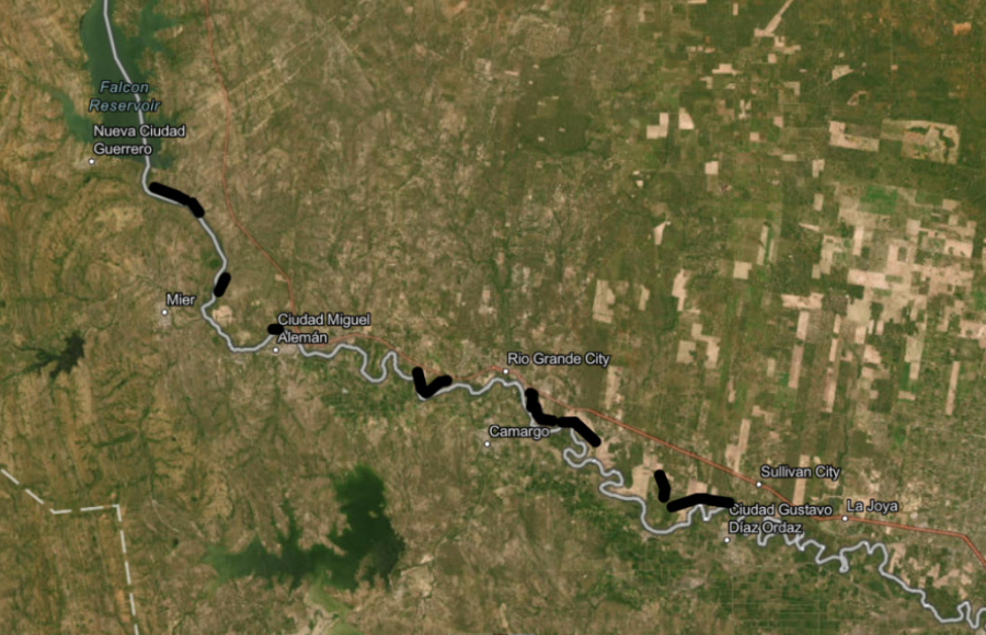
Since learning of the new border wall, several residents and regional leaders also have tried to navigate the black lines in the CBP graphic to decipher where the new 18-foot-tall border wall will be built.
But over the weekend the maps were taken offline and not available to the public without a special password.
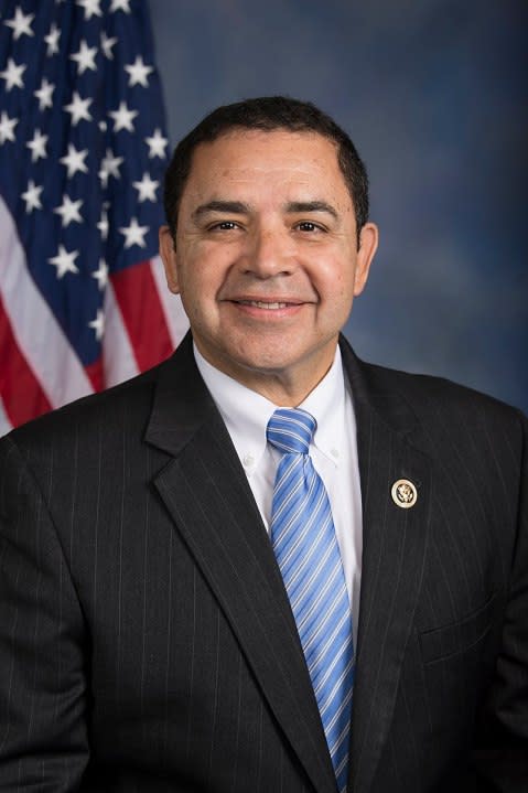
U.S. Rep. Henry Cuellar, a Democrat who represents Starr County, helped to intervene and got government officials to restore the CBP maps online for everyone to see on Monday.
“The public needs to know,” Cuellar told Border Report on Monday.
On Friday, Cuellar said he spoke with Starr County officials and walked them through the border wall plans.
Cuellar is the ranking member of the House Homeland Security Appropriations Subcommittee, and as such is privy to sensitive information from DHS because all agency funding must go through his subcommittee.
He says there are 17 miles of new border wall to be built in seven sections spread out throughout the county of just 65,000.
Funding for the border wall was approved by Congress in Fiscal Year 2019 and can only be rescinded by Congress.
Scott Nicol, an environmentalist who is on the board of Friends of the Wildlife Corridor, told Border Report that there is about $195 million in funding out of the original $1.375 billion originally appropriated.
Jim Chapman, president of the board of Friends of the Wildlife Corridor, says building a metal wall will prevent wildlife from going to and from the Rio Grande for water. And noise and pollution from construction could affect habitats and the migration of birds.
Biden administration waiving 26 federal laws to allow border wall construction in Texas
The Rio Grande Valley is one of the premiere birding locations in North America.
The wall is to be built from the western edge of the county one mile south of Falcon Dam. That segment is to be two miles long.
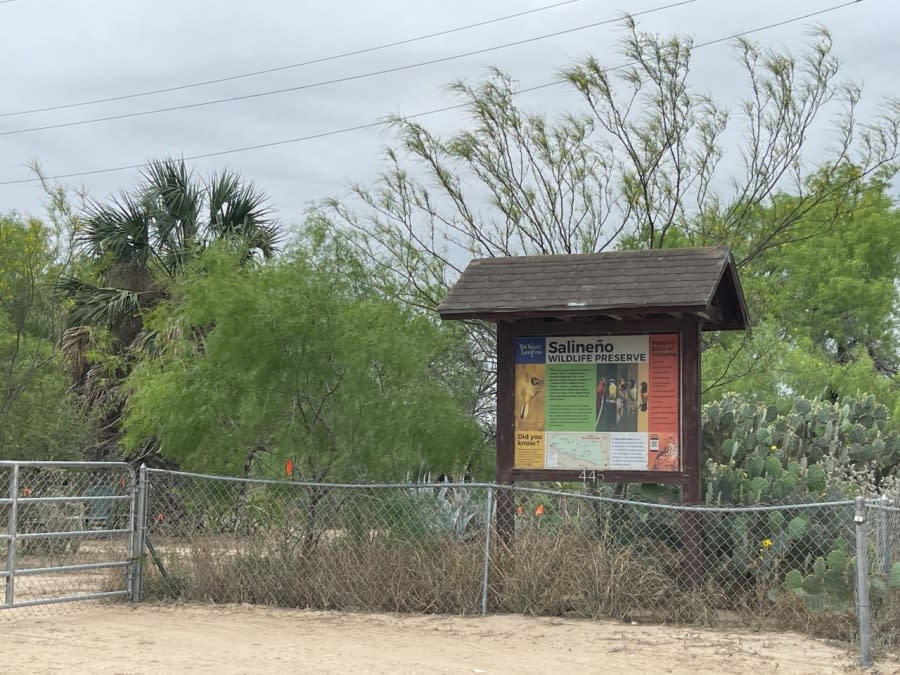
But it will stop short of the Salineño Wildlife Preserve, a world-renowned migratory bird sanctuary, Debralee Rodriguez, executive director of the Valley Land Fund, which owns the preserve, told Border Report.
But several other wildlife tracts will be affected by border wall construction. According to the Federal Register, the wall is slated to be built:
Starting at the southeast boundary of the Arroyo Morteros Tract of the Lower Rio Grande Valley National Wildlife Refuge and extending southeast for approximately one mile.
Starting at the northernmost boundary of the Las Ruinas Tract of the Lower Rio Grande Valley National Wildlife Refuge and extending north for approximately one mile.
Starting at the eastern boundary of the Arroyo Ramirez Tract of the Lower Rio Grande Valley National Wildlife Refuge and extending east for approximately half mile.
Starting half mile south of the intersection of Perez Road and U.S. Highway 83 and generally following the Rio Grande River to a quarter mile south and east of the intersection of Leos Road and U.S. Highway 83.
Starting approximately three-quarters of a mile southeast of the intersection of North Redwoods Street and U.S. Highway 83 and extending southeast to the northwest boundary of the Los Velas West Tract of the Lower Rio Grande Valley National Wildlife Refuge.
Starting approximately one-tenth of a mile south of the intersection of Trophy Street and Moonbeam Street and extending east to approximately one mile south of the intersection of Los Olmitos Road and Farm to Market Road 1430.
Starting approximately one mile south of the intersection of Los Olmitos Road and Farm to Market Road 1430 and extending southeast to the northwest boundary of the La Casita East Tract of the Lower Rio Grande Valley National Wildlife Refuge.
Starting approximately one mile south of the intersection of Mission Street and Old Military Highway and extending southeast for 1.75 miles.
Starting at the northeast boundary of the Villareales Banco Tract of the Lower Rio Grande Valley National Wildlife Refuge and extending east to the western boundary of the Cuevitas Tract of the Lower Rio Grande Valley National Wildlife Refuge.
Sandra Sanchez can be reached at SSanchez@BorderReport.com.
For the latest news, weather, sports, and streaming video, head to FOX 5 San Diego.

