Stateside thunderstorms may bring severe weather to southwestern Ontario
After a wet and stormy day on Tuesday, with Ontario’s first confirmed tornado of the year making a guest appearance, folks across southern Ontario can look forward to more on Thursday.
Forecasters are carefully monitoring a low-pressure system tracking stateside that could usher in some more heavy rain throughout the region, and possibly some rotating storm cells for those in the extreme southwest. While it’s unlikely – but not impossible – to see the province’s second tornado, folks should still be weather aware throughout the day as forecasters continue to monitor conditions.
RELATED: PHOTOS: Storms yield hail, funnel clouds and a tornado in Ontario
THURSDAY
Areas: Southern Ontario
Timing: Thursday afternoon and evening
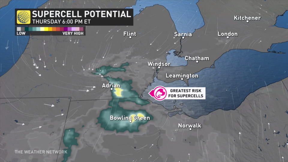
Weather: A weak surface low will steer in a threat for severe thunderstorms Thursday afternoon and evening across southern Ontario. The exact location of the low itself poses a slight risk for stronger, rotating storms.
Some thunderstorm energy and wind shear – a change of wind direction with height – will be monitored with stateside storms that develop through the day. These storms could get strong enough to sustain themselves as the system moves into extreme southwestern Ontario, ushering in the chance for rotation. However, the threat remains very conditional, with some weather models keeping the severe ingredients stateside, and others saying there is a chance we could see some severe weather on our side of the border.
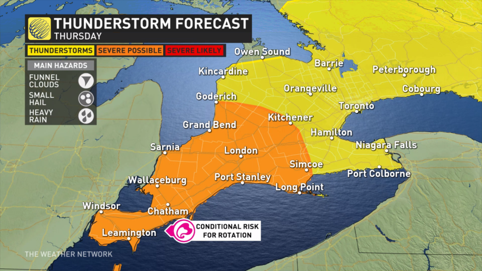
Windsor, Chatham, Sarnia, and surrounding regions should pay close attention to weather alerts throughout the day as these are the areas with the greatest chance of seeing storms with rotation and possible funnel clouds.
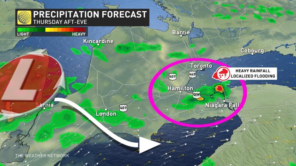
Periods of heavy rainfall and gusty winds may also stretch across southern Ontario, affecting the western edge of the Greater Toronto Area in time for the evening commute. Especially those travelling along the Queen Elizabeth Way from Niagara heading west towards Hamilton and the GTA may find themselves driving into some less-than-pleasant conditions.
WEEKEND AHEAD
Areas: Southern Ontario
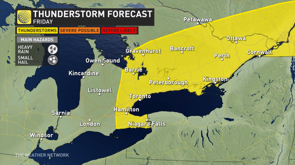
Timing: Friday thunderstorm potential, drier Saturday/Sunday
Weather: Some lingering energy and instability could bring another round of rumbles into Friday. As the low tracks east, the risk moves with it, into the Golden Horseshoe and eastern Ontario. Passing showers and gusty winds could be accompanied by embedded thunder.
Father’s day weekend looks to dry out for southern Ontario, remaining seasonal for comfortable golf and BBQ weather, or for however you choose to spend the weekend.
Make sure to keep checking back to The Weather Network for more forecast updates and information for southern Ontario.

